A handheld GPS earns its place when phone service disappears, weather turns, or a trail gets hard to follow. The right unit should give you dependable offline navigation, useful battery life, and controls you can manage outdoors.
Our top pick is Garmin eTrex 22x because it combines routable TopoActive maps, AA-battery power, and a compact build. The Garmin eTrex 32x is the Best value choice if you also want a 3-axis compass and barometric altimeter.
We compared Garmin specifications, current product documentation, owner feedback across non-Amazon sources, and safety/recall records.
Handheld GPS Compared
| Product | Best for | Battery | Display | Navigation | Score |
|---|---|---|---|---|---|
|
Budget
|
Best budget mapping | 25 hr | 2.2-inch color | TopoActive + microSD | 86/100 |
|
Mid-range
|
Best for geocaching | 25 hr | 2.2-inch color | TopoActive + sensors | 84/100 |
|
Mid-range
|
Best solar charging | Up to 200 hr GPS-only | 2.16-inch monochrome | Courses/waypoints; no add-on maps | 85/100 |
|
Premium
|
Best battery life | Up to 180 hr GPS | 3-inch color | TopoActive + multi-band GNSS | 91/100 |
|
Premium
|
Best satellite messaging | Up to 180 hr GPS | 3-inch color | TopoActive + inReach | 94/100 |
Handheld GPS: Our Top Picks
1. Garmin eTrex 22x
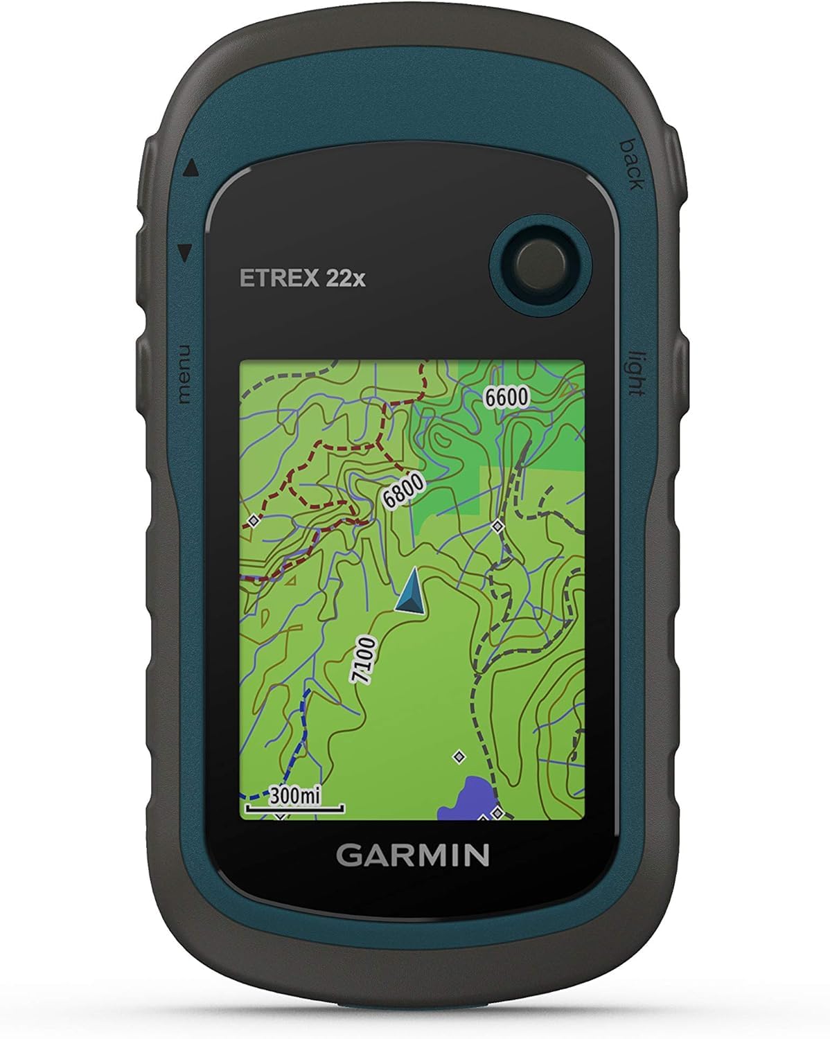
Bottom line: The Garmin eTrex 22x is a compact choice for hikers who want real onboard TopoActive maps and the flexibility of replaceable AA batteries without extra sensors or satellite messaging.
- Display: 2.2-inch color, compact and sunlight-readable
- Battery: up to 25 hours, powered by two AA cells
- Water rating: IPX7, built for rain and wet trail use
- Weight: about 5 ounces with batteries, easy to pack
- Navigation: GPS + GLONASS with routable TopoActive maps
The 22x gives you 8 GB of internal storage plus a microSD slot for additional compatible maps. Its button controls also remain usable when gloves, rain, or cold make a phone touchscreen less convenient.
The trade-off is simplicity. You do not get a barometric altimeter, 3-axis electronic compass, multi-band GNSS, or built-in satellite messaging. The small display and menu structure also take more setup than a phone app.
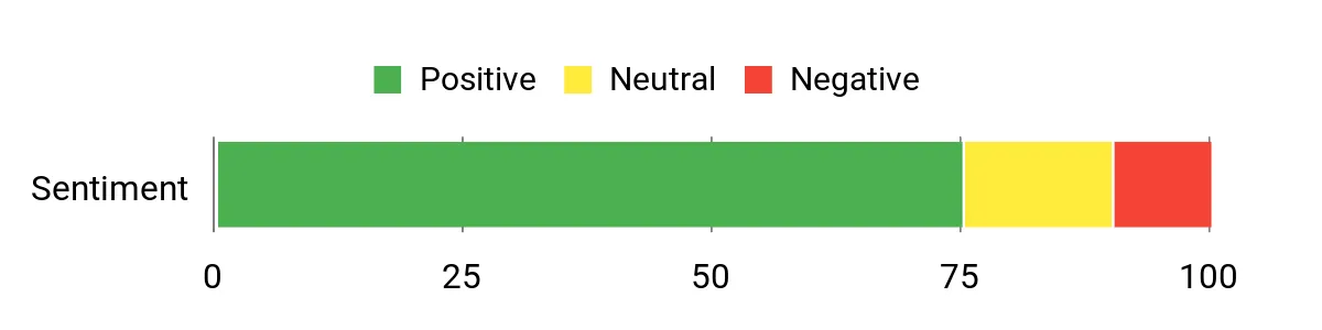
- Preloaded routable TopoActive maps
- Replaceable AA batteries are easy to carry
- microSD expansion supports extra compatible maps
- Compact and light for hiking packs
- No barometric altimeter or 3-axis electronic compass
- Small screen and older button-driven interface
- No satellite messaging or SOS
2. Garmin eTrex 32x

Bottom line: The Garmin eTrex 32x keeps the 22x’s compact mapping design but adds a 3-axis compass and barometric altimeter, making it a better fit for geocaching and trips where heading and elevation data matter.
- Display: 2.2-inch color, same compact format as the 22x
- Battery: up to 25 hours, powered by two AA cells
- Water rating: IPX7, suitable for wet outdoor conditions
- Weight: about 5 ounces with batteries, easy to carry
- Navigation: GPS + GLONASS, TopoActive maps, compass and altimeter
Like the 22x, it includes 8 GB of internal memory and supports microSD expansion. You can load GPX data, follow routes, mark waypoints, and use the built-in sensors without depending on cell service.
The 32x still uses the smaller eTrex display and button interface. Large or complex map sets can make map management feel slower than newer handhelds, so it is best for users who value rugged simplicity over a modern touchscreen experience.
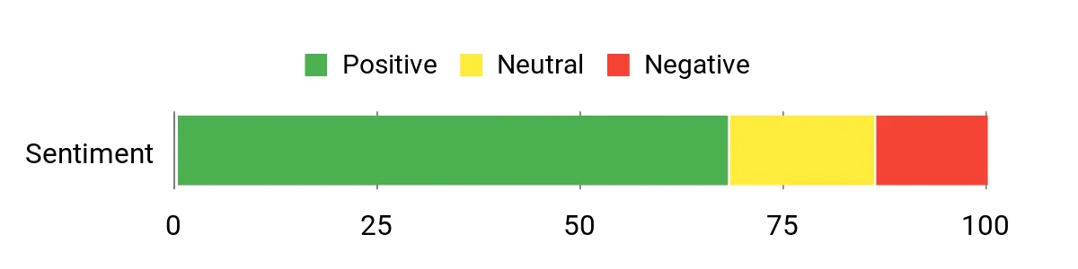
- Adds a 3-axis compass and barometric altimeter
- Preloaded routable TopoActive maps
- Replaceable AA power works well off-grid
- microSD expansion for additional compatible maps
- Same small 2.2-inch display as the 22x
- Map rendering can feel slow with complex files
- No built-in satellite messaging or SOS
3. Garmin eTrex Solar

Bottom line: The Garmin eTrex Solar is for hikers who care more about extreme runtime, multi-band positioning, and simple course or waypoint navigation than detailed maps on the device itself.
- Display: 2.16-inch monochrome, high-contrast and power-efficient
- Battery: up to 200 hours GPS-only; solar can extend runtime
- Water rating: IPX7, suitable for rain and splashes
- Weight: about 5 ounces, light for long trips
- Navigation: multi-band GNSS with compass, courses and waypoints
The key advantage is power management. Garmin rates it for up to 100 hours with GNSS and multi-band tracking, up to 1,800 hours in expedition mode, and unlimited battery life under its stated 75,000-lux solar conditions.
The important limitation is mapping: Garmin says adding maps is unsupported on the eTrex Solar. Detailed maps can be viewed in Garmin Explore, while the handheld itself focuses on waypoints, courses, tracks, geocaching, and TracBack-style navigation.
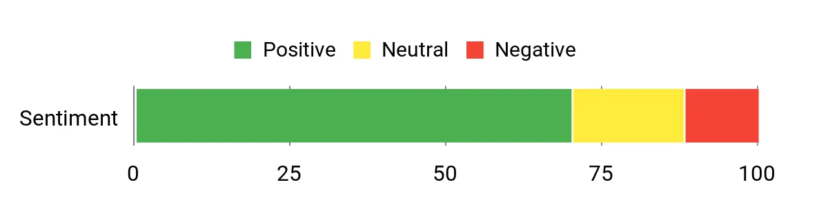
- Very long battery modes with solar charging
- Multi-band GNSS for challenging signal environments
- 3-axis digital compass works while stationary
- USB-C and Garmin Explore connectivity
- No support for adding detailed maps to the handheld
- Monochrome display is navigation-focused rather than map-rich
- Built-in battery is not as field-swappable as AA cells
4. Garmin GPSMAP 67

Bottom line: The Garmin GPSMAP 67 is the stronger navigation-only choice for demanding backcountry use, with multi-band GNSS, a larger map display, long battery life, and more advanced mapping than the eTrex models.
- Display: 3-inch color, larger for route and map checks
- Battery: up to 180 hours GPS; up to 840 expedition
- Water rating: IPX7, designed for wet outdoor use
- Weight: 8.1 ounces, heavier but still handheld
- Navigation: multi-band GNSS with TopoActive maps and sensors
The 67 includes 16 GB of internal memory, a microSD slot, routable TopoActive maps, a 3-axis compass, and a barometric altimeter. Multi-band GNSS helps in terrain where cliffs, tree cover, or buildings can make satellite signals harder to use.
It is physically larger and uses an internal rechargeable battery rather than AA cells. It also lacks built-in inReach communication, so remote users who need two-way messaging or interactive SOS should look at the 67i instead.
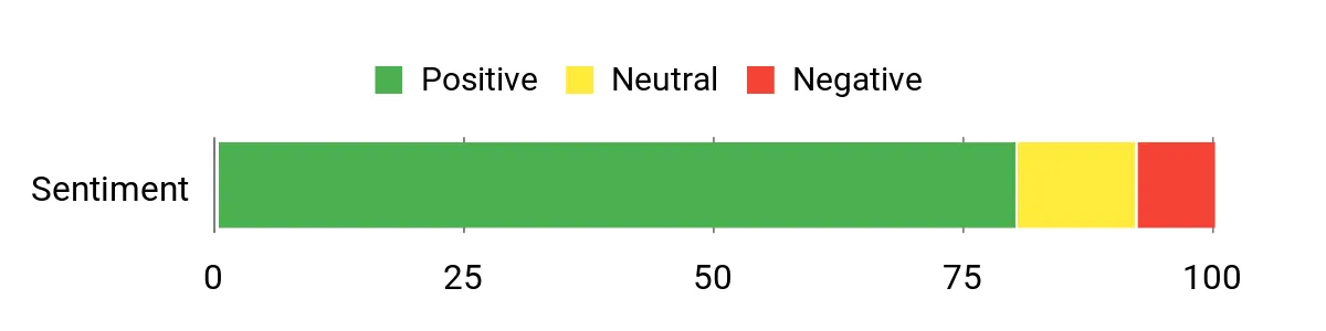
- Multi-band GNSS for difficult terrain
- Long GPS and expedition battery modes
- 3-inch color display with routable TopoActive maps
- 16 GB storage plus microSD expansion
- Compass and barometric altimeter included
- Heavier than the eTrex models
- Internal battery cannot be swapped like AA cells in the field
- No built-in inReach messaging or interactive SOS
5. Garmin GPSMAP 67i

Bottom line: The Garmin GPSMAP 67i combines the GPSMAP 67’s mapping and multi-band positioning with inReach two-way messaging and interactive SOS for remote trips beyond cellular coverage.
- Display: 3-inch color, roomy for maps and waypoint checks
- Battery: up to 180 hours GPS; up to 165 with 10-minute inReach tracking
- Water rating: IPX7, intended for outdoor weather exposure
- Weight: 8.1 ounces, substantial but pack-friendly
- Navigation: multi-band GNSS, TopoActive maps and inReach communication
You get 16 GB of storage, microSD expansion, routable TopoActive maps, a 3-axis compass, and a barometric altimeter. The inReach radio adds messaging, tracking, weather, and SOS features outside cell coverage when the required service is active.
The main catch is complexity and ongoing service cost. Garmin states that messaging, SOS, tracking, and inReach weather require an active satellite subscription. The unit is also bulkier than a dedicated messenger.
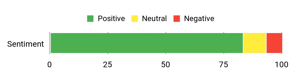
- Integrated inReach two-way messaging and interactive SOS
- Multi-band GNSS with full TopoActive mapping
- Long battery modes for remote trips
- 3-inch color display with physical controls
- Compass and barometric altimeter included
- inReach communication features require an active subscription
- Heavier and bulkier than a dedicated satellite messenger
- Menu system takes time to learn
Garmin eTrex 22x vs Garmin eTrex 32x: Is the Upgrade Worth It?
The two eTrex models share the same compact display, AA power, TopoActive mapping, and microSD expansion. The reason to step up to the 32x is its added navigation sensors.
- Compass: the 32x adds a 3-axis electronic compass for heading while stationary.
- Elevation: the 32x adds a barometric altimeter for pressure-based elevation data.
- Core mapping: both use routable TopoActive maps and support compatible maps by microSD.
- Battery: both are rated for up to 25 hours on two AA batteries.
Which Handheld GPS Should You Buy?
- Simple offline maps: get the Garmin eTrex 22x.
- Geocaching and extra sensors: get the Garmin eTrex 32x.
- Maximum power independence: get the Garmin eTrex Solar.
- Advanced mapping and battery life: get the Garmin GPSMAP 67.
- Satellite messaging and SOS: get the Garmin GPSMAP 67i.
How We Chose
- Navigation: we checked satellite systems, mapping support, waypoint/course features, and onboard sensors.
- Battery strategy: we compared replaceable AA power, rechargeable lithium batteries, solar charging, and expedition modes.
- Field durability: we checked Garmin water ratings and current model specifications.
- Owner experience: we looked for repeated trends across non-Amazon retailers, forums, and outdoor communities rather than isolated comments.
- Safety and freshness: we checked current manufacturer support, recall sources, and whether newer generations now exist.
Handheld GPS Buying Guide
Onboard Maps vs Course Navigation
If you want detailed trails and roads displayed directly on the handheld, choose a mapping model such as the Garmin eTrex 22x, Garmin eTrex 32x, Garmin GPSMAP 67, or Garmin GPSMAP 67i. The eTrex Solar is different: it focuses on waypoints, courses, tracks, and app-assisted planning rather than add-on maps stored on the device.
Satellite Accuracy
GPS and GLONASS are enough for many open-sky hikes. Multi-band GNSS can help when signals reflect or become obstructed around cliffs, dense forest, or tall buildings. The Garmin eTrex Solar, Garmin GPSMAP 67, and Garmin GPSMAP 67i add multi-band support.
Battery and Power Strategy
Choose AA-powered eTrex models if you like carrying spare batteries and replacing power in the field. Choose the Garmin eTrex Solar if sunlight and very long runtime matter most. The GPSMAP 67 series provides much longer rechargeable runtime but depends on an internal battery and USB-C charging.
Satellite Messaging and SOS
Navigation and communication are separate needs. The Garmin GPSMAP 67i adds inReach two-way messaging and interactive SOS, while the other four units do not. Budget for the required inReach subscription if you plan to use those communication features.
Display and Controls
The eTrex units are smaller and lighter, but their 2.2-inch-class screens show less map area. The GPSMAP 67 and 67i use larger 3-inch color displays and physical buttons. Buttons remain practical in rain and gloves, but the menu systems are less phone-like and need practice.
Mistakes to Avoid When Buying a Handheld GPS
- Assuming every GPS has detailed maps: check whether the exact model supports onboard maps or only courses and waypoints.
- Ignoring regional map coverage: TopoActive content varies by the region where the device is sold.
- Confusing SOS with navigation: most handheld GPS units do not include satellite messaging.
- Skipping practice: load routes, test buttons, and learn backtracking before a remote trip.
- Forgetting service costs: inReach communication requires an active plan even though normal GPS navigation does not.
FAQs
Do I Need a Handheld GPS?
You need a handheld GPS when reliable offline navigation, rugged controls, or longer independent power matter more than phone convenience. A phone can handle many day hikes with downloaded maps, but a dedicated GPS gives you purpose-built navigation hardware and battery options that do not depend on cellular service.
Do Handheld GPS Units Work Without Cell Service?
Yes. Handheld GPS receivers use navigation satellites, so core positioning works without a cellular connection. Some connected extras, such as app syncing or live weather, may require a paired phone or internet access. Satellite messaging models use a separate satellite network and service plan rather than cellular towers.
How Do Maps and Updates Work?
It depends on the model. The eTrex 22x and 32x use preloaded TopoActive maps and can support compatible maps by microSD. The GPSMAP 67 series also supports TopoActive and additional mapping options. The eTrex Solar does not support adding maps; detailed maps are handled through Garmin Explore on a paired device.
Is Multi-Band GNSS Worth It?
Multi-band GNSS is most useful when your route passes through signal-challenging places such as steep terrain, dense tree cover, or urban canyons. It is less critical for simple open-sky hiking. In this group, the eTrex Solar, GPSMAP 67, and GPSMAP 67i provide multi-band support.
Is Satellite Messaging Worth It?
Satellite messaging is useful when you travel beyond cell coverage and need two-way contact or an emergency SOS option. The GPSMAP 67i integrates those features through inReach, but they require an active satellite subscription. Test messaging and learn the SOS process before relying on it remotely.
Do I Need a Subscription for a Handheld GPS?
No subscription is required for normal GPS positioning and navigation on these handhelds. A subscription is required for inReach communication features on the GPSMAP 67i, including messaging, SOS, tracking, and inReach weather. Optional premium map services can also carry separate costs on compatible models.
Customer Preferences
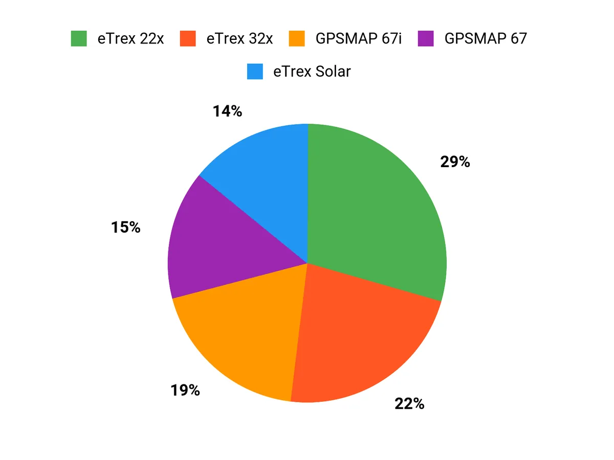
Your choice comes down to mapping depth, power strategy, sensors, and communication. The eTrex 22x favors simplicity, the 32x adds compass and altimeter data, and the eTrex Solar prioritizes runtime over onboard maps. The GPSMAP 67 adds advanced mapping and multi-band accuracy, while the 67i adds inReach communication.
Final Verdict
The best handheld GPS is the one that matches how far you go, how much mapping detail you need, and whether you need to communicate beyond cell service. For a compact all-around mapping unit, the eTrex 22x keeps the feature set simple and practical.
Choose the Garmin eTrex 32x for the Best value sensor upgrade, or the Garmin GPSMAP 67 if advanced mapping and longer rechargeable battery life matter more.
| Product Name | Image | Rating | Battery Life | Display Size | Weight |
|---|---|---|---|---|---|
| Garmin 010-02256-00 eTrex 22x |
|
4.3/5 (2,062 reviews) | 25 hours | 2.2 inches | 4.96 ounces |
| Garmin eTrex 32x |
|
4.2/5 (678 reviews) | 25 hours | 2.2 inches | 4.96 ounces |
| Garmin eTrex® Solar |
|
4.2/5 (118 reviews) | Unlimited (solar charging) | 2.2 inches | 5 ounces |
| Garmin GPSMAP® 67 |
|
4.5/5 (103 reviews) | 180 hours (standard mode) | 3 inches | 8.1 ounces |
| Garmin GPSMAP® 67i |
|
4.4/5 (261 reviews) | 165 hours | 3 inches | 8.1 ounces |