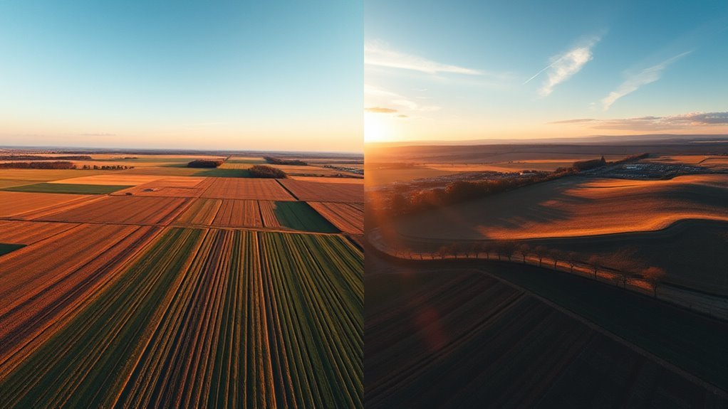
Nadir and oblique drone images serve different mapping and modeling functions. Nadir captures uniform, top-down geometry for planimetric accuracy and surface continuity. Oblique imagery adds side perspective, revealing façades, edges, and vertical structure that nadir often misses. Each approach has clear limits when used alone. In many projects, the real question is not which view is better, but how the two can be combined to produce a more complete spatial result.
What’s the Difference Between Nadir and Oblique Drone Images?
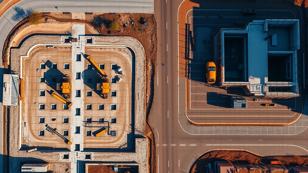
Nadir and oblique drone images differ primarily in camera angle and the type of information they capture. Nadir imagery is collected directly overhead at a 90-degree angle, creating uniform planimetric coverage that supports accurate mapping and cleaner orthomosaics.
Because the camera remains level to the ground plane, ground sample distance stays consistent, which improves measurement reliability across broad, relatively flat areas.
Oblique photography, by contrast, is acquired at roughly 30 to 60 degrees, revealing façades, slopes, and other vertical surfaces that nadir views cannot describe well. This tilt produces variable GSD, yet it adds depth, context, and structural detail useful for 3D modeling and condition assessment.
Each method serves a distinct analytical role: one clarifies horizontal geometry, the other exposes vertical complexity. Together, they extend the survey record and strengthen the freedom to read terrain and built form without relying on a single constrained perspective.
When Do Nadir Drone Images Work Best?
They work best when the survey objective is to capture a uniform, top-down record of relatively flat terrain. Nadir images, acquired at a 90-degree vertical angle, minimize perspective distortion and support high-fidelity 2D mapping.
On farmland, parking lots, and similar low-relief surfaces, they preserve consistent ground sample distances across the frame, which improves measurement repeatability and visual clarity. For large-area surveys, this consistency enables efficient photogrammetric processing into orthomosaics and digital surface models, delivering calibrated geographic outputs that can be trusted for decision-making.
In agricultural monitoring, the method supports crop assessment, field delineation, and area calculations with disciplined spatial accuracy. It is also effective for roof area measurements and stockpile volume estimation when the task depends on planar representation rather than side visibility.
The result is a dataset optimized for liberation through precision: fewer ambiguities, tighter metrics, and a more reliable spatial record of the surface under review.
When Are Oblique Drone Images the Better Choice?
Oblique drone images are the better choice when vertical detail capture is required, because they record facades, balconies, windows, and surface defects that nadir views omit.
They are also more effective for facade and damage analysis in building assessments, accident reconstruction, and crime scene documentation, where spatial relationships and visual evidence must be resolved accurately.
For 3D model enhancement, their multiple viewing angles improve triangulation, increase photogrammetric accuracy, and produce more complete urban reconstructions.
Vertical Detail Capture
When vertical surfaces must be documented with precision, oblique drone imagery becomes the superior option because it captures façades, wall textures, and other structural details at viewing angles typically between 30 and 60 degrees. Oblique images resolve vertical features that nadir views flatten, enabling freer interpretation of built form without losing measured rigor.
| Attribute | Nadir | Oblique |
|---|---|---|
| Facades | Limited | Clear |
| Wall texture | Sparse | Rich |
| Architectural context | Planar | Spatial |
| Structural cues | Partial | Explicit |
| 3D reconstruction | Supportive | Essential |
In inspections and urban planning, this added perspective improves semantic completeness. Combined with nadir coverage, the dataset becomes more emancipatory: it supports accurate models, preserves detail, and reduces blind spots in complex environments.
Facade And Damage Analysis
For facade and damage analysis, oblique drone images are often the better choice because they preserve vertical detail that nadir views routinely miss. In building inspections, oblique angles expose windows, doors, cornices, and surface defects with measurable clarity, improving condition assessments and risk decisions.
- They reveal cracks, spalling, and water intrusion on walls.
- They document damage patterns from multiple viewpoints.
- They support accident reconstruction by showing spatial relationships.
- They give planners exact facade context for development review.
This perspective empowers teams to read structures without constraint, replacing blind spots with evidence.
3D Model Enhancement
3D model enhancement depends heavily on image geometry, and oblique drone captures often provide the missing vertical perspectives needed to reconstruct accurate facades, overhangs, and other surface details that nadir imagery cannot resolve.
In practice, oblique views improve triangulation by supplying convergent rays across building facades and height variations, increasing point-cloud completeness and mesh fidelity.
Where terrain or structures exhibit strong relief, the added side perspective clarifies depth, spatial relations, and structural edges.
For architecture, construction, and urban planning, this yields models that better represent the built environment without distortion.
Oblique imagery can also expose cracks, water damage, and other diagnostic features, enabling more rigorous inspection workflows.
Combined with nadir data, it supports precise, emancipatory decision-making grounded in spatial accuracy.
Why Combine Nadir and Oblique Drone Images?
Combining nadir and oblique drone images produces a more complete spatial dataset by capturing both planimetric accuracy and vertical structure in a single workflow. Nadir and oblique passes supply complementary geometry: Nadir frames preserve uniform GSD for orthomosaics, while oblique views expose facades, edges, and other vertical elements needed for robust 3D interpretation.
- Improves reconstruction fidelity for complex scenes
- Reduces omitted vertical information in assessments
- Strengthens digital surface model accuracy
- Supports textured 3D representations with richer detail
This integration also benefits reconstruction algorithms by increasing image redundancy and viewpoint diversity, which improves feature matching and surface continuity. The result is a clearer representation of buildings, terrain breaks, and other structures that would remain partially hidden in a single angle set.
Although the combined approach can increase flight time and battery use, the added cost is technically justified by the higher-quality outputs and the broader analytical freedom it enables.
How Are Oblique Drone Images Captured?
Oblique drone images are captured by tilting a camera-mounted gimbal typically between 30 and 60 degrees, which exposes vertical surfaces that nadir views cannot record.
In oblique capture, multirotor platforms with adjustable gimbals execute a planned mission that often begins with a nadir grid for roof and terrain coverage, then adds an oblique crosshatch with four passes from cardinal directions at roughly 45 degrees.
This geometry records building walls, facades, and edges with enough perspective to support dense 3D reconstruction. Some operators extend the pattern to a 5-direction method to increase angular diversity and reduce occlusion.
Because slanted views introduce more geometric variation, image overlap usually rises to 70–80 percent to preserve stitching accuracy and maintain detail.
The result is a systematic, emancipatory acquisition process: one flight can gather complementary perspectives that render structures as accessible spatial evidence rather than flattened traces alone.
How SkyeBrowse Supports Nadir and Oblique Workflows?
SkyeBrowse supports nadir workflows by combining flight planning and processing tools that produce accurate orthomosaics and 3D models from downward-facing imagery.
It also supports oblique workflows by enabling angled capture and using those datasets to improve geometry reconstruction for complex structures.
Together, the dual modes allow users to switch efficiently between capture strategies while generating more complete digital twins.
Nadir Workflow Support
Aerial mapping workflows are supported through coordinated capture of nadir and oblique imagery, enabling extensive data collection for both orthomosaic generation and detailed 3D reconstruction.
In nadir workflow support, SkyeBrowse prioritizes vertically oriented acquisition for planimetric accuracy and uniform scale across the mapped surface. Its mission planning tools define efficient flight paths, preserve overlap, and reduce gaps that would compromise stitching.
Processing pipelines are optimized for nadir imagery, producing orthomosaics and digital surface models with consistent geometric fidelity. The interface keeps dataset management direct, so operators can move between capture modes without procedural friction.
- Accurate top-down coverage
- Preserved image overlap
- Efficient orthomosaic processing
- Consistent dataset control
Oblique Workflow Support
Beyond nadir capture, the platform integrates oblique workflows to support extensive mapping and 3D modeling in a single operational framework.
SkyeBrowse provides oblique workflow support through dual-phase missions that pair nadir grids with oblique crosshatch passes, producing dense datasets for reconstruction. High image overlap is maintained to improve stitching fidelity when perspective shifts across facades and roofs.
Adjustable gimbal settings allow rapid shifts between capture modes, enabling operators to tailor geometry to mission goals without procedural friction. The planning engine coordinates flight paths efficiently, reducing airtime while preserving data quality.
For analysis of building condition, this combined approach yields richer surface detail, stronger dimensional consistency, and fewer blind zones. The result is a more liberated workflow, where technical control and operational efficiency align.
Frequently Asked Questions
What Is the Difference Between Nadir and Oblique Imagery?
Nadir imagery is captured straight down at a 90-degree angle, producing uniform, map-ready views with consistent ground sample distance.
Oblique imagery is captured at 30–60 degrees, revealing building façades, vertical surfaces, and contextual detail that vertical views miss.
The former supports precise orthomosaics on flat terrain; the latter supports inspection and richer 3D reconstruction.
Together, they expand analytical freedom by representing ground and structure more completely.
Which Type of Drone Is Best for Mapping?
Rotary wing drones are generally best for mapping, especially when precision, hover stability, and flexible nadir or oblique capture matter. Their objection—shorter flight time—is real, yet for most survey missions it is offset by superior maneuverability and simpler mission control.
Fixed wing drones suit very large areas where endurance dominates.
In practice, multirotor platforms with RTK and adjustable gimbals offer the most liberated, technically reliable mapping workflow.
Is Photogrammetry More Accurate Than Lidar?
Photogrammetry is not inherently more accurate than LiDAR; the accuracy comparison depends on terrain, vegetation, and data processing.
In open, well-textured areas, photogrammetry can match LiDAR and sometimes exceed it after rigorous calibration.
In dense canopy, shadows, or low-texture surfaces, LiDAR usually delivers superior elevation fidelity.
The liberated choice is project driven: photogrammetry offers efficient, cost-effective mapping, while LiDAR provides dependable precision in difficult environments.
What Is a Nadir Photo?
A nadir photo is an image captured with the camera pointed straight downward, perpendicular to the ground, producing a true top-down view.
This geometry supports nadir photography techniques that minimize perspective distortion and maintain consistent ground sample distance.
Typical nadir image applications include orthomosaic production, land surveying, agricultural monitoring, and digital surface model generation.
Such imagery is especially effective over flat terrain, where accurate spatial representation is required for liberated, precise mapping.
Conclusion
In conclusion, nadir and oblique drone images serve different but complementary functions in mapping and modeling. Nadir imagery supports accurate planimetric data and clean 2D outputs, while oblique imagery improves vertical detail and structural realism. Used together, they provide a more complete spatial record, reducing gaps in reconstruction and interpretation. For projects requiring both precision and depth, the two-view approach is the best of both worlds, delivering stronger results across mapping, inspection, and model generation.
