Using GPS and mapping tools for fishing can turn a random day on the water into a planned, safer, and more productive trip. Instead of guessing where fish might hold, you can read depth contours, mark waypoints, study underwater structure, and return to proven locations with confidence. When you combine digital charts, fish finders, weather awareness, and smart map reading, you make better decisions before and during every trip.
Quick Answer
GPS helps you navigate, save productive spots, and return safely, while fishing maps reveal depth changes, weedbeds, reefs, brush, and other fish-holding structure. Use both together to plan routes, avoid hazards, target likely habitat, and adjust your fishing strategy based on water depth, season, weather, and real-time conditions.
Key Takeaways
- GPS helps you mark boat ramps, safe routes, productive spots, hazards, and successful catch locations.
- Depth contour maps show drop-offs, ledges, humps, flats, creek channels, and other structure fish often use.
- Waterproof paper maps still help when batteries fail, cell service drops, or your electronics get wet.
- Fishing apps and fish finders work best when you combine map data with current weather, water temperature, and local rules.
- Never rely on one navigation tool. Carry backups, watch conditions, and keep safety gear ready.
At a Glance
| Best For | Anglers who want safer navigation, better spot selection, and repeatable fishing success |
| Difficulty | Beginner to intermediate |
| Tools Needed | GPS unit, fish finder, fishing map app, waterproof map, compass, phone backup, and marine weather source |
| Main Benefit | Less guesswork, safer travel, and better targeting of fish-holding structure |
Importance of GPS in Fishing
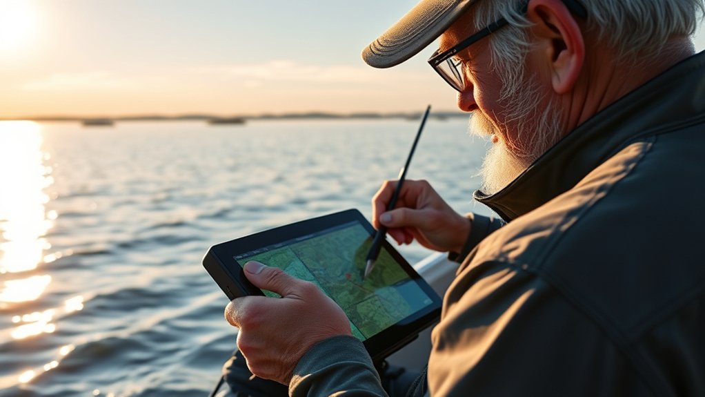
When you head out on the water, a reliable GPS can make your fishing trip safer, smoother, and more focused. It provides precise location tracking, so you can navigate to productive fishing spots without relying only on memory, shoreline landmarks, or guesswork.
GPS also helps you plan your route before you launch. You can mark boat ramps, channels, no-wake zones, shallow hazards, docks, reefs, and areas you want to fish. Once you find a good spot, you can save it as a waypoint and return later under similar conditions.
Many fishing GPS devices and chartplotters include detailed underwater topography maps. These maps help you identify fish habitats such as drop-offs, humps, flats, creek channels, points, weedlines, and submerged timber. When you know how the bottom changes, you can fish with more purpose.
Advanced tools may also support real-time weather updates, route planning, sonar overlays, tide information, and integration with fish finders. This setup lets you compare your GPS location with depth, bottom structure, vegetation, and fish activity in real time.
This combination improves your overall fishing strategy. You spend less time searching empty water and more time working high-percentage areas where fish are more likely to feed, rest, or move through.
Warning: GPS is helpful, but it is not a replacement for safe boating habits. Carry required safety gear, check marine weather before launching, keep a backup navigation method, and slow down in unfamiliar water.
Understanding Underwater Topography
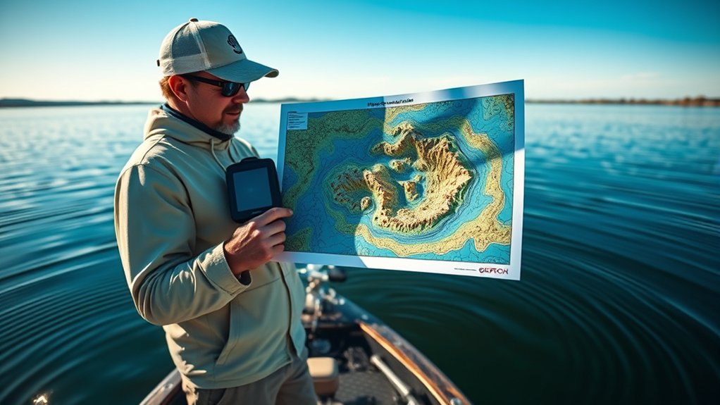
Understanding underwater topography is essential for any angler who wants to maximize fishing success. Topography shows how the bottom changes below the surface, including depth contours, rises, depressions, channels, ledges, flats, and steep breaks.
By mapping the structure of lakes, rivers, reservoirs, and coastal areas, you can pinpoint productive fishing spots. Fish often relate to changes in depth, current, cover, oxygen, temperature, and available food. A flat may look plain from the surface, but a map may reveal a hidden ditch, hump, or hard-bottom edge that holds fish.
Familiar habitats like weedbeds, submerged brush, timber, rock piles, docks, points, and rubble reefs are key areas where fish often gather. These areas provide shelter and feeding opportunities for baitfish and predator fish.
Accurate maps help you find those features faster. They also help you understand why fish may use one area in the morning, another area during midday, and a different area when wind, sun, current, or water temperature changes.
Tools like AutoChart Live, real-time sonar mapping, and detailed lake charts can offer real-time insights into aquatic environments. When you combine these tools with your own observations, your fishing strategy becomes more efficient and more repeatable.
Utilizing Waterproof and Tear-Resistant Maps
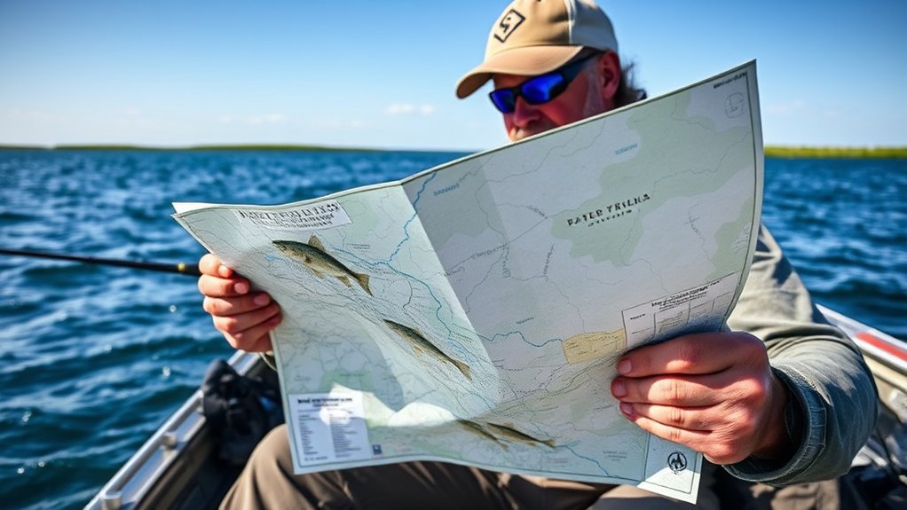
Utilizing waterproof and tear-resistant maps can greatly enhance your fishing experience, especially in rain, spray, wind, and rough outdoor conditions.
Digital tools are useful, but batteries drain, phones overheat, screens crack, and cell service can disappear. A durable printed map gives you a dependable backup when electronics fail or when you need a wider view of the lake without zooming in and out.
These durable maps are often made from water-resistant or plastic-like material, so they can handle wet environments and rough handling better than standard paper. Many fold down into a compact size and open into a larger chart that shows depth contours, access points, navigation aids, and shoreline features.
Consider these benefits:
- Detailed Legends: Gain insights into lake characteristics, depth contours, fish habitats, ramps, marinas, and nearby facilities.
- GPS Locations: Find marinas, campgrounds, marked structures, access areas, and fishing zones for better planning.
- Durability: Use reliable information that stays readable when conditions get wet or messy.
- Enhanced Navigation: Navigate with more confidence because you have essential information at your fingertips.
- Backup Safety: Keep a non-digital reference ready if your phone, chartplotter, or fish finder stops working.
With these maps in hand, you’ll be better equipped to tackle the water and make the most of your fishing adventures.
Note: Before relying on any map, check its update date. Water levels, navigation markers, access rules, and hazards can change over time.
Identifying Fish Habitats With Mapping Tools
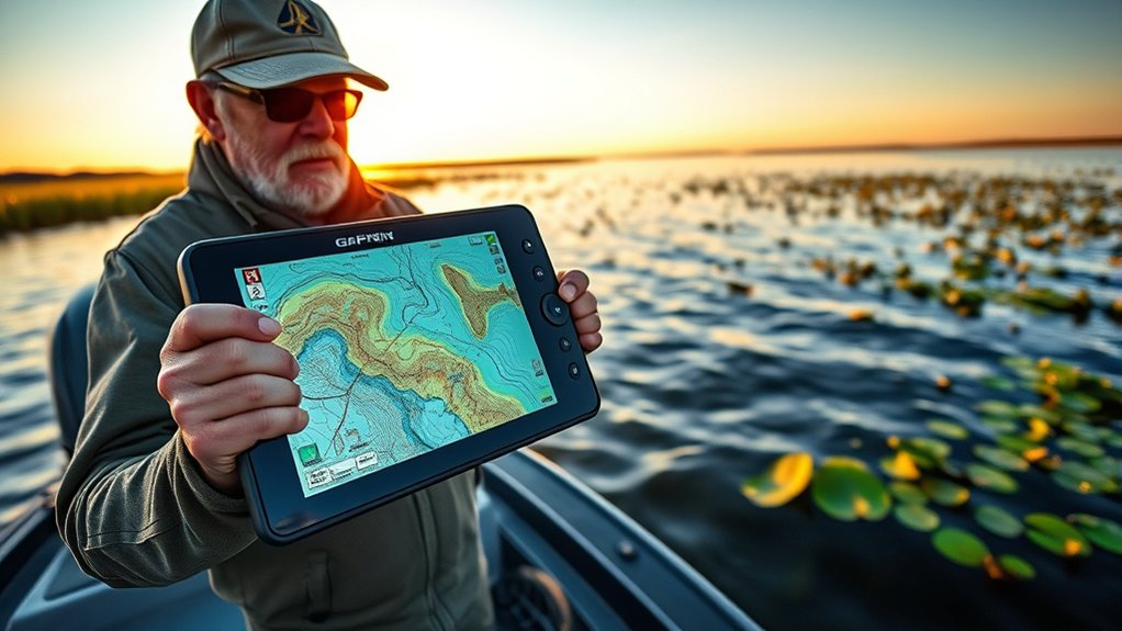
Mapping tools play an essential role in identifying fish habitats. They help you locate prime fishing spots by showing underwater features you cannot see from the surface. By understanding underwater topography, you can pinpoint structures that attract fish and improve your odds of a successful catch.
Effective tools highlight critical habitats like weedbeds, submerged brush, rock rubble reefs, artificial reefs, ledges, points, and channel edges. Predator fish often use these places to ambush prey, rest near cover, or move between shallow and deep water.
| Habitat Type | Description | Fishing Strategy |
|---|---|---|
| Weedbeds | Dense vegetation attracting baitfish | Target edges, pockets, and openings |
| Submerged Brush | Cover for fish in deeper water | Cast near the structure and work slowly |
| Rock Rubble Reefs | Complex habitats for predators | Use varied retrieval techniques |
| Artificial Reefs | Man-made structures enhancing aquatic life | Focus on specific GPS coordinates |
Look for habitat combinations whenever possible. A point with weeds, rock, and nearby deep water often has more potential than a feature with only one attractive element. The more reasons fish have to use an area, the more carefully you should fish it.
The Role of GPS Coordinates in Navigation
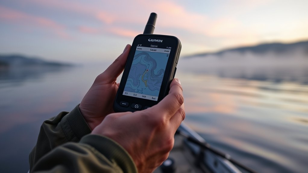
While fishing can be exciting, finding your way to the best spots often requires precision and efficiency. GPS coordinates play an essential role in navigation because they guide you directly to saved locations without depending on memory or shoreline landmarks.
Fishing is more efficient when you can save, name, and organize productive GPS coordinates instead of trying to remember every spot by sight.
Here’s how GPS can enhance your fishing adventures:
- Precise Location: Navigate directly to marked fishing spots for better success.
- Mark Successful Catches: Save your coordinates to return to previous catches when conditions line up again.
- Real-Time Navigation: Use fishing maps and apps for immediate guidance to specific sites.
- Enhanced Technology Integration: Pair GPS with fish finders to identify underwater structures, depth changes, and habitats.
- Safer Return Routes: Mark boat ramps, channels, hazards, and safe travel paths before visibility drops.
With accurate GPS tracking, you can greatly boost your fishing efficiency. You’ll avoid unproductive water and focus on the most promising locations, which improves your chances for a successful outing.
Embrace GPS technology, but stay alert. Wind, current, low light, boat traffic, and changing water levels can all affect your route, even when your GPS position looks accurate.
How to Mark and Organize Fishing Waypoints
Marking waypoints is one of the easiest ways to build your own fishing knowledge over time. A waypoint is a saved GPS location that helps you return to a ramp, hazard, structure, or fish-catching area later.
Start by naming waypoints clearly. Instead of saving random numbers, use names that tell you what happened or what the spot offers. For example, use names like “North Point Weed Edge,” “Deep Brush 18 ft,” “Rock Hump Bass,” or “Safe Channel Turn.”
Add notes when your device or app allows it. Record water temperature, depth, lure, wind direction, time of day, season, and species caught. These small details help you recognize patterns across multiple trips.
Organize your waypoints into categories:
- Safety waypoints: Boat ramps, docks, shallow bars, stumps, rocks, channel turns, and no-entry areas.
- Structure waypoints: Points, humps, ledges, brush piles, reefs, weedlines, and creek channels.
- Catch waypoints: Spots where you caught fish or saw consistent activity.
- Seasonal waypoints: Spring spawning areas, summer deep spots, fall baitfish zones, and winter holding areas.
Review your saved locations before each trip. Then choose a route based on weather, water level, target species, and the amount of time you have available.
Pro Tip: Drop a waypoint when you catch a fish, but also mark nearby structure. The fish may move, yet the depth change, weed edge, or rock pile that attracted it will remain useful.
Strategies for Effective Fishing With Maps
When you’re out fishing, understanding the underwater landscape is essential for success. A good map lets you narrow a large body of water into smaller, more manageable target zones.
By using maps that highlight fish habitats and depth contours, you can pinpoint productive locations where fish are likely to gather. This strategic approach not only boosts your chances of a successful catch but also makes your fishing trips more enjoyable and efficient.
Understanding Fish Habitats
Understanding fish habitats is essential for any angler looking to improve success on the water. By familiarizing yourself with underwater topography, you can identify key areas where fish gather, feed, and travel.
Effective maps provide useful insights into these habitats, allowing you to choose fishing locations with more confidence.
- Look for weedbeds and rock rubble reefs that attract baitfish and predator fish.
- Pay attention to submerged brush and trees, which offer shelter for fish.
- Recognize food sources like minnows, crawdads, insects, and smaller panfish that draw in larger fish.
- Use waterproof maps to navigate and adapt to changing weather, light, and water conditions.
- Check transition zones where mud, sand, rock, gravel, or vegetation meet.
With this knowledge, you’ll improve your fishing experience and increase your chances of landing a better catch.
Utilizing Depth Contours
To maximize your fishing success, use depth contour maps because they reveal the underwater landscape where fish often travel and hold. These maps help you identify structures like drop-offs, ledges, and humps, which can be prime spots for fish.
Contour lines show depth changes. Lines packed closely together usually show a steep break, while wider lines show a gradual slope. Predator fish often use these breaks to move between deep and shallow water.
| Structure Type | Fish Species | Preferred Depth Range |
|---|---|---|
| Drop-offs | Bass, Trout | 10-30 feet |
| Ledges | Walleye | 15-25 feet |
| Humps | Pike, Crappie | 5-20 feet |
| Weedbeds | Panfish, Catfish | 0-10 feet |
These depth ranges are general starting points, not fixed rules. Fish may move shallower or deeper based on season, oxygen, sunlight, water clarity, bait movement, pressure, and weather.
Mapping Productive Locations
Mapping productive locations requires a strategic approach that builds on the insights gained from depth contours. By using underwater topography maps, you can pinpoint fish habitats and improve your chances of a successful day on the water.
Here are some effective strategies:
- Identify key structures: Look for weedbeds, rock rubble reefs, points, docks, and submerged structures that attract predator fish.
- Use seasonal insights: Track how fish move during spawning, summer heat, fall feeding, and cold-water periods.
- Create real-time maps: Use mapping tools to refine your strategy as you navigate.
- Focus on high-percentage areas: Use chart data and fishing history to avoid empty water and target better zones.
- Match structure with conditions: Wind-blown banks, shaded docks, current seams, and temperature breaks can all change where fish feed.
With these strategies, you’ll improve your fishing success and enjoy your time outdoors.
Using Maps Before, During, and After a Trip
Maps work best when you use them throughout the full fishing process, not just while you are already on the water. A simple before, during, and after routine helps you learn faster.
Before the Trip
Study the lake or river before you launch. Look for access points, parking, ramps, shallow hazards, long runs, likely fish habitat, and backup areas if wind makes your first plan unsafe.
Choose a few primary spots and a few secondary spots. This keeps your day flexible without turning it into random searching.
During the Trip
Use GPS to follow safe routes and compare map features with what your sonar shows. If your fish finder reveals bait, vegetation, bottom hardness, or fish near a mapped structure, slow down and work the area carefully.
Mark anything useful. Save waypoints for catches, missed bites, bait schools, brush piles, and hazards. These details help you build a more accurate personal fishing map.
After the Trip
Review your waypoints and notes after you return. Delete useless marks, rename important ones, and record what worked. Over time, this habit helps you see patterns that a single trip cannot show.
Enhancing Safety Through Mapping Technology
While you’re out on the water, advanced mapping technology can improve your safety as an angler. Tools like electronic navigation charts, lake depth contour maps, and GPS routes can help you steer clear of hazardous areas.
Real-time mapping can improve your awareness while fishing. GPS integrated into fish finders helps you track your location, return to safe routes, and avoid getting turned around in unfamiliar waters.
| Feature | Benefit | Example |
|---|---|---|
| Electronic Navigation Charts | Help identify marked routes, hazards, and navigation aids | ENCs |
| Real-Time Mapping | Create or update maps while you travel | AutoChart Live |
| GPS Integration | Support precise location tracking | Fish finders |
| Extensive Fishing Maps | Identify ramps, channels, and navigation aids | Emergency routing |
| Weather Updates | Support better decisions before and during a trip | Marine forecasts |
Leveraging these features keeps you safer and improves your fishing experience, but you still need good judgment. Turn back when weather builds, keep your speed reasonable, and avoid taking shortcuts through shallow or unfamiliar water.
Integrating Technology Into Fishing Guides
When you integrate advanced mapping software into your fishing guides, you gain access to real-time data that can transform your fishing experience.
With enhanced navigation tools, you can pinpoint better fishing spots, avoid potential hazards, and make smarter decisions on the water. This technology does not replace fishing skill, but it helps you apply that skill in the right places.
Mapping Software Advantages
Utilizing advanced mapping software can greatly enhance your fishing experience by giving you access to useful information about underwater landscapes.
With tools like Humminbird Fishing Charts, AutoChart Live, C-MAP, and Navionics-style charting, you can study water more effectively and choose productive spots with more confidence. Key advantages include:
- Detailed underwater topography: Understand depth contours and terrain features.
- Vegetation mapping: Identify habitats that attract fish species.
- Community-sourced data: Learn from updated user-generated insights where available.
- GPS navigation: Find your way back to successful locations.
- Route planning: Plan safer paths between ramps, channels, and fishing zones.
These features help you focus on promising areas and make better use of your fishing time.
Real-Time Data Integration
Integrating real-time data into fishing guides changes how you approach your trips. It can provide immediate access to useful information like water depth, mapped contours, bottom hardness, vegetation, water temperature, and fish activity.
Innovative tools like AutoChart Live let you create real-time maps that reveal underwater features while you’re on the water. This helps when a lake map is outdated, incomplete, or missing detail in the area you fish most.
Fishing apps may also let you review saved tracks, compare waypoints, and store notes from past trips. Community-sourced maps can offer local updates, but you should treat user-generated information as helpful guidance rather than guaranteed truth.
With advanced mapping technologies like Humminbird’s VX Technology, you can study underwater topography more clearly and increase your chances of finding productive fishing spots.
Enhanced Navigation Tools
As real-time data reshapes how you navigate fishing trips, enhanced navigation tools take your experience to another level.
These technologies help you fish smarter, plan better routes, and make better use of your time on the water. Here are some key tools that can elevate your fishing game:
- Humminbird’s AutoChart Live: Create real-time maps of productive spots as you fish.
- C-MAP App: Access updated navigation and fishing charts for detailed planning.
- Interactive online chart viewers: Explore depth contours and lake features before a trip.
- Navionics compatibility: Add detailed charting options to compatible fish finders and mobile devices.
- Saved tracks: Follow your previous route back to the ramp or repeat a productive drift.
With these tools, you’ll navigate with more confidence, discover new fishing locations, and increase your chances of landing that big catch.
Choosing Between Phone Apps, Handheld GPS, and Fish Finders
Different GPS and mapping tools serve different needs. The best setup depends on where you fish, how often you go, and how much detail you need.
| Tool | Best Use | Main Limitation |
|---|---|---|
| Phone App | Trip planning, quick maps, offline charts, and backup navigation | Battery life, screen visibility, water exposure, and signal limits |
| Handheld GPS | Portable navigation, hiking to remote banks, kayak fishing, and backup routes | Smaller screen and fewer fishing-specific sonar features |
| Fish Finder With GPS | Boat fishing, sonar, waypoints, contour maps, and real-time structure reading | Higher cost and installation needs |
| Paper Map | Backup navigation, big-picture lake study, and low-tech planning | No live location or real-time updates |
For many anglers, the strongest setup is a fish finder with GPS on the boat, a phone app with offline maps, and a waterproof paper map as a backup.
The Future of Fishing Navigation Tools
While the fishing landscape continues to evolve, the future of fishing navigation tools will likely make trip planning, navigation, mapping, and fish-habitat analysis even more connected.
Advanced GPS technology already lets you pinpoint productive fishing spots with strong accuracy. Features like AutoChart Live allow you to create personalized maps in real time, capturing underwater structures and habitats as you fish.
Tools such as Humminbird’s SmartStrike analyze conditions and patterns, helping you avoid unproductive water and focus your fishing time. Community-sourced mapping platforms also support collaboration among anglers by allowing shared updates and local insights.
Future tools may continue improving in areas like chart detail, offline access, sonar interpretation, route planning, weather integration, and cross-device syncing. Even so, the best results will still come from combining technology with observation, patience, and time on the water.
Enhanced mapping tools, including underwater topography maps and detailed legends, provide vital information about fish habitats and depth contours. These innovations make your fishing trips more informed and help transform your overall experience on the water.
Tips for Choosing the Right Mapping App
When choosing the right mapping app for your fishing adventures, focus on features that improve planning, navigation, and fishing decisions. Good apps should make it easy to study water, save spots, and navigate without confusion.
Don’t underestimate the importance of a user-friendly interface. A clean, simple app matters when you are dealing with wind, sun glare, rain, boat movement, or cold hands.
Finally, evaluate mapping accuracy to make sure you’re relying on useful data for successful fishing outings.
Determine Key Features
Choosing the right mapping app can make a big difference in your fishing adventures. To enhance your experience, look for key features that fit your needs:
- Detailed lake depth contour maps and electronic navigation charts for insights into underwater topography.
- Tools for identifying target species, seasonal patterns, and likely habitat.
- Offline maps that allow navigation in remote areas, especially where cell service is weak.
- Fishing-specific features, such as real-time mapping, waypoint notes, saved tracks, and community-sourced maps.
- Simple route planning so you can estimate travel distance and avoid unsafe shortcuts.
Assess User Interface
A user-friendly interface is essential for making the most of your mapping app, especially when you’re out on the water.
Look for apps with interactive maps that allow easy navigation and customization for your fishing needs. Prioritize apps that offer detailed underwater topography, including depth contours and fish habitats.
Real-time updates can also help. Choose apps that provide useful data like weather, map updates, water information, or fishing conditions when available.
Extensive legends are important too. They help you understand depth contours, GPS locations, marinas, ramps, campgrounds, hazards, and navigation aids.
Finally, consider apps that support community-sourced maps or personal map storage, enabling you to create a more tailored fishing experience.
Evaluate Mapping Accuracy
While navigating large or unfamiliar water, having accurate mapping information is essential for a successful fishing trip.
To choose the right mapping app, consider the following factors that enhance accuracy:
- Select apps that use regularly updated chart data from reliable sources.
- Look for lake depth contour maps, shoreline detail, and navigation aids.
- Make sure the app includes detailed legends that explain depth contours, fish habitats, hazards, and map symbols.
- Consider apps with community-sourced maps for localized insights, but verify important details before trusting them.
- Check whether offline maps remain available when cell service drops.
Common Mistakes When Using GPS and Fishing Maps
GPS and mapping tools help a lot, but they can also create problems when you rely on them without thinking. Avoid these common mistakes:
- Trusting old map data completely: Water levels, hazards, markers, and access points can change.
- Ignoring weather: A saved route may not be safe in high wind, storms, fog, or strong current.
- Saving messy waypoints: Unnamed marks become hard to use later.
- Fishing only the waypoint: Fish may move, so also study nearby structure and depth changes.
- Forgetting battery management: Charge devices, carry power backups, and keep a paper map available.
- Skipping local rules: Some waters have restricted zones, seasonal closures, speed limits, or protected habitats.
Good anglers use GPS as a tool, not as a shortcut for awareness. Keep watching the water, the weather, your depth, and your surroundings.
Frequently Asked Questions
What is the best GPS for fishing?
The best GPS for fishing is one that matches how and where you fish. Look for accurate mapping, waypoint storage, easy screen readability, durable construction, offline chart access, and compatibility with your fish finder or chartplotter. Boat anglers may prefer a fish finder with built-in GPS, while kayak and bank anglers may prefer a phone app or handheld GPS.
Is there a navigation app like Google Maps for boats?
Yes. Boating-focused apps such as C-MAP and Navionics-style charting apps are designed for marine navigation and fishing. They usually offer nautical charts, depth contours, navigation aids, route planning, and offline chart options. Always compare app data with local rules, posted markers, and current conditions.
How do you use Google Maps to fish?
You can use Google Maps to find lakes, rivers, boat ramps, parking areas, shoreline access, nearby marinas, and visible structure such as points, docks, bridges, and channels. Satellite view can help with planning, but it is not a full marine chart. Use a fishing or boating map for depth contours, hazards, and navigation details.
How much does the C-MAP app cost?
C-MAP app pricing can vary by region, chart coverage, subscription level, and available promotions. Some features may be free, while premium charts or advanced features may require a subscription or purchase. Check the official C-MAP app listing or website for the current price before buying.
Can GPS help you catch more fish?
GPS can help you catch more fish by letting you save productive spots, follow depth changes, repeat successful routes, and return to areas where fish were active. It does not guarantee a catch, but it helps you fish more efficiently and make better decisions.
Should you use a fishing map app offline?
Yes, offline maps are useful because many fishing areas have weak or no cell service. Download charts before your trip, charge your device, and carry a backup map or GPS option. Offline access is especially important on large lakes, remote rivers, and coastal areas.
Conclusion
Incorporating GPS and mapping technology into your fishing adventures is one of the smartest ways to improve safety, planning, and spot selection. With tools that guide you to prime spots, show depth changes, and help you save waypoints, you can focus more on fishing and less on guessing.
Use GPS to mark ramps, routes, hazards, catches, and structure. Use maps to understand the underwater world that fish actually live in. Then combine that information with weather, season, water conditions, and your own observations.
As you embrace these tools, you’ll improve your safety and elevate your overall experience on the water. Gear up, mark those waypoints, keep a backup plan, and let smart mapping guide you toward your next big catch.
Sources
- U.S. Coast Guard Boating Safety — boating safety practices and preparation reminders
- National Weather Service Marine Forecasts — marine weather awareness before and during trips
- NOAA Electronic Navigational Charts — official electronic chart information for navigation
- Humminbird AutoChart Live — real-time mapping and fishing chart technology
- C-MAP App — boating and fishing chart app features