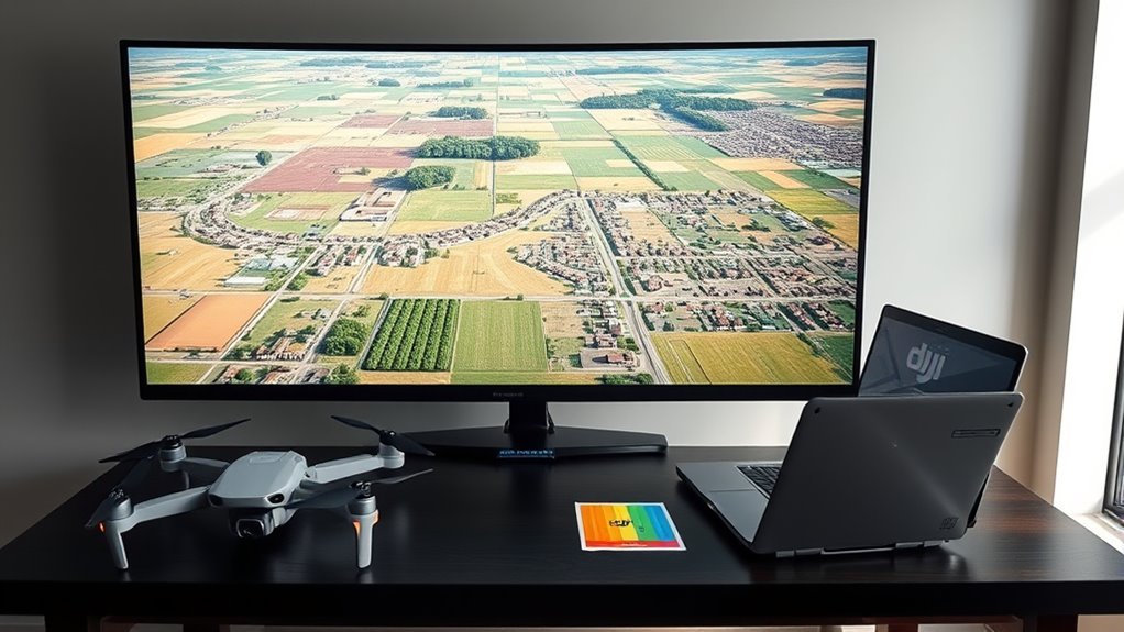
DJI Terra converts aerial photos and LiDAR data into geospatial products such as 2D orthomosaics, digital surface models, point clouds, and 3D reconstructions. It is especially useful in DJI Enterprise workflows where mapping data must move from field capture into GIS, CAD, inspection, or measurement software. Accuracy depends less on the software name than on image quality, overlap, positioning, terrain, control points, and how the finished map is validated.
Quick Answer
DJI Terra is desktop reconstruction software for turning drone imagery and LiDAR data into orthomosaics, DSMs, point clouds, 3D models, and other mapping deliverables. For reliable orthomosaics, use sharp nadir photos, sufficient overlap, accurate positioning, the correct coordinate system, and independent checkpoints when project accuracy must be proven.
Key Takeaways
- DJI Terra produces 2D orthomosaics, DSMs, 3D models, point clouds, multispectral outputs, and photorealistic Gaussian Splatting results for supported workflows.
- For visible-light mapping, DJI normally recommends about 80% forward overlap and 70% side overlap, with more overlap where terrain or scene complexity requires it.
- An orthomosaic is best for georeferenced 2D viewing and measurement; a DSM or point cloud is needed when elevation and 3D geometry matter.
- Matrice 4E and Mavic 3 Enterprise are stronger mapping choices than consumer-focused DJI drones because they are designed around enterprise capture, positioning, and mapping workflows.
- Current DJI Terra 5.x workflows should not be described like older Terra versions: general mapping-route planning has largely moved to apps such as DJI Pilot 2 while Terra focuses on processing and reconstruction.
What DJI Terra Does for Orthomosaics?
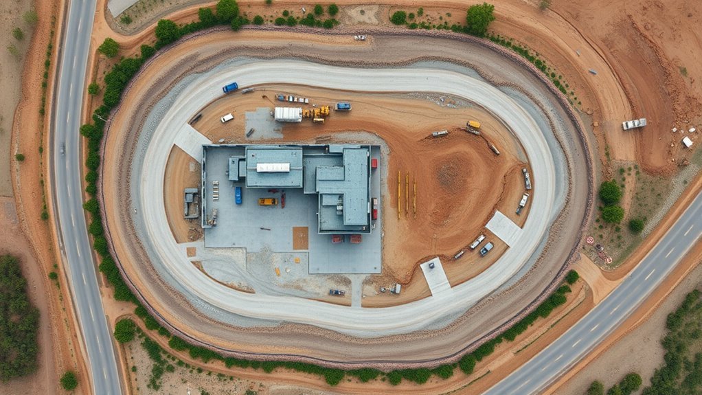
DJI Terra converts overlapping aerial imagery into a georeferenced digital orthophoto map, commonly called an orthomosaic or DOM. Photogrammetry identifies matching features across many photographs, solves camera positions, corrects perspective and terrain-related distortion, and mosaics the corrected imagery into a map with consistent scale.
This should be kept separate from DJI Terra’s 3D Gaussian Splatting capability. Gaussian Splatting is designed for photorealistic 3D reconstruction and visualization; it is not what makes a conventional 2D orthomosaic orthorectified.
DJI has previously reported example throughput of roughly 2,000 images per hour for 2D projects and around 700 images per hour for 3D projects. Those figures are useful as reference points rather than guaranteed processing rates because workstation hardware, image resolution, reconstruction quality, overlap, dataset complexity, and software version all affect speed. See DJI Enterprise’s Terra workflow overview.
Ground Control Points can be introduced when a project requires stronger control against surveyed coordinates. Checkpoints should be kept independent from the adjustment when the goal is to verify accuracy rather than simply improve the solution.
A clean-looking orthomosaic is not automatically an accurate survey. Positioning, overlap, camera quality, control, and independent validation determine whether the finished map meets the required tolerance.
For 2D reconstruction, DJI Terra can produce digital orthophoto maps and digital surface models in GeoTIFF-based workflows, allowing the output to move into GIS and other geospatial software.
Why DJI Terra Matters for Mapping
DJI Terra matters because it brings several reconstruction workflows into one desktop environment. Depending on the license, data, and current software version, it can process visible-light imagery, LiDAR data, multispectral imagery, conventional 3D photogrammetry, and photorealistic Gaussian Splatting reconstruction.
For DJI Enterprise users, the main benefit is workflow integration. Imagery captured by mapping-focused aircraft can be reconstructed into orthomosaics, DSMs, point clouds, textured models, and other deliverables without repeatedly converting the raw data between unrelated applications.
3D Reconstruction Power
DJI Terra’s 3D reconstruction tools serve a different purpose from a 2D orthomosaic. Conventional 3D photogrammetry reconstructs geometry from overlapping images, while Gaussian Splatting emphasizes photorealistic scene representation. LiDAR processing can preserve dense measured geometry from compatible laser-scanning payloads.
The right output depends on the job. Construction documentation may need both an orthomosaic and a point cloud. An inspection team may value a textured 3D model. A visualization workflow may benefit from Gaussian Splatting. Agriculture can use multispectral reconstruction where compatible data is available.
Accurate Mapping Outputs
Mapping accuracy is driven by the complete acquisition and processing chain. Sharp photos, appropriate Ground Sample Distance, sufficient overlap, reliable GNSS or RTK positioning, proper camera calibration, suitable control distribution, and the correct coordinate system all matter.
- Orthomosaic/DOM: georeferenced 2D imagery for mapping and planimetric measurements
- DSM: raster surface elevations representing terrain plus visible objects such as buildings and vegetation
- Point cloud: 3D points preserving surface geometry and elevation
- Textured 3D model: reconstructed geometry with imagery applied to the surface
- Gaussian Splatting: photorealistic 3D scene representation for compatible workflows
DJI’s published Phantom 4 RTK example states that 2D-map absolute accuracy can be around one to two times the GSD under its test conditions and gives an example of roughly 2–5 cm horizontal accuracy at a 100 m flight height. That is an example, not a universal accuracy promise. Project acceptance should be based on checkpoints or another suitable validation method. See the official DJI Terra FAQ.
Fast Workflow Integration
Terra reduces handoffs between reconstruction and downstream mapping work, but current workflows differ from older versions of the software.
| Capability | Current Practical Value | Important Note |
|---|---|---|
| 2D reconstruction | DOM and DSM production | Processing speed depends on hardware and dataset complexity |
| 3D reconstruction | Point clouds, models, and photorealistic reconstruction | Choose the output type based on the deliverable |
| Coordinate systems | 8,500+ built-in systems plus PRJ/custom transformation support | The project’s required horizontal and vertical reference systems must be selected correctly |
| Flight capture | Handled mainly in current aircraft apps such as DJI Pilot 2 | Terra 5.x no longer provides the same general route-planning workflow as older releases |
What Changed in the Current DJI Terra Version?
As of September 2026, DJI’s download page lists DJI Terra V5.3.5, released on August 20, 2026. That makes older wording about V4.2 being an upcoming release obsolete. Always check the official DJI Terra Downloads page before relying on version-specific instructions.
Recent DJI Terra updates have expanded reconstruction beyond the older orthomosaic-and-mesh workflow. DJI has highlighted features such as thermal 2D reconstruction, rolling-shutter correction, video-based 3D modeling, Gaussian Splatting improvements, newer LAS/LAZ point-cloud support, and updated online documentation.
Note: Avoid following old Terra tutorials step-for-step without checking the version number. Flight-planning menus, licensing, outputs, reconstruction options, and supported hardware have changed across major releases.
DJI Terra vs Aerial Photo
A standard aerial photograph is a perspective image taken from one camera position. Buildings can lean, scale changes across the frame, and terrain relief can shift features away from their true map positions.
A DJI Terra orthomosaic combines many overlapping photographs and applies georeferencing and orthorectification so the resulting raster can be used like a map within the limits of the source data and processing accuracy.
- Aerial photo: useful for visual inspection from one viewpoint
- Orthomosaic: designed for consistent-scale, georeferenced 2D mapping
- DSM: stores surface-elevation information separately from the visual orthophoto
- Point cloud: preserves full 3D point geometry
- 3D model: provides reconstructed surfaces and textures for three-dimensional viewing
An orthomosaic is therefore more useful for GIS overlays, site documentation, distance or area measurements, and repeated mapping than an uncorrected single aerial photograph.
[Amazon Products Picked for You]


How DJI Orthomosaics Are Made
DJI orthomosaic production starts before Terra is opened. The quality of the final map is largely determined during mission planning and data capture.
- Define the project boundary and required accuracy. Decide the coordinate system, target Ground Sample Distance, deliverables, and whether RTK, GCPs, or checkpoints are needed.
- Plan the mapping flight. Set altitude, line spacing, speed, camera orientation, and overlap for the terrain and sensor.
- Capture sharp, consistent imagery. Avoid motion blur, strong exposure changes, missing flight lines, and excessive moving objects.
- Import the imagery into DJI Terra. Confirm image locations, camera information, project coordinate settings, and control-point data.
- Run aerotriangulation and reconstruction. Terra matches features, solves camera positions, orthorectifies imagery, and generates selected outputs.
- Review the quality report and checkpoints. Check residuals, image coverage, control distribution, reconstruction completeness, and independent accuracy evidence.
- Export the required deliverables. Move the orthomosaic, DSM, point cloud, model, or other output into the client’s GIS, CAD, inspection, or analysis workflow.
There is no universal rule that a 50-acre project should contain 400–800 images. Image count changes with camera resolution, altitude, GSD, overlap, terrain-following behavior, survey shape, and sensor footprint.
Pro Tip: Review several images at full resolution before leaving the site. A complete-looking flight can still fail reconstruction if images are blurred, overexposed, poorly focused, or captured with inadequate overlap.
Best DJI Drones for Orthomosaic Work
For professional DJI mapping, the strongest choices are enterprise aircraft designed for repeatable capture, mechanical-shutter imaging, and precise positioning.
[Amazon Products Picked for You]


Precision Measurement: Each UAV GCP features a 1.18 inches center hole for installing an RTK surveying pole or marker rod, ensuring perfect alignment between the coordinate measurement point and the image recognition point

DJI Matrice 4E
The DJI Matrice 4E is one of DJI’s current mapping-focused aircraft. Its wide camera uses a 4/3-inch 20 MP sensor and mechanical shutter, and DJI states that the aircraft supports precision mapping when RTK is enabled. It also supports Smart 3D Capture and enterprise mission planning through DJI Pilot 2. See the DJI Matrice 4 Series FAQ.
DJI Mavic 3 Enterprise
The Mavic 3 Enterprise remains a practical compact mapping platform. It combines a 4/3-inch 20 MP camera with a mechanical shutter and supports an RTK module for high-precision positioning. Its smaller form factor makes it useful where portability matters. See the official Mavic 3 Enterprise page.
What About Mavic 4 Pro?
The consumer-focused Mavic 4 Pro can capture high-quality images, and those images may be useful in photogrammetry workflows, but it should not be presented as equivalent to a Matrice 4E or Mavic 3E for an integrated professional DJI mapping workflow. Enterprise models provide the capture, positioning, mission-planning, and documentation features expected in repeatable survey operations.
Likewise, there is no universal 17,000-acre DJI Terra project limit. The practical scale is controlled by aircraft endurance, flight logistics, photo count, overlap, computer memory, storage, processing configuration, and whether cluster reconstruction is used.
Do not assume a six-month DJI Terra license is automatically bundled with every aircraft purchase. License bundles and promotional terms can vary by product, dealer, region, and purchase date, so verify the current offer before budgeting the project.
How to Plan a Clean Flight
A clean orthomosaic flight starts with the survey boundary, required GSD, terrain, legal flight limits, positioning method, and desired output accuracy.
For visible-light reconstruction, DJI generally recommends approximately 80% forward overlap and 70% side overlap. DJI says the ratio can be reduced in relatively uniform terrain, but recommends keeping forward overlap at about 65% or greater and side overlap at about 60% or greater. Increase overlap where elevation changes, complex structures, repetitive surfaces, or other scene conditions make feature matching harder.
Current Terra users should also understand an important workflow change: beginning with Terra 5.0.0, DJI no longer supports the same general flight-route planning functions found in earlier versions. For modern enterprise aircraft such as Matrice 4E and Mavic 3 Enterprise, mapping missions are normally planned and flown in DJI Pilot 2, with Terra used afterward for reconstruction and analysis.
- Set a flight altitude that produces the required GSD without violating airspace or operating limits.
- Use consistent nadir imagery for standard orthomosaic capture.
- Keep exposure and focus consistent across the survey.
- Use terrain-following or additional margin where elevation changes could reduce effective overlap.
- Confirm RTK fix quality when RTK is part of the accuracy strategy.
- Distribute GCPs and checkpoints across the project rather than clustering them in one area.
- Plan enough battery reserve for safe return and landing.
Warning: Do not reduce overlap simply to shorten a flight when mapping steep terrain, tall structures, repetitive surfaces, or feature-poor areas. Insufficient overlap can cause missing blocks, distorted building edges, or complete aerotriangulation failure.
What Affects DJI Terra Accuracy?
DJI Terra cannot create accuracy that is absent from the source data. The main factors are image resolution, Ground Sample Distance, overlap, camera calibration, positioning quality, terrain, control distribution, image sharpness, and the coordinate-reference system used for processing and export.
- Ground Sample Distance: smaller GSD generally allows finer visible detail.
- Image overlap: sufficient common imagery helps Terra solve camera positions reliably.
- RTK/PPK positioning: improves camera-position information when correctly configured.
- Ground Control Points: can constrain the reconstruction to surveyed coordinates.
- Checkpoints: provide independent evidence of accuracy when they are not used to adjust the model.
- Image quality: blur, poor focus, strong shadows, overexposure, or inconsistent brightness can weaken feature matching.
- Terrain: large elevation differences can reduce effective overlap at high points unless the mission is planned accordingly.
- Coordinate system: horizontal, vertical, geoid, and local transformation settings must match the project specification.
DJI Terra supports more than 8,500 built-in coordinate systems, and it also supports PRJ import and seven-parameter transformations for appropriate local-coordinate workflows. The availability of many coordinate systems does not remove the need to choose the correct one.
For agricultural missions, multispectral reconstruction can produce vegetation-index outputs where supported sensor data is available. This is a separate analytical workflow from ordinary RGB orthomosaic production.
Orthomosaic vs Point Cloud
An orthomosaic is a georeferenced 2D raster created from corrected aerial imagery. A point cloud is a 3D collection of points representing surface geometry. The two products answer different questions and are often delivered together.
Data Type Differences
An orthomosaic’s pixels are positioned in a georeferenced raster, so software can derive real-world map coordinates from their raster location. The orthomosaic itself should not be described as storing elevation in every visual pixel. Surface elevation is normally represented by a separate DSM or by 3D data such as a point cloud.
A point cloud contains points with X, Y, and Z geometry and may also contain additional attributes depending on the source and output format. It is therefore better suited to terrain modeling, profiles, volumes, structural geometry, and other three-dimensional analysis.
- Orthomosaic: 2D georeferenced raster
- DSM: raster surface elevation
- Point cloud: 3D spatial points
- Mesh: connected 3D surface geometry
- Gaussian Splatting: photorealistic 3D representation rather than a traditional engineering point dataset
Do not treat figures such as “100 MB–2 GB for orthomosaics” or “50 GB+ for point clouds” as standard file sizes. Actual sizes can range widely with site area, resolution, point density, tiling, compression, color data, and export settings.
Visuals Vs Measurements
Orthomosaics excel when the job requires a clear plan-view image: inspecting roofs, mapping pavement, documenting site progress, drawing boundaries, measuring areas, or overlaying features in GIS.
Point clouds are stronger when the question depends on height, depth, slope, volume, cross-section, or three-dimensional shape. They preserve information that a flat map cannot.
For engineering work, using both products can be valuable. The orthomosaic provides a readable visual base map while the point cloud or DSM supplies the elevation component.
Best Use Cases
- Orthomosaics: construction progress maps, agriculture, asset documentation, site planning, cadastral-support workflows, and GIS basemaps
- DSMs: surface-height analysis, drainage context, terrain visualization, and elevation comparison
- Point clouds: terrain reconstruction, earthwork analysis, engineering measurement, structures, and 3D design reference
- 3D models: inspections, visualization, digital twins, and presentation
- Gaussian Splatting: photorealistic 3D scene visualization when traditional mesh geometry is not the only priority
The best format follows the deliverable. A visually impressive 3D model is not a substitute for a validated survey dataset when the project requires measured positional accuracy.
DJI Terra Export Formats
DJI Terra supports multiple output types for GIS, CAD, visualization, and 3D-processing workflows. The exact options available can depend on reconstruction type and software version.
- 2D reconstruction: digital orthophoto maps and DSMs in GeoTIFF-based workflows
- Point clouds: formats including LAS, LAZ, PNTS and other supported 3D point formats depending on workflow/version
- Textured models: formats such as OBJ, PLY, I3S and other supported model formats
- LOD models: formats such as OSGB, B3DM and S3MB
- Aerotriangulation: XML and Terra-specific results
- Derived mapping data: supported workflows can generate additional contour, grid, terrain, or related deliverables
The original statement that “V4.2 is scheduled to add landXML and GeoJSON” is no longer current. DJI Terra has progressed well beyond that release. Check the current DJI Terra support documentation for the output formats available in the version you are actually running.
DJI Terra also supports thousands of known coordinate systems, PRJ import, and custom seven-parameter transformations. Correct coordinate-system selection is essential when Terra results must line up with existing engineering, GIS, or survey data.
What to Check Before You Buy DJI Terra
Start with hardware. DJI’s current guidance for standalone reconstruction specifies a 64-bit Windows 10 or later environment, at least 32GB of RAM, and at least 4GB of NVIDIA GPU memory on a compatible NVIDIA graphics card. DJI recommends 64GB or more RAM and an NVIDIA RTX 2070-class GPU or better for stronger performance.
DJI Terra is not currently a native macOS application, and DJI states that non-NVIDIA GPUs such as AMD graphics are not supported for its current reconstruction requirements.
Note: RAM determines how large a photo set Terra can process efficiently, while GPU, CPU, disk speed, free cache space, reconstruction quality, and image resolution strongly affect processing time.
Before purchasing, check:
- Whether the required Terra edition includes the reconstruction features your project needs
- Whether your PC meets current Windows, RAM, GPU, driver, and storage requirements
- Whether the aircraft and payload fit the intended DJI Pilot 2 and Terra workflow
- Whether the required coordinate systems and output formats are supported
- Whether offline operation or cluster reconstruction is required
- Whether the client expects a specific GIS, CAD, point-cloud, or 3D-model deliverable
- Whether a permanent license or time-limited license makes more financial sense for the expected workload
DJI currently advertises a one-month Terra trial. Its current product page states that reconstruction of more than 500 photos is not supported in the trial and LiDAR reconstruction is limited to 8GB. Trial conditions can change, so confirm them on the official DJI Terra product page.
Common DJI Terra Problems and Fixes
Missing or Distorted Areas in the Orthomosaic
Low overlap is one of the first things to check. DJI specifically notes that insufficient overlap can contribute to distorted building edges or incomplete reconstruction. Increase overlap and consider higher flight altitude or terrain-aware planning when topography changes sharply.
Aerotriangulation Fails
Look for missing image blocks, poor GPS positions, large differences in lighting, motion blur, overexposure, badly focused photographs, insufficient common features, or multiple unrelated datasets imported into one reconstruction.
Water, Glass, Snow, or White Surfaces Reconstruct Poorly
Photogrammetry depends on identifiable texture that appears consistently in overlapping images. Water moves and reflects light; glass changes reflections with camera angle; white walls and snow can provide little texture. These scenes may contain holes or unstable geometry even when the flight itself is complete.
Repetitive Surfaces Cause Errors
Solar panels, repetitive roof patterns, crop rows, floor tiles, and similar surfaces can give matching algorithms many features that look alike. More overlap, additional viewpoints, better lighting, and surrounding unique features can improve the solution.
Orthomosaic Generation Fails Near the End
Check free disk space and the Terra cache directory. DJI’s troubleshooting documentation identifies insufficient storage as a possible cause of DSM, orthorectification, orthophoto mosaic, and map-tile generation failures.
Elevation Does Not Match Survey Measurements
Confirm that the project is using the intended coordinate system and vertical reference, then review RTK status, control-point coordinates, camera positions, and checkpoints. A visually good orthomosaic cannot establish vertical accuracy by itself.
Sources
- DJI Terra Downloads — current DJI Terra version, manuals, release notes, and known issues.
- DJI Terra FAQ — overlap guidance, reconstruction outputs, mapping accuracy examples, and processing guidance.
- DJI Terra Support — system requirements, flight-planning changes, licensing, supported functions, and output information.
- DJI Matrice 4 Series FAQ — Matrice 4E precision-mapping and RTK information.
- FAA Remote Identification of Drones — current U.S. Remote ID requirements and identification information.
- FCC Covered List — current federal equipment-security restrictions relevant to foreign-produced UAS.
Frequently Asked Questions
Are DJI Drones Getting Banned in the US?
The situation is more specific than a simple nationwide flight ban. FCC actions have restricted new equipment authorization for covered foreign-produced UAS, including major effects on new DJI products entering the U.S. market. The FCC has also considered additional restrictions on continued importation or marketing of some previously authorized equipment. However, the FCC has stated that already-authorized devices can continue to be used. Pilots must still comply with FAA registration, Remote ID, airspace, and operating rules. Because the policy is changing quickly, check current FAA and FCC guidance before buying equipment for a long-term U.S. program.
What Is the Best 3D Mapping Software for Drones?
There is no universal best 3D mapping package. DJI Terra is a strong choice when you use DJI Enterprise aircraft or payloads and want an integrated desktop workflow for photogrammetry, LiDAR, multispectral reconstruction, point clouds, or Gaussian Splatting. Other software may be preferable when you need different hardware support, cloud processing, specialized survey tools, particular CAD integrations, or a different licensing model.
What Are the Key Things to Consider Before Buying a Drone?
Match the aircraft to the mission rather than choosing by camera specifications alone. For mapping, consider sensor type, mechanical shutter availability, RTK capability, flight endurance, mission-planning software, Remote ID and local regulatory requirements, payload compatibility, image interval, wind limits, batteries, support, and whether your processing software accepts the resulting data.
Can FAA Know You Flew a DJI Drone?
A drone that must be registered normally must comply with FAA Remote ID unless an exception applies. Standard Remote ID broadcasts identification and location information about the drone and control station that nearby receivers can detect. FAA and authorized law-enforcement systems can also correlate available Remote ID, registration, and airspace-authorization information. This is different from saying that the FAA automatically receives every DJI flight log.
Can DJI Terra Run on a Mac?
No native macOS version is currently supported. DJI’s current reconstruction requirements call for a 64-bit Windows system and a compatible NVIDIA GPU. Check DJI’s current system-requirement page before buying a workstation because requirements can change with major Terra releases.
Do You Need Ground Control Points With DJI Terra?
Not every project requires GCPs. RTK-equipped mapping aircraft can produce strong direct georeferencing under suitable conditions, but GCPs can provide additional control and independent checkpoints are valuable when you must demonstrate that the final map meets a stated accuracy tolerance. The right control strategy depends on the project’s specification rather than a fixed number of points.
Conclusion
DJI Terra can turn well-planned drone imagery into useful orthomosaics, DSMs, point clouds, and 3D reconstructions, but software alone does not guarantee mapping accuracy. Reliable results begin with the right aircraft, sharp images, adequate overlap, accurate positioning, suitable control, correct coordinate settings, and enough computing resources to process the dataset properly.
For current projects, also build the workflow around the version you actually use. DJI Terra V5.x differs significantly from older tutorials, especially in flight planning and newer reconstruction features. Treat the orthomosaic as one part of a measured mapping workflow, validate important deliverables with independent checks, and choose the output—DOM, DSM, point cloud, mesh, or Gaussian Splatting model—that best answers the project’s real question.
