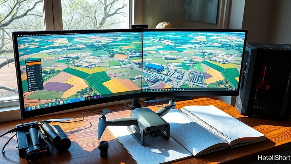
Choosing the right orthomosaic software depends on what you need to map, how accurate the results must be, and how much processing control you want. Some tools are designed for affordable drone mapping, while others support detailed surveying, terrain modeling, and large projects. Understanding these differences helps you avoid paying for features you do not need or producing maps that cannot meet your project requirements.
Quick Answer
WebODM is a practical free option for drone orthomosaics. Agisoft Metashape and Pix4DMapper provide detailed photogrammetry controls, while SkyeBrowse supports cloud-based mapping from video. Choose according to terrain complexity, required accuracy, GeoTIFF export, available hardware, and budget. Projects involving slopes, buildings, or precise measurements also need reliable elevation information and suitable ground control.
Last checked: September 28, 2026. Pricing and key technical details were verified against official sources.
Key Takeaways
- A visually sharp aerial mosaic is not necessarily an accurate orthomosaic. Terrain correction and georeferencing determine whether it can support reliable mapping.
- Desktop software offers local processing control, while cloud processing reduces the need for powerful personal hardware.
- Ground sample distance describes image resolution, not guaranteed positional accuracy.
- Ground control points and independent checkpoints help establish whether a map meets its accuracy requirements.
- GeoTIFF is the practical export choice for GIS work, while KML and KMZ support Google Earth visualization.
How to Choose Orthomosaic Software
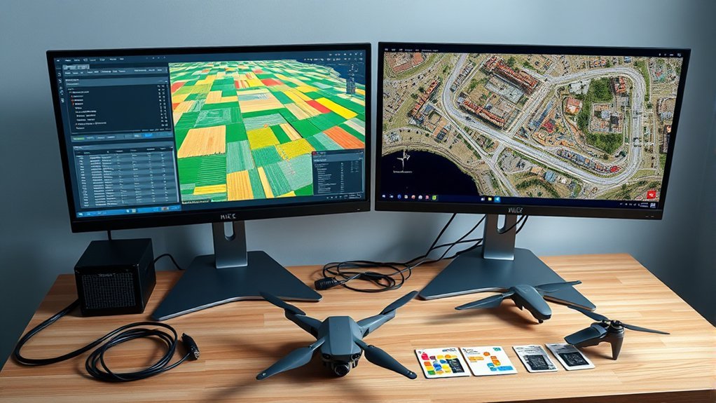
Start by identifying your required outputs, accuracy, and project size. A simple aerial overview has different processing needs from a map used for engineering measurements or terrain analysis.
An orthomosaic combines overlapping photographs into one geometrically corrected image. Unlike an ordinary stitched panorama, it accounts for camera perspective and terrain effects to create a map with consistent scale. The U.S. Geological Survey’s explanation of orthoimagery describes why this correction matters for mapping and measurement.
Before selecting a platform, consider these requirements:
- Required outputs: Determine whether you need an orthomosaic, digital surface model (DSM), digital terrain model (DTM), point cloud, or textured 3D model.
- Target accuracy: Decide whether approximate positioning is sufficient or whether the project requires surveyed control and documented accuracy.
- Image resolution: Identify the smallest features you need to see and the ground sample distance (GSD) required to show them.
- Terrain: Flat agricultural fields, forests, urban areas, and quarry walls create different reconstruction challenges.
- Project size: Consider image count, camera resolution, available memory, and acceptable processing time.
- Workflow: Check whether you need offline processing, cloud collaboration, automated processing, or manual editing controls.
Budget should include more than the software license. Hardware, cloud processing, storage, training, and repeat processing can affect the total cost.
Community feedback is useful for identifying common errors and usability problems. However, evaluate each program against your own imagery and required deliverables rather than relying on general ratings alone.
Desktop vs Cloud Orthomosaic Software
Desktop orthomosaic software processes imagery on your computer, while cloud platforms use remote computing resources. The choice affects hardware costs, upload requirements, processing control, and collaboration.
Neither approach is automatically faster. Performance depends on dataset size, processing settings, computer specifications, internet speed, and cloud capacity.
| Factor | Practical implication |
|---|---|
| Control | Desktop tools generally offer detailed processing settings and direct access to project files. |
| Speed | Cloud processing can reduce local computing demands, but uploading large datasets takes time. |
| Cost | Desktop licenses may involve subscriptions or upfront payments. Cloud costs depend on the provider’s plan and usage. |
| Access | Cloud platforms simplify remote collaboration, while local processing can work without continuous internet access. |
| Hardware | Desktop processing depends on local CPU, RAM, storage, and supported GPU resources. |
Agisoft Metashape and Pix4DMapper offer established desktop workflows for users who need detailed control over reconstruction and outputs.
SkyeBrowse emphasizes cloud-based processing and sharing. WebODM supports local installation and offers cloud processing through a separate service.
For sensitive project data, also consider where imagery is stored, who can access it, and whether the platform meets your organization’s data-handling requirements.
Do You Need 3D for an Orthomosaic?
You do not always need a complete textured 3D model to create an orthomosaic. However, accurate orthorectification requires suitable information about the surface being mapped.
On flat ground, a simple elevation assumption may be sufficient for some projects. Where terrain changes significantly, a digital elevation or surface model helps correct displacement caused by slopes and other raised features.
Flat Ground Exceptions
Flat sites can support simpler processing because the ground surface changes little in elevation. This can reduce the need for detailed surface reconstruction when project accuracy requirements allow it.
However, ordinary 2D image stitching and true orthorectification are not identical. A stitched image may look correct while still containing positional errors.
- Capture overlapping photographs with consistent camera geometry.
- Maintain a suitable GSD across the site.
- Use ground control points when reliable absolute positioning is required.
- Check the final mosaic for stretching, seams, and misplaced features.
Ground control points remain useful even on flat terrain. They help connect the image reconstruction to known coordinates and reduce georeferencing errors.
For quick visual mapping, simplified processing can save time. For measurement work, verify that the resulting image meets the required accuracy.
Terrain Relief Matters
Elevation changes affect where ground features appear in aerial photographs. Without suitable terrain correction, a mosaic may contain shifted features, distorted slopes, or visible alignment problems.
The greater the relief, the more important accurate elevation information becomes.
| Surface | 3D need | Risk |
|---|---|---|
| Flat lot | Low for simple mapping | Position errors if georeferencing is weak |
| Rolling field | Moderate | Feature displacement across elevation changes |
| Steep slope | High | Stretching, smearing, and inaccurate geometry |
| Quarry wall | High | Poorly reconstructed vertical surfaces and feature displacement |
For steep slopes and quarry walls, combine suitable camera angles with sufficient image overlap. A standard top-down flight alone may not capture the detail needed for reliable reconstruction of near-vertical surfaces.
A digital surface model can represent visible features such as buildings and vegetation. A digital terrain model represents the underlying ground surface.
Select the surface model according to what you need to measure or display.
3D Models Improve Accuracy
Elevation-informed processing improves orthomosaic geometry where the mapped surface is not flat. It helps place image pixels in their correct positions and reduces distortion around changes in elevation.
A textured 3D mesh is not always necessary. Some workflows can produce an orthophoto from a digital elevation model without creating a final textured model.
- Use detailed elevation information for slopes, embankments, buildings, and irregular surfaces.
- Choose the appropriate DSM or terrain model for the intended output.
- Use a simplified workflow for flat sites when its accuracy is adequate.
- Skip unnecessary 3D deliverables when only the orthomosaic is required.
For example, WebODM’s processing options include a fast-orthophoto setting that avoids the complete dense reconstruction stage.
Pixpro also provides different reconstruction layers. Its orthophoto workflow guidance explains how point clouds and elevation models contribute to the final image.
These shortcuts can reduce processing time, but inspect the resulting surface before using the map for demanding measurements.
Best Orthomosaic Software for Every Budget
Orthomosaic software ranges from free local tools to professional subscriptions and permanent licenses. Compare the processing limits, supported exports, and licensing terms before deciding which option fits your work.
The following prices are US-dollar figures from vendor pricing pages checked in September 2026. Taxes, payment periods, and license conditions may affect the final amount.
| Software | Cost | Best Fit |
|---|---|---|
| WebODM | Free local installation; optional paid cloud processing | Budget-conscious and open-source mapping workflows |
| Agisoft Metashape Professional | $3,499 node-locked license | Detailed photogrammetry, large datasets, and 3D reconstruction |
| Pix4DMapper | $3,990 annually, equivalent to $332.50 per month when billed yearly | Structured geospatial processing and professional mapping deliverables |
| Correlator3D | From $295 monthly; $5,900 permanent license | High-throughput photogrammetry and aerial mapping |
| SkyeBrowse | Free viewing tier; Pro from $49.99 per model with monthly billing | Cloud-based mapping from video and professional exports |
| Pixpro | From $6 monthly when billed annually | Accessible photogrammetry with cloud and offline options |
WebODM: Free Local Processing
WebODM provides an affordable entry point for users who want to process drone imagery without purchasing an expensive commercial license.
Its official WebODM download page provides free installation options. Windows and macOS users can use an installer, while Docker supports other deployment workflows.
It can generate orthophotos, elevation models, point clouds, and textured 3D models. Ground control support makes it suitable for more demanding projects when users provide appropriate survey data.
Local processing still requires adequate hardware and some technical setup. Optional cloud processing provides another route when local resources are limited.
Agisoft Metashape: Detailed Processing Control
Agisoft Metashape Professional supports photogrammetric reconstruction, georeferenced outputs, and detailed processing workflows.
The official Agisoft online store lists the Professional node-locked license at $3,499 and Standard at $179.
For geospatial orthomosaic work, verify that the selected edition includes the mapping features you need.
Metashape can handle substantial image collections, but practical project size depends on image resolution, available memory, and processing settings. The original 50,000-image figure should not be treated as a fixed capacity limit.
Pix4DMapper: Structured Mapping Outputs
Pix4DMapper provides a desktop workflow for image calibration, point cloud generation, surface modeling, and orthomosaic production.
Its current subscription pricing lists annual billing at $3,990. The plan includes unlimited desktop processing and high-resolution outputs.
The software also provides processing reports that help users review image calibration, ground control, and reconstruction quality.
Correlator3D: High-Throughput Mapping
Correlator3D focuses on photogrammetric processing for drone, aircraft, and satellite imagery.
Its official pricing page lists monthly, annual, permanent, and floating license options.
This makes it relevant for teams comparing recurring processing costs with permanent licensing.
SkyeBrowse: Video-Based Cloud Mapping
SkyeBrowse converts captured video into 3D models and top-down orthomosaic views. It suits users who prefer cloud processing rather than maintaining a dedicated reconstruction computer.
Its pricing structure distinguishes between viewing and professional exports.
The free tier does not provide exports. Commercial models also exclude exports, while Pro includes GeoTIFF and other professional file formats.
For GIS delivery, confirm that the chosen plan includes the necessary export features.
Pixpro: Accessible Photogrammetry
Pixpro combines an approachable interface with point clouds, elevation layers, orthophotos, and measurement features.
The official Pixpro pricing page lists cloud and offline processing options with different image limits.
Users should compare those limits with their expected mission size before selecting a subscription.
Best Software for Beginner Mapping
Beginners benefit from software that makes importing photographs, processing imagery, reviewing results, and exporting maps straightforward.
The most practical starting point depends on whether you want free local control, cloud convenience, or a simple interface for learning photogrammetry.
- WebODM: A useful starting point for low-cost mapping. It supports common outputs and gives users access to an open-source workflow.
- SkyeBrowse: Suitable for users who want to turn drone video into a map without running intensive processing locally.
- Pixpro: Provides an accessible interface for creating orthophotos, point clouds, and related mapping layers.
- QGIS: Useful for opening, inspecting, editing, and combining geospatial outputs after processing.
QGIS is primarily a geographic information system, not a direct replacement for photogrammetry processing software.
A beginner can create an orthomosaic in WebODM or another reconstruction tool, then use QGIS to inspect the GeoTIFF, compare layers, and prepare the final map.
Online communities and official documentation can help resolve alignment failures, installation issues, and export problems.
Computer Specs for Orthomosaic Processing
Orthomosaic processing depends heavily on CPU performance, available memory, storage speed, and supported GPU acceleration.
Small projects may run on modest systems. Large image collections and detailed reconstructions need substantially more memory and computing power.
CPU, GPU, and RAM
A balanced workstation is more useful than maximizing a single component. The recommended hardware also depends on the processing software and the resolution of the source photographs.
Agisoft’s hardware recommendations provide a practical reference for planning a photogrammetry workstation.
- CPU: A multi-core Intel Core i7 or AMD Ryzen 7 is a practical choice for demanding processing. More cores can improve performance in supported operations.
- GPU: A dedicated NVIDIA or AMD graphics card with at least 4 GB VRAM meets Agisoft’s published recommended configuration. Actual acceleration depends on software support.
- RAM: Although some smaller workloads can run with 16 GB, 32 GB is a stronger starting point for regular mapping work.
- System balance: Match processor, memory, graphics, and storage to the image count and reconstruction quality you expect.
For very large datasets, additional RAM may be more useful than a faster graphics card.
GPU acceleration does not apply equally to every processing stage, so avoid assuming that a powerful GPU will automatically make every task faster.
Storage and System Setup
Use fast SSD storage for source photographs, project files, and processing caches. Photogrammetry creates substantial intermediate data, so free storage space matters as much as the final orthomosaic size.
An SSD with at least 500 GB of capacity is a practical starting point. Larger projects may need considerably more space.
For regular processing, consider these practices:
- Store active project files on an SSD rather than a slow external hard drive.
- Keep sufficient free space for temporary processing files.
- Use compatible operating systems and graphics drivers.
- Maintain reliable cooling during long processing sessions.
- Keep a separate backup of the original photographs and survey data.
A high-resolution display can also help when inspecting fine map details, seamlines, and reconstruction artifacts.
Cloud processing reduces dependence on local computing hardware, but large uploads still require suitable internet access and storage arrangements.
Flight Setup for Better Orthomosaics
Good orthomosaic results begin with consistent image capture. Software cannot fully recover missing coverage, severe motion blur, or photographs that lack enough common features for alignment.
Plan the flight according to terrain, camera characteristics, and the intended ground sample distance.
Choose the Right Image Overlap
Overlap allows the software to identify the same features across photographs and calculate their relative positions.
The official Pix4D image acquisition guidance recommends different overlap levels according to the surface being mapped.
| Mapping conditions | Recommended front overlap | Recommended side overlap |
|---|---|---|
| General mapping | At least 75% | At least 60% |
| Flat agricultural fields | At least 80% | At least 80% |
| Forests and dense vegetation | At least 85% | At least 85% |
These are image-acquisition recommendations, not guarantees that a dataset will process successfully.
Areas containing water, snow, sand, or other surfaces with few recognizable features may need additional planning.
Set Flight Height and Camera Settings
Flight altitude affects ground sample distance, which describes how much ground area each image pixel represents.
A lower GSD means finer spatial resolution. For example, 2 cm/pixel means one image pixel represents approximately 2 cm on the ground.
However, resolution is not the same as positional accuracy. A detailed image can still be incorrectly located on a map.
At approximately 100 ft, some drone cameras can capture imagery around 0.5–1 inch per pixel, but the actual GSD depends on camera resolution, sensor size, focal length, and flight height.
For consistent results:
- Use a grid flight path appropriate for the site.
- Maintain a suitable height above the terrain.
- Keep flight speed consistent to preserve image spacing.
- Use a fast enough shutter speed to limit motion blur.
- Keep ISO as low as practical for the available light.
- Use an appropriate aperture when the camera supports adjustment.
For steep terrain, consider terrain-following flight planning so image resolution and overlap remain more consistent.
Use Ground Control Points Correctly
Ground control points (GCPs) connect identifiable image locations to surveyed ground coordinates. They help improve georeferencing and control distortion across the mapped area.
Follow established WebODM ground control guidance when planning marker placement.
Distribute control points across the site rather than concentrating them in one area. Include high and low elevations where terrain relief is significant.
Keep some surveyed locations as independent checkpoints instead of using every point to adjust the reconstruction.
Checkpoints provide a stronger test of accuracy because they allow you to compare the finished map against coordinates that were not used to fit it.
Pro Tip: Before leaving the site, review sample photographs for sharpness, adequate overlap, visible control targets, and missing coverage. Finding a capture problem in the field is usually easier than correcting it after processing.
Best Export Settings for Orthomosaics
Choose export settings according to how the finished map will be used. GIS analysis, client previews, and Google Earth visualization have different file requirements.
For professional mapping, preserve the coordinate reference system, suitable pixel resolution, and necessary georeferencing information.
GeoTIFF for GIS Mapping
GeoTIFF is a preferred format for georeferenced orthomosaics because it stores image data with geographic positioning information.
It is widely used with GIS software such as QGIS and ArcGIS.
Pix4D’s orthomosaic export documentation identifies LZW as a lossless compression option that reduces file size without degrading image data.
For most GIS deliverables, use these settings:
- Format: GeoTIFF.
- Compression: LZW when supported.
- Coordinate system: The required project CRS.
- Resolution: Match the project requirement and useful source-image detail.
- Output size: Use a single file or tiled output according to software and delivery requirements.
Reducing export resolution can make files smaller, but it cannot improve the detail captured by the camera.
JPG, KML, and KMZ for Sharing
JPG is useful for lightweight previews when embedded georeferencing is not required. Higher compression reduces file size but can also remove visible detail.
For Google Earth, KML or KMZ can package georeferenced imagery for easier viewing.
Pix4D documents a 1 GB limit for unzipped KML/KMZ content and suggests exporting at approximately 25% image scale when files are too large.
This is an export-size recommendation, not a universal requirement to reduce every orthomosaic to 25%.
Choose the Right Blending Mode
Blending settings affect how overlapping photographs appear in the final mosaic.
Minimal and Full blending address general mosaicking needs, while Deghost can help reduce artifacts from moving objects. Deghost processing may increase runtime.
Inspect roads, vehicles, roof edges, and other detailed features after export. A visually clean seam does not automatically confirm geometric accuracy.
Common Orthomosaic Mistakes
Most orthomosaic problems begin with image capture, georeferencing, or unsuitable processing settings. Identifying the underlying cause is more effective than repeatedly exporting the same flawed reconstruction.
- Insufficient overlap: Missing shared image features can cause gaps, failed alignment, and visible seamlines. Increase overlap during capture and inspect the flight coverage before processing.
- Missing or poorly distributed GCPs: Weak ground control can reduce absolute positional accuracy. Use properly surveyed points when project requirements demand them.
- Confusing GSD with accuracy: A 2 cm/pixel image does not guarantee 2 cm positional accuracy. Validate measurements against independent checkpoints.
- Incorrect export resolution: Excessively fine settings inflate file size without creating real detail. Coarse exports can remove useful information.
- Uncorrected terrain relief: A poor surface model can introduce distortions around slopes, buildings, and other elevated features.
- Inconsistent imagery: Motion blur, changing exposure, reflections, and lens problems can weaken alignment or produce visible artifacts.
- Wrong coordinate reference system: Incorrect CRS information can place an otherwise usable orthomosaic in the wrong location.
- Skipping quality checks: A completed processing job does not establish that its measurements are reliable.
If the result contains gaps or distorted features, review the original photographs and alignment report first. Then inspect the surface model, control points, and export settings.
For projects involving surveying, engineering, or other high-accuracy work, have a qualified professional verify that the data meets the required positional accuracy.
Frequently Asked Questions
What Is the Best Software for Processing Drone Data?
The best software depends on your required outputs and budget. WebODM provides free local processing, while Metashape and Pix4DMapper offer detailed photogrammetry workflows. SkyeBrowse focuses on cloud-based video processing, and Pixpro provides accessible reconstruction tools. QGIS is useful for examining and preparing the resulting geospatial data.
What Software Can Be Used to Create Orthomosaic Images?
WebODM, OpenDroneMap, Agisoft Metashape, Pix4DMapper, Pixpro, Correlator3D, and SkyeBrowse can support orthomosaic production. They differ in processing methods, supported inputs, licensing, and export capabilities. Check whether the chosen workflow supports GeoTIFF output, ground control, and the elevation information required for your project.
What Is the Best Software for Processing LiDAR Data?
ArcGIS Pro supports LiDAR visualization, point cloud analysis, and terrain modeling. PDAL and LAStools provide additional processing options for specialized workflows. The right choice depends on whether you need classification, filtering, conversion, elevation modeling, or integration with other geospatial datasets.
What Is the Best Software for Drone Mapping?
Metashape and Pix4DMapper are established choices for detailed drone photogrammetry. WebODM offers a free local alternative, Pixpro supports accessible mapping workflows, and SkyeBrowse processes video through the cloud. Compare these options using your image count, terrain, accuracy requirements, hardware, and intended deliverables.
Can QGIS Create an Orthomosaic From Drone Photos?
QGIS is mainly used to manage, visualize, and analyze geospatial data rather than perform a complete drone photogrammetry reconstruction. Generate the orthomosaic in suitable processing software, then open the GeoTIFF in QGIS to inspect its positioning, combine layers, and prepare mapping outputs.
How Do You Check Orthomosaic Accuracy?
Compare identifiable locations in the finished orthomosaic against independently surveyed checkpoints. Review the differences between mapped and surveyed coordinates, along with the processing quality report. Ground sample distance describes image resolution, so it should not be used as the sole measure of positional accuracy.
Conclusion
The right orthomosaic software is the one that matches your project requirements, available hardware, and accuracy needs. WebODM offers a low-cost starting point, while commercial desktop and cloud platforms provide different processing and delivery options.
Even a detailed 2 cm/pixel dataset can produce an unreliable map if image overlap, elevation correction, or georeferencing is inadequate. Choose the processing workflow before the flight, capture suitable imagery, and validate the finished orthomosaic before using it for measurements.
Sources
- U.S. Geological Survey — Orthophoto Definition: Orthorectification, terrain distortion, and map-scale characteristics.
- WebODM — Official Downloads: Free local installation and supported installation methods.
- Agisoft — Online Store: Metashape licensing and official pricing.
- Pix4D — Pix4DMapper Pricing: Subscription pricing and included processing features.
- SimActive — Correlator3D Pricing: Subscription and permanent license costs.
- Pixpro — Plans and Pricing: Processing plans, image limits, and subscription costs.
- SkyeBrowse — Pricing: Cloud processing tiers and export availability.
- WebODM — Processing Options Guide: Fast orthophoto processing and reconstruction settings.
- Pixpro — True Orthophoto Workflow: Point clouds, elevation models, and orthophoto generation.
- Agisoft — Hardware Recommendations: CPU, RAM, GPU, and storage guidance.
- Pix4D — Image Acquisition: Recommended overlap, terrain considerations, and flight planning.
- WebODM — Ground Control Points: Ground control placement and georeferencing.
- Pix4D — Orthomosaic Export: GeoTIFF compression, image scale, and KML/KMZ settings.
- PDAL — Pipeline Documentation: Point cloud processing and data transformation workflows.
