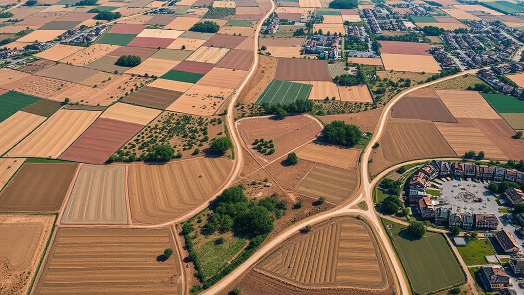
Creating a drone orthomosaic map for free is possible in 2026, but the tools are not interchangeable. Some are permanently free and run on your own computer, some are cloud freemium services with export limits, and others are only temporary trials. Image overlap, camera quality, geotag accuracy, available hardware, and ground control all affect the final map.
Quick Answer
For a genuinely free orthomosaic workflow, current WebODM/ODX and OpenDroneMap are strong self-hosted choices, while GeoNadir Essentials provides limited free cloud processing. SkyeBrowse offers free video-based mapping with export restrictions. DJI Terra is a one-month trial, and Polycam Free is better treated as 3D photogrammetry rather than a GIS-ready orthomosaic exporter.
Key Takeaways
- WebODM and OpenDroneMap are separate projects in 2026. Current WebODM uses the ODX processing engine.
- GeoNadir Essentials is permanently free with up to 500 images per dataset and 100 GB of processing and storage.
- SkyeBrowse Freemium is video-first and has a 2 GB maximum file size, but free exports are restricted.
- DJI Terra is a trial, not a permanent free plan. Its current trial lasts one month and limits photo reconstruction to 500 images.
- Accuracy depends more on capture and control than price alone. Good overlap, sharp images, GCPs or RTK/PPK where required, and independent checkpoints matter more than a visually sharp mosaic.
What Is Free Drone Orthomosaic Software?
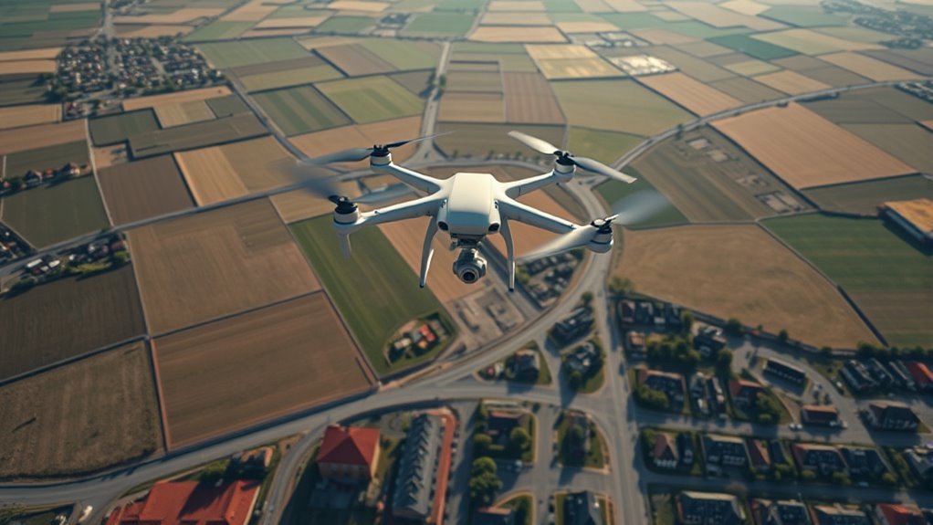
Free drone orthomosaic software processes overlapping aerial photographs into a geometrically corrected map in which the imagery is tied to a coordinate system. Unlike a simple photo panorama, an orthomosaic is intended to represent the ground from a consistent overhead perspective so it can be viewed and, when accuracy has been properly controlled, measured in GIS software.
Photogrammetry software first detects matching features between overlapping images. It estimates camera positions, reconstructs surface geometry, projects the imagery onto that surface, and blends the corrected images into an orthophoto or orthomosaic.
Current open-source options include WebODM, which is powered by the ODX photogrammetry engine, and OpenDroneMap, a separate open-source photogrammetry project. Both can produce georeferenced mapping outputs without an ongoing software license fee.
A common output is GeoTIFF, which stores raster imagery together with geographic information and can be opened in GIS applications such as QGIS. Depending on the software and processing settings, other outputs may include point clouds, digital surface models, digital terrain models, textured 3D models, contours, and tiled web maps.
Free does not always mean unrestricted. A self-hosted application may be limited mainly by your computer’s RAM, disk space and processing power, while a cloud service may limit images per dataset, storage, file size, export formats, model retention, or the number of projects.
Note: A 3D photogrammetry model, a flight-planning application, a web-map publisher and an orthomosaic processor are related tools, but they are not the same thing. Confirm that a product actually generates the output you need before choosing it.
Best Free Drone Mapping Tools in 2026
The most useful free drone-mapping options fall into three groups: permanently free self-hosted software, permanent cloud freemium plans, and temporary trials of paid software.
| Tool | Free Access | Best Fit | Important Limitation |
|---|---|---|---|
| WebODM / ODX | Permanent, self-hosted | Orthomosaics, DEMs, point clouds and 3D models with local data control | Requires capable computer hardware; large datasets need substantial RAM and storage |
| OpenDroneMap / ODM | Permanent, open source | Technical users who want a command-line photogrammetry workflow | More technical setup and operation than a hosted cloud service |
| GeoNadir Essentials | Permanent cloud free tier | Small RGB drone datasets, environmental projects and cloud collaboration | Up to 500 images per dataset and 100 GB processing/storage; advanced downloads and analysis are paid features |
| SkyeBrowse Freemium | Permanent freemium | Fast video-based mapping and basic browser viewing | 2 GB maximum video file; free tier has restricted exports and other advanced tools |
| DJI Terra | One-month trial | Testing DJI’s desktop reconstruction workflow | Trial supports no more than 500 photos and limits LiDAR reconstruction data to 8 GB |
| Polycam Free | Permanent free tier | Drone and mobile 3D photogrammetry | Primarily a 3D-model workflow rather than a direct replacement for a GIS-ready orthomosaic processor |
A practical way to picture these workflows is:
- A still-photo grid is processed locally in WebODM or ODM into a georeferenced orthomosaic.
- A video capture is uploaded to SkyeBrowse for rapid browser-based reconstruction.
- A compact geotagged image dataset is processed and shared through GeoNadir.
- A drone or smartphone image set is sent to Polycam when the main goal is a 3D photogrammetry model rather than a GeoTIFF orthomosaic.
Free Plan Limits You’ll Hit Fast
Free plans can be useful, but the limiting factor is not always image count. Export rights, processing hardware, model retention and data-download access can matter just as much.
| Tool | Current Free Limit | Practical Consequence |
|---|---|---|
| WebODM | Hardware-limited when self-hosted | Large projects may require much more RAM, disk space and processing time |
| SkyeBrowse | 2 GB maximum video file | Large or long captures may need another workflow; exports are restricted on Freemium |
| GeoNadir | 500 images per dataset; 100 GB processing/storage | Large surveys may exceed the free dataset limit and processed-data downloads require an upgrade |
| Polycam Free | Up to 150 images or 3 minutes of video per photogrammetry capture | Better suited to smaller 3D-capture jobs than large GIS orthomosaics |
| DJI Terra Trial | 500 photos; 8 GB LiDAR; one month | Useful for evaluation but not a permanent free production workflow |
Self-hosted WebODM avoids a subscription image cap, but that does not make processing unlimited in practice. Its current documentation recommends around 16 GB of RAM and 100 GB of free disk space as a practical minimum configuration and notes that larger image sets require progressively more memory.
Cloud free tiers remove the need to maintain processing hardware, but they may restrict downloads, output formats, retention or advanced accuracy tools. Review those limits before completing a flight rather than after processing finishes.
How to Create an Orthomosaic?
An orthomosaic starts with overlapping images that cover the same ground from many neighboring camera positions. The images are aligned, reconstructed, georeferenced and projected onto a surface model before being blended into one continuous map.
At a Glance
| Time Required | Varies by site size, image count, computer performance and cloud queue; processing may range from minutes to many hours |
| Difficulty | Beginner to intermediate for visual mapping; advanced for survey-grade accuracy |
| Tools Needed | Drone and camera, overlapping geotagged photos, processing software or cloud service, and optional GCP/RTK equipment for higher absolute accuracy |
| Cost | Software can be $0 with self-hosted open-source tools; hardware, cloud processing, storage, surveying equipment and operator time can still add cost |
Capture Overlapping Drone Photos
For ordinary 2D and 2.5D mapping, current OpenDroneMap guidance recommends roughly 70–80% image overlap, with overlap closer to the upper end for complex vegetation, buildings or uneven terrain. More overlap gives the reconstruction engine more shared features to match between frames.
A grid or lawnmower flight pattern normally works well for a conventional nadir orthomosaic. Keep altitude and camera angle consistent, avoid motion blur, and try to maintain stable lighting throughout the flight.
Lower altitude can produce a smaller ground sampling distance and more visible surface detail, but it also increases the number of images required to cover the same area. Choose altitude based on required detail, legal restrictions, terrain, obstacle clearance and the processing capacity available afterward.
- Plan parallel flight lines that cover the complete site.
- Set sufficient front and side overlap for the terrain and subject.
- Use consistent focus, exposure and camera orientation.
- Check several images at full size for blur before leaving the site.
Warning: A visually sharp orthomosaic is not automatically a licensed or survey-grade deliverable. Property boundaries, engineering compliance and other high-stakes measurements may require surveyed control, independent accuracy checks and a qualified professional. Always follow the aviation and airspace rules that apply where you fly.
Check the Images Before Processing
Before uploading or processing the dataset, remove obvious capture problems from the workflow. Look for severe blur, missed flight lines, sudden exposure changes, duplicate frames, corrupted files and missing or incorrect geolocation metadata.
Do not automatically delete every imperfect image. Removing too many frames can create a coverage gap. The goal is to identify images that are unusable while preserving enough overlapping views for feature matching.
Process Images Into Orthomosaic
Load the overlapping photographs into a photogrammetry processor such as WebODM/ODX or OpenDroneMap. The processing engine identifies matching features, estimates camera positions, creates a dense reconstruction, generates a surface model and projects the imagery into a georeferenced orthophoto.
OpenDroneMap documents a GeoTIFF orthophoto as one of its standard outputs, while current WebODM supports high-resolution GeoTIFF export along with point-cloud, DEM and 3D-model formats.
MapTiler belongs after this reconstruction step. MapTiler’s own drone workflow advises creating a precise orthomosaic in specialized photogrammetry software first and then loading the finished raster into MapTiler for rendering, tiling, hosting or web-map publishing.
Georeference and Control Accuracy
Geotagged photographs can position a project approximately using the drone’s onboard GNSS coordinates. For applications that require stronger absolute accuracy, use higher-accuracy RTK/PPK image positions, surveyed ground control points (GCPs), or both.
GCPs are known ground coordinates that are marked in multiple photographs and used during reconstruction. Checkpoints are different: they are deliberately excluded from the adjustment and used afterward to independently test the resulting map.
Pro Tip: If accuracy matters, reserve several surveyed points as checkpoints rather than using every point as a GCP. A map can fit its control points well while still containing errors elsewhere; independent checkpoints provide a better test of final accuracy.
Inspect the Orthomosaic Before Export
Zoom through the completed map before measuring or delivering it. Look at roof edges, roads, fences, poles, vegetation and elevation transitions for doubled features, warped geometry, gaps or seam artifacts.
Also review the software’s quality report when available. Check image alignment, camera positions, GCP residuals, checkpoint error and any warnings generated during reconstruction.
Once the project passes those checks, export the required format. GeoTIFF is usually the most useful choice when the orthomosaic will be opened in GIS software.
Free Orthomosaic Features to Compare
Choosing free orthomosaic software is easier when you compare workflow requirements rather than marketing labels.
| Feature | Why It Matters |
|---|---|
| True orthomosaic output | Confirms that the software creates geometrically corrected map imagery rather than only a textured 3D model. |
| GeoTIFF export | Allows the finished raster to retain coordinate information for GIS use. |
| GCP and checkpoint support | Important when absolute accuracy must be improved and independently tested. |
| RTK/PPK support | Allows higher-quality camera coordinates from compatible mapping systems. |
| Image or file limits | Determines whether the complete site can be processed as one dataset. |
| Local vs cloud processing | Affects privacy, hardware requirements, upload time, collaboration and recurring cost. |
| DEM and point-cloud outputs | Useful when elevation, volumes, terrain or 3D analysis matters in addition to the orthomosaic. |
| Multispectral support | Needed for calibrated multi-band workflows and vegetation or spectral analysis. |
A self-hosted platform can process thousands of images when the hardware is capable enough, but image count alone is a poor measure of capacity. Image dimensions, processing options, RAM, disk space and scene complexity all influence whether a large project will finish successfully.
MapTiler can then provide a convenient drag-and-drop path for turning an already-created aerial raster into web-map tiles or hosted map layers.
The most useful “free” tool is not the one with the longest feature list. It is the one that produces the required map format, preserves enough accuracy for the job, and lets you export or reuse the result without an unexpected restriction.
- Confirm what the software accepts: photos, video or both.
- Confirm whether it creates an orthomosaic or only a 3D reconstruction.
- Confirm the coordinate and accuracy controls available.
- Confirm that the free tier lets you export the format you actually need.
When to Upgrade Beyond the Free Tier
A free workflow is often sufficient for learning, visual documentation, research, site inspection and small mapping projects. An upgrade becomes more attractive when the bottleneck moves from basic reconstruction to scale, accuracy control, collaboration, export automation or support.
| Need | Free Workflow | Reason to Consider Paid Tools |
|---|---|---|
| Large image volume | Possible with sufficient local hardware or within cloud limits | More processing capacity and easier scaling |
| Team collaboration | Often basic or limited | Roles, project management, sharing and client workflows |
| Advanced exports | May be restricted on cloud free tiers | Broader GIS, CAD, point-cloud and report exports |
| Survey control | Available in some open-source workflows | More integrated RTK/GCP reporting, support and quality-control workflows |
| Support and turnaround | Community support or self-service | Vendor support, managed infrastructure and service commitments |
| Specialized analytics | Varies widely | Change detection, agriculture analysis, reporting and enterprise integrations |
Commercial platforms such as DroneDeploy and Pix4D can add managed cloud workflows, collaboration and broader export or analysis features. Pix4D products, for example, can generate and export georeferenced GeoTIFF orthomosaics, while DroneDeploy provides map-data exports on qualifying paid plans.
The upgrade decision should therefore be based on the deliverable and workflow rather than an assumed increase in image quality. Better software cannot compensate for missing coverage, motion blur, poor control points or an unsuitable capture plan.
Open-Source Drone Mapping With WebODM
WebODM is a free and open-source drone mapping application that provides a browser-based interface for processing aerial images on your own computer or server. In current 2026 releases it is powered by the ODX photogrammetry engine.
This distinction matters because older tutorials often describe WebODM as an interface for OpenDroneMap. Current WebODM documentation states that WebODM is no longer affiliated with OpenDroneMap and no longer uses ODM as its standard processing engine.
WebODM can generate orthomosaics, georeferenced elevation models, point clouds, textured 3D models and other mapping outputs. Local processing can be valuable when project data should stay under the operator’s control or when recurring cloud-processing charges are undesirable.
The main tradeoff is hardware. Photogrammetry can consume large amounts of memory and storage. Current WebODM guidance recommends roughly 16 GB of RAM and 100 GB of free disk space as a practical minimum for a standalone processing setup, while larger datasets need progressively more memory.
A typical local WebODM project may produce:
- A georeferenced orthomosaic for GIS use.
- A dense or classified point cloud for 3D analysis.
- A DSM or DTM for elevation and terrain work when the required processing options are enabled.
- A textured 3D model for visualization and inspection.
OpenDroneMap remains a separate open-source alternative. Its documented outputs include GeoTIFF orthophotos, point clouds, textured models, DSMs and DTMs. Technical users may prefer direct ODM processing, while users who want a graphical browser interface may find WebODM easier to manage.
Which Free Orthomosaic Tool Fits Your Use Case?
The right free tool depends on whether you need a real georeferenced orthomosaic, a quick browser preview, a 3D model, or a temporary test of commercial software.
| Use Case | Tool to Consider | Why |
|---|---|---|
| Permanent free local orthomosaic processing | WebODM / ODX | Free self-hosted interface with GeoTIFF and other mapping outputs |
| Open-source command-line mapping | OpenDroneMap / ODM | Direct control over an established photogrammetry processing engine |
| Small cloud RGB orthomosaic | GeoNadir Essentials | Free cloud processing with up to 500 images per dataset and 100 GB processing/storage |
| Video-first rapid mapping | SkyeBrowse Freemium | Accepts drone video and offers a permanent free entry tier |
| 3D drone photogrammetry | Polycam Free | Convenient image/video-to-3D workflow, but not equivalent to a full GIS orthomosaic pipeline |
| Testing DJI reconstruction | DJI Terra Trial | One-month evaluation period for DJI’s desktop mapping workflow |
SkyeBrowse Freemium is useful when the capture starts with video and the immediate goal is browser-based reconstruction. Its free tier has a 2 GB maximum file size and restricted export capability.
WebODM is a better match when local data control and reusable GIS outputs matter and you have enough processing hardware.
GeoNadir Essentials works well for compact cloud-based RGB mapping projects within its 500-image dataset limit, especially when viewing, sharing and environmental context are more important than unrestricted output downloads.
Polycam Free is useful for lightweight 3D photogrammetry from drone, phone or camera imagery. It should not be described as a direct substitute for a dedicated georeferenced orthomosaic processor when GeoTIFF map delivery is the requirement.
DJI Terra’s trial is valuable for evaluating reconstruction quality and DJI-specific workflows before purchasing a license, but it should not be planned as a permanent free production system.
Fix Failed Orthomosaic Uploads
A failed drone-mapping job may fail during upload, during image alignment, or later during dense reconstruction and orthomosaic generation. Identifying the stage makes troubleshooting much faster.
Failed orthomosaic projects usually trace back to file limits, weak image overlap, unusable photographs, missing metadata, insufficient memory or a reconstruction setting that does not match the dataset.
- Check the plan limit. Confirm image-count, video-size, storage and project restrictions before uploading again.
- Check overlap and coverage. For ordinary 2D mapping, roughly 70–80% overlap is a stronger baseline than sparse coverage. Increase it for complex vegetation, structures or terrain.
- Inspect image sharpness. Motion blur, severe overexposure, featureless surfaces and repeated patterns can prevent reliable matching.
- Verify file support. JPG and TIFF are commonly supported by aerial mapping tools, but exact supported formats depend on the platform.
- Check geolocation metadata. Incorrect coordinates can distort a project even when the photographs align visually.
- Check available RAM and disk space. Local photogrammetry processing can fail when memory or temporary storage is exhausted.
- Review the processing log. Alignment warnings, missing-camera messages and out-of-memory errors usually point toward the actual cause.
- Split only when necessary. Very large datasets can sometimes be processed in overlapping subprojects and merged, but this requires enough overlap and careful georeferencing between sections.
If a project reconstructs but the map contains gaps, bent roads, doubled roofs or smeared trees, the problem is usually no longer an upload failure. Review overlap, camera calibration, image sharpness, terrain complexity, surface-model quality and control-point distribution.
Frequently Asked Questions
How Accurate Are Free Orthomosaics for Field Measurements?
They can be accurate enough for many visual, relative and approximate measurements, but software price does not determine accuracy. WebODM documentation notes that relative accuracy can be much better than absolute global positioning. Standard onboard drone GPS can have horizontal absolute errors measured in meters. Surveyed GCPs, RTK/PPK positioning and independent checkpoints can substantially improve and verify a project when higher accuracy is required.
Can I Create Orthomosaics Without GPS Data in Photos?
Photogrammetry can reconstruct imagery from visual feature overlap even when embedded image GPS is unavailable. However, the model still needs external coordinate information if you want it accurately placed in a real-world coordinate system. Surveyed GCPs or a separate image-geolocation file can provide that reference. Without external control, the reconstruction may remain in a local or arbitrary coordinate frame.
What Drone Flight Patterns Improve Orthomosaic Quality?
A parallel lawnmower or grid pattern is the normal starting point for a 2D orthomosaic. Current OpenDroneMap guidance recommends roughly 70–80% overlap for 2D and 2.5D mapping, with more overlap for complex vegetation, buildings or terrain. Cross-grid and oblique imagery can improve reconstruction when 3D structure matters, while consistent altitude, exposure and sharpness help every workflow.
Do Free Tools Support Multispectral Drone Imagery?
Some do. Open-source photogrammetry engines can support multispectral workflows, but correct results may require compatible sensors, band alignment and radiometric calibration. Creating a multiband orthomosaic is only part of the job; reliable vegetation indices and reflectance analysis also depend on proper calibration and capture procedures.
How Long Does Cloud Processing Usually Take?
There is no reliable universal processing time. Small datasets may finish quickly, while large high-resolution surveys can take hours. Image count, megapixels, reconstruction settings, requested outputs, server queue, internet upload speed and the provider’s available computing resources all affect turnaround.
Is WebODM Still Part of OpenDroneMap?
No. Current 2026 WebODM documentation states that WebODM is not affiliated with OpenDroneMap and that modern WebODM uses the ODX processing engine rather than ODM. Older tutorials may still describe the previous relationship, so check the current WebODM documentation when installing or troubleshooting it.
Can MapTiler Create an Orthomosaic Directly From Raw Drone Photos?
For a precision drone workflow, create the orthomosaic first in dedicated photogrammetry software. MapTiler’s own guidance describes using specialized software for stitching, perspective correction and georeferencing, then loading the resulting orthomosaic into MapTiler for rendering, web tiling, hosting or offline use.
Sources
- WebODM — current WebODM/ODX architecture, supported outputs and open-source status.
- OpenDroneMap Flying Tips — recommended image-overlap and capture practices.
- GeoNadir Pricing — current Essentials free-tier storage, image limits and processing features.
- SkyeBrowse Pricing — current Freemium file-size, processing and export limits.
- DJI Terra — current one-month trial, 500-photo reconstruction limit and 8 GB LiDAR limit.
- MapTiler Drone Mapping Workflow — orthomosaic publishing workflow after photogrammetry processing.
Conclusion
Free drone orthomosaic software can produce genuinely useful georeferenced maps, but the best option depends on the required output and the resources available. WebODM/ODX and OpenDroneMap provide permanent open-source processing without a recurring software license, while GeoNadir offers a limited free cloud workflow. SkyeBrowse is useful for video-first mapping, DJI Terra provides a temporary evaluation path, and Polycam is better suited to 3D photogrammetry than a traditional GIS orthomosaic workflow.
Whichever platform you choose, capture quality remains the foundation. Use strong image overlap, sharp and consistent photographs, appropriate georeferencing, and GCPs or RTK/PPK when the project requires higher absolute accuracy. Inspect the finished map and validate it before relying on measurements. A carefully captured dataset processed with free software can be more useful than an expensive platform fed poor imagery.
