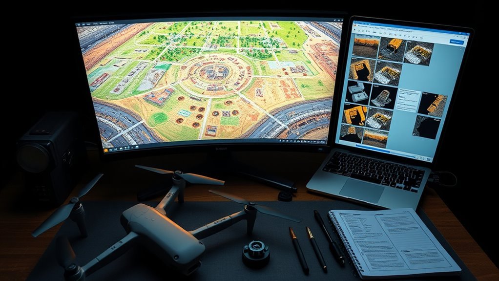
Orthomosaic holes in drone photo projects usually come from incomplete coverage, weak image matching, motion blur, sparse point clouds, or DEM and mesh gaps in Metashape. Good practice is 70–85% overlap, low and steady flight speed, higher shutter speeds, and systematic grid flights. GCPs or RTK improve alignment and reduce voids. In Metashape, recheck point cloud coverage, adjust mesh and DEM settings, and use interpolation or Fill Gaps. More detailed fixes become clear next.
Key Takeaways
- Orthomosaic holes usually come from poor image overlap, motion blur, sparse point clouds, or difficult terrain and vegetation.
- Use 70–85% overlap, low steady flight speed, and shutter speeds of 1/200s or faster for cleaner drone photos.
- In Metashape, inspect point cloud coverage and adjust mesh or DEM settings to reduce voids before exporting the orthomosaic.
- Add evenly distributed GCPs or RTK data to improve georeferencing, alignment, and overall mapping accuracy.
- Reprocess problem datasets and review the final orthomosaic for gaps, seams, white holes, and other defects.
Why Orthomosaic Holes Appear
Orthomosaic holes typically appear when data coverage is incomplete during DEM or mesh generation, especially in areas with complex terrain or dense vegetation where image matching is more difficult.
In drone imagery, insufficient image overlap, below the usual 70–85 percent range, can prevent reliable tie point formation and produce gaps in the mosaic. Motion blur from slow shutter speeds, such as 1/60s, further degrades feature detection and weakens reconstruction.
Point cloud density also governs continuity; sparse or uneven returns leave voids that surface as orthomosaic holes. Ground Control Points improve georeferencing precision, helping align the model and reduce positional error across the dataset.
Sparse point clouds create voids in orthomosaics, while Ground Control Points improve alignment and reduce reconstruction errors.
Thorough pre-flight planning, correct altitude, and stable exposure settings support stronger coverage and cleaner reconstruction. For teams seeking operational autonomy, these factors define whether the final product can represent terrain faithfully or remain fragmented by missing data.
Check Drone Photos for Coverage Gaps
Once holes are suspected in an orthomosaic, the source drone photos should be checked directly for coverage gaps and weak overlap. In drone mapping, the standard target is 70–85% overlap, because fewer overlapping images can leave voids that later appear in orthomosaic mapping.
Each flight set should be reviewed for uniform image spacing, edge coverage, and consistent framing across the survey block. High-resolution images from platforms such as the M210RTK v2 with the X4S sensor improve feature extraction and reduce ambiguity in matching.
Motion blur must be inspected carefully; a shutter speed of 1/60s may be too slow, producing unusable frames and weakening tie-point generation. The point cloud should then be examined for sparse zones that indicate insufficient capture.
Where gaps persist, the area should be re-flown with revised altitude or perpendicular passes, especially over complex terrain, so that the data set supports complete reconstruction and more reliable results.
Fix DEM and Mesh Holes in Metashape
Metashape DEM and mesh holes should be traced to their source by inspecting point cloud coverage, camera overlap, and image quality for gaps or blur-related failures.
Once the deficient areas are identified, interpolation can be applied to the DEM, and mesh parameters such as octree depth can be increased to improve surface continuity and detail retention.
If gaps persist, the dataset should be reprocessed with adjusted orthophoto resolution and DTM enabled to isolate and correct the underlying omissions.
Detect Hole Sources
Holes in the DEM or mesh should be identified early, because any missing surface data can propagate into the orthomosaic as large white gaps. In Metashape, the Digital Elevation Model and mesh should be audited before export, with emphasis on liberation from hidden voids.
Technical checks include:
- inspect point cloud density in steep, vegetated, or shadowed zones;
- review photo projections for low-accuracy matches;
- raise mesh octree depth and minimum feature counts when needed;
- compare DEM interpolation results against terrain continuity.
Sparse coverage usually reveals the source of failure, not the orthomosaic itself. By tracing defects upstream, operators can isolate whether holes arise from insufficient tie points, unstable geometry, or conservative reconstruction settings.
This disciplined review supports cleaner surfaces, stronger mapping integrity, and fewer gaps in the final product.
Fill Mesh Gaps
Mesh gaps in Metashape are best addressed by restoring continuity in the DEM before mesh export, using interpolation to bridge minor voids and reduce breakpoints in the surface model.
To fill mesh gaps, the workflow should prioritize detailed point clouds derived from well-aligned aerial imagery, because sparse reconstruction limits surface completeness. Raising point cloud density, including lower minimum feature thresholds, can improve coverage in weakly sampled zones.
A higher mesh octree depth, such as 14, increases geometric resolution and helps resolve missing patches with greater fidelity. Reprocessing with optimized camera accuracy settings can further stabilize the mesh and orthomosaic.
Capture planning remains decisive: adequate overlap and controlled altitude reduce void formation at source. In Metashape, these adjustments support cleaner DEMs, tighter mesh continuity, and more reliable export.
Set Overlap, Altitude, and Speed Correctly
Proper orthomosaic capture depends on maintaining 70–85% image overlap to preserve continuous ground coverage and reduce gaps in the final mosaic.
An altitude of roughly 300–400 feet usually provides a practical balance between spatial detail and scene coverage, especially over uneven terrain or vegetation.
Flight speed must remain low and consistent enough to sustain the target capture rate, limit motion blur, and keep overlap uniform across each pass.
Overlap for Coverage
A well-planned overlap strategy is essential for producing a complete orthomosaic, with frontlap set to 70–85% and sidelap at 60% or higher to reduce gaps between images. In flight planning, this overlap supports systematic flight patterns and preserves image quality across the survey area.
- Grid or lawnmower routes improve coverage.
- Consistent trigger intervals limit motion blur.
- Test flights reveal ideal settings per site.
- Moderate altitude aids coverage in complex terrain.
These settings help the aircraft collect contiguous data without missed sections. Speed should remain low enough for stable capture, while altitude and overlap can be adjusted to match terrain and sensor behavior.
The result is cleaner source imagery, fewer holes, and a more dependable orthomosaic for users seeking precise, unrestricted mapping outcomes.
Altitude for Detail
Altitude set between 300 and 400 feet typically provides a practical balance between image detail and coverage, preserving enough ground resolution for accurate orthomosaic generation while maintaining the 70–85% overlap needed for reliable feature matching.
This altitude for detail keeps GSD sufficiently low for terrain interpretation without sacrificing scene breadth. Excessive height increases GSD, reducing resolution and weakening edge definition in complex landforms, which can leave gaps during reconstruction.
Consistent altitude also stabilizes image scale, allowing Metashape to align features with greater certainty and minimize voids. When terrain varies, a perpendicular secondary flight line can raise data density and support liberation from residual holes in the mosaic.
Stable altitude settings remain foundational for precise, repeatable photogrammetric outputs.
Speed for Sharpness
Image sharpness in orthomosaic capture depends on balancing overlap, altitude, and flight speed so each frame retains enough detail for reliable stitching. For liberated mapping workflows, the drone should be configured for disciplined, repeatable motion rather than haste. High-resolution photos, proper shutter control, and stable trajectories preserve sharpness and reduce alignment errors in Metashape.
- Maintain 70-85% frontlap and sidelap.
- Fly near 300-400 feet for clarity.
- Keep speed around 3-5 m/s.
- Use at least 1/200s shutter speed.
These settings limit motion blur, support dense vegetation coverage, and improve data continuity across complex terrain. When speed rises, sharpness falls, and holes become more likely.
Careful parameter control lets drone photos support accurate orthomosaic construction without sacrificing detail or autonomy.
Reduce Motion Blur Before You Fly
Reducing motion blur begins before takeoff, with camera and flight settings configured to keep each frame sharp. In drone photos, motion blur weakens texture matching and can leave gaps in Agisoft Metashape outputs. A faster shutter speed, ideally 1/200s or quicker, should be set according to wind and airspeed. Pre-flight checks should confirm camera settings, including shutter and ISO, before departure. A stabilized gimbal helps hold the sensor level and limits vibration. Flight planning should favor smooth lines, avoiding abrupt turns, climbs, or descents that can smear detail. Consistent altitude and speed support uniform exposure and cleaner overlap.
| Control | Target | Effect |
|---|---|---|
| Shutter speed | ≥1/200s | Freezes movement |
| Flight path | Smooth | Reduces smear |
| Altitude/speed | Constant | Stabilizes capture |
This disciplined preparation preserves image clarity and supports precise reconstruction without unnecessary operational drag.
Add GCPs or RTK for Better Accuracy
For higher orthomosaic accuracy, survey-grade reference data should be added through Ground Control Points (GCPs) or RTK positioning. GCPs constrain bundle adjustment, improving georeferencing accuracy so each pixel is tied to known coordinates. RTK positioning supplies centimeter-level camera locations during acquisition, reducing positional drift in orthomosaic outputs.
Together, they form a disciplined framework that supports spatially faithful mapping and greater operational autonomy.
Together, they create a disciplined framework for spatially faithful mapping and more autonomous survey workflows.
- Distribute GCPs evenly across edges and interior zones.
- Use RTK positioning to reduce reliance on sparse image tie points.
- Combine both methods in steep terrain or dense vegetation.
- Verify control coordinates before processing to prevent systemic bias.
This dual-reference approach can reduce white holes by strengthening image registration and minimizing ambiguity in stitched datasets.
In complex survey areas, it provides a more resilient spatial scaffold, allowing the final orthomosaic to reflect terrain with higher fidelity and fewer distortions.
Use Metashape Settings to Fill Gaps
Metashape gap reduction begins with mesh refinement, where a mesh-octree-depth of 14 and a higher min-num-features threshold, such as 10,000, improve surface continuity in complex areas.
Ortho settings should then be tuned for output fidelity, with dem-resolution and orthophoto-resolution set near 2.0 to preserve detail across weak coverage zones.
Enabling DTM processing further supports terrain reconstruction and can reduce holes in the final orthomosaic.
Fill Mesh Gaps
Closing mesh gaps in Metashape typically begins with adjusting reconstruction and texture settings to improve surface continuity and preserve fine detail.
To fill gaps, the operator enables fill gaps during texture generation, then evaluates the mesh for discontinuities. Higher Mesh Octree Depth values, such as 14, often increase geometric fidelity in complex terrain.
- Set Min Num Features to 10,000 or more.
- Reprocess at higher orthophoto resolution, such as 2.0 cm.
- Inspect and refine camera calibration for tighter alignment.
- Confirm that texture generation uses Fill Gaps.
These controls can reduce voids by improving data density and reconstruction coherence.
When applied carefully, they support cleaner surfaces, stronger visual continuity, and more dependable downstream analysis.
Tune Ortho Settings
Tuning orthomosaic output in Metashape begins with matching processing settings to the dataset’s terrain complexity and image overlap. A min-num-features value of at least 10,000 strengthens tie-point detection, helping overlapping frames lock together and reducing seam voids.
For rugged surfaces, a mesh-octree-depth of 14 yields finer geometric detail, so the surface model can carry relief without white holes. DEM resolution should be set to 2.0 to preserve terrain structure and propagate elevation into weakly sampled zones.
Enabling dtm=true directs Metashape to build a terrain model that can bridge vegetation gaps and complex breaks. Finally, orthophoto-resolution should begin at 2.0, then be tuned to balance clarity, throughput, and coverage.
Troubleshoot Uniform Fields and Weak Texture
Uniform fields with limited visual texture often create weak feature matches during processing, which can produce gaps or large holes in the orthomosaic. In photogrammetry, this failure mode is common where crop rows, soil, or pasture lack contrast, reducing tie points and destabilizing the orthomosaic map.
Stronger image overlap, ideally 80-85%, increases redundant observations and improves detection across bland terrain. Ground Control Points (GCPs) add external reference structure, tightening georeferencing and helping constrain missing areas.
Higher image overlap and well-placed GCPs add redundancy, improving detection and tightening georeferencing across uniform terrain.
- Use faster shutter speeds to suppress motion blur.
- Raise image overlap to improve tie point density.
- Place GCPs evenly to anchor the model.
- Check exposure consistency to preserve usable texture.
A precise capture plan supports clearer reconstruction and more reliable outputs. When uniformity persists, additional viewing geometry can expose subtle surface cues without compromising workflow autonomy.
Re-Fly the Site When Needed
When the orthomosaic shows gaps, white holes, or poorly aligned sections, a re-fly can supply the missing image coverage needed to improve the final product.
In practice, operators should re-fly the site with updated flight lines informed by earlier results, then import the new aerial images into Metashape for integration. A lower altitude pass often strengthens detail in complex terrain and dense vegetation, where occlusion and weak tie points can limit reconstruction.
Maintaining 70–85% image overlap during the re-fly supports stable alignment, while a perpendicular flight path can reveal alternate perspectives and reduce voids.
Camera settings should be checked before launch so exposure, focus, and shutter behavior remain consistent with the earlier dataset. This measured revision gives the workflow more control, allowing survey teams to reclaim coverage, refine geometry, and produce a cleaner orthomosaic without dependence on incomplete capture.
Review the Orthomosaic Before Exporting
After any re-fly and image integration in Metashape, the orthomosaic should be inspected carefully before export. A disciplined quality check can expose gaps, white holes, and subtle misalignments that reduce accuracy and constrain downstream use. The operator should zoom through the full frame, compare edge zones, and confirm that the orthomosaic remains continuous across terrain breaks.
Inspect the orthomosaic carefully after re-fly integration to catch white holes, gaps, and subtle misalignments before export.
- Verify coverage for white holes and missing pixels.
- Examine point cloud and mesh data for internal holes.
- Adjust orthophoto resolution to match required detail.
- Reprocessing may be justified when defects persist.
Higher resolution often reveals defects that lower settings conceal, so export parameters should reflect the intended measurement standard.
If the review shows structural voids or repeated seam errors, reprocessing the dataset can improve capture geometry and restore fidelity. This final inspection protects the integrity of the deliverable and supports a more open, precise mapping workflow.
Frequently Asked Questions
What File Types Work Best for Importing Drone Photos Into Metashape?
JPEG files typically work best for importing drone photos into Metashape; despite doubts, their JPEG advantages include smaller size and speed. RAW formats preserve data, while TIFF benefits and high image resolution improve alignment precision.
How Many Photos Are Typically Needed to Map One Hectare?
Typically, 80–200 photos cover one hectare, depending on flight altitude, ground resolution, photo overlap, and image quality. Higher overlap or lower altitude increases image count; precise planning liberates mapping from gaps and uncertainty.
Can Weather Conditions Affect Orthomosaic Hole Formation?
Yes—weather conditions can cause holes. Like a 12% cloud-cover flight leaving gaps, weather impacts drone photography by degrading orthomosaic quality; wind, haze, and variable lighting disrupt tie points, especially under unstable environmental conditions.
Does Camera Calibration Reduce Stitching Errors in Metashape?
Yes; camera calibration reduces stitching errors in Metashape by improving lens distortion modeling, calibration accuracy, and alignment. With proper camera settings and sufficient image overlap, the software can better merge images and suppress seam artifacts.
How Do I Estimate Processing Time for Large Drone Datasets?
Like a factory line, estimation begins by measuring image count, resolution, overlap, and GCPs. He should benchmark a sample chunk, then scale by processing power, data management, software optimization, and workflow efficiency.
Conclusion
Orthomosaic holes usually trace back to missing drone coverage, weak texture, or reconstruction settings in Metashape rather than an isolated software fault. Even when a site appears fully flown, the image set should be checked for gaps, blur, and insufficient overlap before processing. Some may assume Metashape can automatically repair all voids, but persistent DEM, mesh, or mosaic gaps often require re-flying the site with improved capture parameters and a final quality review before export.