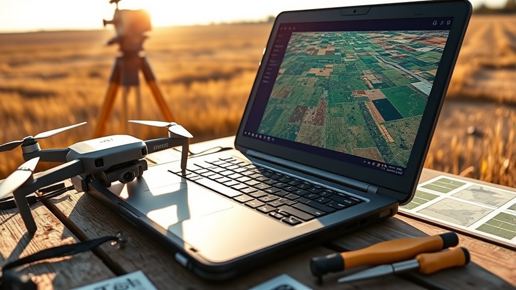
Converting DJI RTK JPG to GeoTIFF requires more than importing drone photographs into QGIS. Each image contains location data, but those coordinates do not create a finished map. To produce an accurate orthomosaic, you need photogrammetry software that aligns the photographs, corrects perspective, and exports a georeferenced raster.
Quick Answer
To convert DJI RTK JPGs into a GeoTIFF, import the original overlapping photographs into WebODM or DJI Terra, verify their RTK coordinates, and run photogrammetric reconstruction. Export the completed orthomosaic as a GeoTIFF, then open it in QGIS. Raw JPG geotags alone cannot provide the pixel-level georeferencing needed for an accurate map.
At a Glance
| Difficulty | Intermediate |
| Tools Needed | Original DJI photographs, WebODM or DJI Terra, and QGIS |
Last checked: September 28, 2026. Dates and figures were verified against official sources.
Why Do DJI JPGs Overlap in QGIS?
)
DJI JPGs overlap because they capture neighboring parts of the same landscape. This overlap is intentional and gives photogrammetry software the shared visual features needed to connect photographs.
The problem begins when you try to display those individual photographs as finished map layers.
A DJI image normally stores GPS coordinates describing the camera’s location at capture time. However, those coordinates do not establish where every image pixel belongs on the ground.
According to the GDAL JPEG documentation, EXIF GPS coordinates alone do not make a JPEG a georeferenced raster.
QGIS therefore cannot reliably position an entire aerial photograph using only its embedded camera coordinates.
Several issues can contribute to confusing results:
- Raw photographs contain overlapping views rather than a continuous map.
- Camera coordinates do not describe the complete ground footprint.
- The imagery has not been corrected for camera angle, lens distortion, and terrain elevation.
- Incorrect or missing raster georeferencing can cause layers to appear in unexpected locations.
- Coordinate reference system (CRS) errors can create additional offsets in data that already have spatial referencing.
The solution is to create an orthomosaic, not to force individual JPGs into the correct-looking positions.
What Can RTK Geotags Actually Do?
Real-Time Kinematic (RTK) positioning improves the accuracy of camera locations recorded during a drone survey. These coordinates help photogrammetry software place images within a consistent geographic reference.
The DJI Phantom 4 RTK specifications list horizontal positioning accuracy of 1 cm + 1 ppm and vertical accuracy of 1.5 cm + 1 ppm under the stated measurement conditions.
These are positioning specifications, not guaranteed accuracy figures for every completed map.
Final orthomosaic accuracy also depends on image overlap, camera calibration, RTK correction quality, processing settings, and ground validation.
| Function | Effect | Result |
|---|---|---|
| Precise coordinates | Better camera position estimates | Improved geographic alignment |
| Sidecar .jgw data | Provides an existing raster’s pixel-to-map transformation | Allows supported software to position that raster |
| Reduced GCP dependence | Fewer control measurements may be needed | More efficient field processing when accuracy is independently verified |
Do RTK photographs still need ground control points?
Not every RTK mapping project requires ground control points (GCPs), but independent accuracy checks remain valuable.
GCPs provide known ground coordinates that can help constrain a reconstruction. Checkpoints are surveyed locations excluded from the adjustment and used to test the finished result.
The WebODM ground control documentation explains how to use GCP files, RTK image positions, and checkpoints during reconstruction.
For survey work, compare the final orthomosaic against independently measured checkpoints before reporting positional accuracy.
Are JGW files required for DJI RTK processing?
No. A JGW file is not normally required when photogrammetry software can read valid camera-position metadata from the original photographs.
A JGW world file describes the relationship between an existing JPEG raster’s pixels and map coordinates. It does not contain the camera geometry needed to build an orthomosaic.
You cannot create a valid world file for a raw aerial image merely by copying its GPS latitude and longitude.
Similarly, a JGW file does not automatically correct perspective or terrain distortion.
Keep the original image metadata intact. If external camera positions are needed, use the geolocation format supported by your processing software.
Which Software Should You Use for Stitching?
WebODM and DJI Terra can convert overlapping drone photographs into georeferenced orthomosaics. Both perform the image alignment and reconstruction that QGIS does not provide through ordinary raster import.
WebODM
WebODM is an open-source drone mapping platform based on the OpenDroneMap processing ecosystem.
It can generate orthophotos, elevation models, point clouds, and other mapping products from overlapping aerial images.
It also supports ground control points and external geolocation files when the embedded image coordinates need correction or replacement.
DJI Terra
DJI Terra provides an integrated processing environment for supported DJI mapping workflows.
It can perform aerial triangulation and generate 2D and 3D reconstruction outputs.
DJI’s Terra reconstruction documentation confirms that its 2D outputs include digital orthophoto maps and digital surface models in GeoTIFF format, using UTM projections by default.
For this workflow, select the appropriate 2D reconstruction output rather than exporting only a 3D mesh or point cloud.
Which workflow should you choose?
Choose WebODM when you want an open-source processing environment with control over reconstruction settings.
Choose DJI Terra when your aircraft and project are supported and you prefer DJI’s integrated processing environment.
In either case, image quality and flight planning remain essential.
OpenDroneMap’s flight recommendations suggest approximately 70–80% overlap for 2D and 2.5D mapping, with greater overlap useful for complex buildings and vegetation.
A mechanical shutter, where available, can also reduce image distortion caused by subject movement across the sensor during capture.
How Do You Stitch DJI JPGs Into a GeoTIFF?
Start with the original photographs from one mapping mission and process them as a connected image dataset.
Do not begin by converting each JPG into a TIFF. Changing the file extension or image format does not perform photogrammetric reconstruction.
Step 1: Prepare the original images
- Copy the full-resolution DJI JPGs into a dedicated project folder.
- Keep the original filenames and embedded metadata.
- Remove accidental duplicates and photographs that do not belong to the survey.
- Inspect images for blur, exposure problems, and missing coverage.
- Confirm that the photographs contain valid geographic coordinates.
If using RTK corrections, confirm that the camera positions reflect the intended corrected solution rather than assuming every image achieved an RTK fix.
Step 2: Create a reconstruction project
Open WebODM or DJI Terra and create a new project or processing task.
Import the original photographs as one image set. If the project includes several flights, make sure they cover connected areas and use compatible positioning information.
Use the software’s supported geolocation-file option if the image coordinates are missing or need replacement.
Step 3: Configure the coordinate system
Select an appropriate output CRS for the survey location and intended GIS analysis.
A projected CRS such as the correct local UTM zone is often suitable for mapping tasks that require measurements in meters.
Also verify the vertical datum if the workflow includes elevation measurements.
The coordinate system of your ground control data must be identified correctly before it is used during reconstruction.
Step 4: Run image alignment and reconstruction
Start photogrammetric processing.
The software identifies matching features between overlapping photographs and estimates the camera positions and orientations.
It then reconstructs the surveyed surface and produces an orthophoto corrected for camera geometry and terrain.
Review the processing report for failed images, weak alignment, or missing coverage.
Step 5: Export the completed orthomosaic
Export the digital orthophoto as a GeoTIFF.
For WebODM, the documented output asset is orthophoto.tif. The WebODM task documentation identifies this file as the georeferenced orthophoto output.
In DJI Terra, use the digital orthophoto map from the completed 2D reconstruction.
Keep the elevation model separately if you also need height or surface analysis.
Step 6: Open the GeoTIFF in QGIS
- Open your QGIS project.
- Add the completed GeoTIFF as a raster layer.
- Open the layer’s Properties panel.
- Inspect its CRS, extent, pixel size, and source information.
- Compare recognizable features against a suitable reference layer.
- Check independent survey points if positional accuracy matters.
A successful result should appear as one coherent mapped surface rather than a collection of disconnected aerial photographs.
Zoom into roads, building corners, and other recognizable features to inspect alignment and stitching quality.
Pro Tip: Preserve the original photographs and processing report alongside the exported GeoTIFF. If a coordinate or reconstruction problem appears later, these files help you identify its source without repeating the entire data collection process.
How Do You Fix CRS and Alignment Errors?
First determine whether the problem comes from missing georeferencing, an incorrect CRS, or failed photogrammetric alignment.
These problems may look similar in QGIS, but they require different fixes.
| Issue | Cause | Remedy |
|---|---|---|
| Shifted mosaic | Incorrect CRS or positioning data | Verify source coordinates and CRS |
| Missing placement | Incomplete georeferencing | Reprocess with valid image positions or control data |
| Warped overlap | Poor image matching or reconstruction | Review images and reprocess in WebODM |
| Residual offset | Insufficient positioning accuracy or ground control | Refine control points and verify checkpoints |
Check the source and project CRS
Open the raster’s properties in QGIS and examine its assigned coordinate reference system.
Compare it with the CRS used during photogrammetric export and the reference data used for validation.
Remember that a project CRS controls how QGIS displays layers. It does not automatically repair incorrect coordinates stored in a raster.
Assigning a CRS versus reprojecting
These operations serve different purposes.
Assign projection identifies the coordinate system already used by the raster. It does not transform the underlying coordinates.
Warp (reproject) transforms a raster from its source CRS into a different target CRS.
The QGIS raster projection documentation describes both operations.
If the source CRS is wrong, correct that information first. If the source CRS is correct but you need another projection, use the reprojection tool.
Check the vertical datum
Horizontal coordinates and elevations are separate parts of a geospatial reference system.
RTK heights may use an ellipsoidal reference, while another dataset may report elevations relative to a geoid or local vertical datum.
Combining different height references without the appropriate transformation can create apparent elevation errors.
Verify the height system used by the original positioning data, GCPs, and final export.
Reprocess when alignment fails
A CRS correction cannot repair photographs that were incorrectly matched during reconstruction.
If roads, roofs, or other features appear doubled or distorted, inspect the image set and processing report.
Remove unusable photographs, correct positioning inputs, or refine ground control before rebuilding the orthomosaic.
Warning: Do not claim survey-grade accuracy simply because the images contain RTK coordinates. Validate the completed orthomosaic against independent ground measurements before using it for engineering, boundary, or other accuracy-sensitive decisions.
Frequently Asked Questions
Is DJI Still Blacklisted?
DJI faces restrictions in some jurisdictions, but there is no universal worldwide ban. In the United States, the FCC Covered List affects equipment authorization for covered products, while separate government procurement restrictions may also apply. These restrictions are not equivalent to a blanket prohibition on operating every previously purchased DJI drone. See the FCC’s official drone restrictions FAQ for the applicable rules.
How to Stitch Drone Images Together?
Import overlapping photographs into photogrammetry software such as WebODM or DJI Terra. Verify their camera positions, run image alignment and surface reconstruction, and generate an orthomosaic. Export the finished map as a GeoTIFF for use in QGIS. Accurate results depend on sufficient overlap, usable image detail, correct positioning data, and appropriate ground validation.
Can FAA Know You Flew a DJI Drone?
Yes, FAA officials and other authorized parties may identify drone operations through registration information, records, and Remote ID broadcasts. The FAA’s Remote ID guidance explains that compliant drones broadcast identification and location information that nearby receivers can detect. This does not mean the FAA continuously records every flight or automatically identifies every drone operation.
Is JPEG or DNG Better?
DNG generally offers greater flexibility for photographic editing because it can preserve raw sensor information. JPEG uses processed, compressed image data and is commonly supported by mapping software. Adobe explains these differences in its Camera Raw documentation. For DJI photogrammetry, use the format supported by your aircraft and processing software; DNG is not automatically more accurate for mapping.
Conclusion
DJI RTK JPGs provide useful camera positioning data, but they are not finished georeferenced maps. Use WebODM or DJI Terra to reconstruct the photographs and export a GeoTIFF orthomosaic.
Before using the result in QGIS, verify the coordinate system, inspect image alignment, and validate accuracy against independent ground measurements. This workflow produces a more dependable mapping product than attempting to position raw photographs individually.
Sources
- GDAL JPEG Driver Documentation: EXIF GPS metadata, georeferencing, and JPEG world files.
- DJI Phantom 4 RTK Specifications: RTK positioning accuracy and camera specifications.
- WebODM Ground Control Points: GCPs, checkpoints, image geolocation files, and RTK processing.
- DJI Terra Reconstruction Outputs: GeoTIFF orthophotos and digital surface models.
- OpenDroneMap Flying Tips: Recommended flight overlap for photogrammetric reconstruction.
- WebODM Task Documentation: Orthophoto GeoTIFF output and available processing assets.
- QGIS Raster Projection Documentation: Assigning coordinate systems and reprojecting raster layers.
- Federal Communications Commission: Covered List restrictions and drone equipment authorization.
- Federal Aviation Administration: Remote ID requirements and identification broadcasts.
- Adobe Camera Raw Documentation: RAW, DNG, and JPEG image characteristics.
