
Drones are changing how farms collect data, protect crops, manage livestock, and use resources. Instead of relying only on ground checks, you can use aerial imagery, thermal sensors, multispectral cameras, and automated flight routes to spot problems earlier and respond with more precision. The biggest value comes when drone data turns into clear decisions, such as where to spray, irrigate, scout, reseed, or inspect after a storm.
Quick Answer
Drones help agriculture by making crop monitoring, spraying, mapping, livestock checks, and disaster assessment faster and more precise. They can reduce wasted inputs, improve field visibility, support better timing, and help farmers act before small problems become expensive losses.
Key Takeaways
- Agricultural drones support crop scouting, spraying, mapping, soil analysis, livestock monitoring, and post-disaster inspections.
- Multispectral, thermal, RGB, and RTK-enabled drones can turn field conditions into usable maps and management zones.
- Drone spraying can improve targeting, but you still need label compliance, trained operators, and safe weather conditions.
- The best results come from combining drone data with farm software, field notes, soil tests, and agronomic judgment.
Note: Drone rules, chemical application requirements, and licensing rules vary by country and region. Always check local aviation rules, pesticide labels, and agricultural application requirements before flying or spraying.
Aerial Spraying: Revolutionizing Crop Protection

As agricultural demands grow, drones are transforming aerial spraying into a more flexible method for crop protection. Instead of waiting for heavy ground equipment or walking difficult areas by hand, you can use drone systems to reach targeted zones with less soil disturbance and faster setup.
The DJI Agras T50, for instance, is designed for agricultural spraying and spreading work, with a high-capacity liquid tank and wide spray coverage for large fields. Real-world output still depends on crop type, spray volume, battery rotation, wind, terrain, operator settings, and local regulations. That means you should treat manufacturer productivity figures as best-case guidance, not a guaranteed field result.
By employing programmable flight paths, you can improve precision application of pesticides and fertilizers, which helps reduce chemical wastage and lowers the risk of overspray. This high-speed capability allows you to time sprays during critical growth stages, improving protection when disease, insects, or nutrient stress begin to appear.
Drones equipped with adjustable flow rates also support tailored applications. You can deliver different rates based on field zones, crop height, pest pressure, or prescription maps. This approach does not replace proper agronomy, but it gives you a more responsive way to apply inputs where they are actually needed.
Warning: Never spray only because a drone can reach the area. Follow the pesticide label, observe buffer zones, avoid unsafe wind conditions, and use trained operators who understand drift risk, nozzle selection, and flight safety.
By reducing reliance on manual labor and large ground rigs in some situations, drone technology can improve operational efficiency and offer cost savings for farmers. This revolution in aerial spraying not only improves crop protection but also supports more sustainable farming practices when paired with accurate scouting and responsible input use.
Livestock Management: Enhancing Health Monitoring
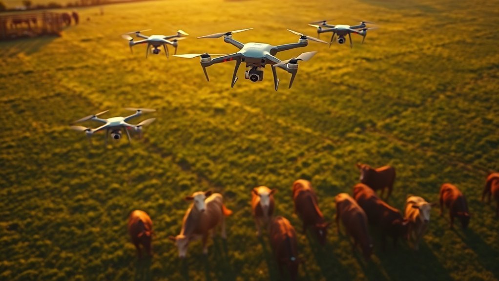
In livestock management, drones equipped with thermal imaging technology can help you monitor animal health by detecting unusual heat patterns, which may point to stress, injury, fever, or poor movement. Automated grazing monitoring can also cut down on repeated pasture checks while giving you a broader view of herd behavior and pasture condition.
Drones can improve your ability to detect predators, check fences, locate missing animals, and review water points. These uses help safeguard livestock and improve productivity, especially on large properties where daily ground checks take time.
Thermal Imaging Insights
While traditional methods of monitoring livestock health can be labor-intensive and time-consuming, thermal imaging drones give you a faster way to scan herds from above. These drones detect abnormal body temperature patterns, enabling early identification of possible health issues and faster follow-up checks.
Thermal imaging should not be treated as a complete diagnosis. Heat patterns can be affected by sunlight, weather, coat thickness, mud, water, distance, and camera angle. Still, when used as a screening tool, thermal data can help you decide which animals need closer inspection.
By automating monitoring processes, you can reduce labor costs while keeping more consistent oversight of large grazing areas. Thermal imaging also allows you to monitor livestock health remotely, which supports better decisions about animal care, water access, shade, and pasture rotation.
This technology also aids in identifying predators like coyotes and feral swine that can cause substantial agricultural losses. Ultimately, thermal imaging can enhance herd welfare and boost productivity, transforming how you manage and care for livestock.
Automated Grazing Monitoring
Automated grazing monitoring transforms livestock management by leveraging drone technology to enhance health oversight and operational efficiency. Drones equipped with thermal imaging allow you to monitor livestock for abnormal temperature patterns, enabling early detection of issues that could affect productivity.
This automated system can conduct regular patrols over large pastures, cutting labor time for boundary checks, water checks, and herd location. By monitoring livestock movements, drones provide valuable insights into grazing pressure and pasture quality without requiring constant ground inspections.
The data gathered enhances operational efficiency because you can assess herd health and behavior with less manual intervention. That leads to better management decisions, healthier grazing patterns, and improved livestock welfare.
Predator Detection Capabilities
Utilizing drones for predator detection enhances livestock management by giving farmers a proactive way to safeguard their herds. Drones equipped with thermal imaging technology can help detect predators like coyotes and feral swine, enabling real-time monitoring of potential threats to livestock.
Regular aerial patrols over grazing areas can identify predators, spot unusual movement, and deter trespassers, improving farm security. Drones can also help you review fence lines after storms or find weak spots where predators may enter.
Thermal sensors on drones can spot unusual heat patterns in livestock, signaling health issues that may require immediate attention. This automation reduces labor costs and supports timely interventions. By facilitating real-time monitoring of pasture conditions, drones help farmers manage grazing practices more efficiently while protecting livestock from predation and promoting overall health.
Crop Monitoring: Assessing Plant Health With Precision

Drones have improved crop monitoring by providing faster plant health assessments through advanced imaging technologies. Equipped with RGB and multispectral sensors, these drones, like the Mavic 3M, can capture detailed field imagery that helps you detect early crop stress and monitor crop conditions more effectively.
The multispectral imagery captured allows you to generate prescription maps using vegetation indices such as normalized difference vegetation index, also known as NDVI. These maps can highlight areas that may require targeted interventions, such as irrigation checks, nutrient review, pest scouting, or disease inspection.
Drones can cover large field areas faster than foot scouting, depending on battery life, flight height, camera settings, weather, and regulatory limits. They offer real-time data on crop growth and soil conditions, which can improve efficiency compared to traditional scouting methods alone.
Thermal imaging capabilities can reveal abnormal temperature variations, which may signal water stress, drainage problems, irrigation failures, or pest pressure. By integrating drone data with agriculture software platforms, you streamline analysis and enhance operational efficiency, empowering you to make informed decisions based on thorough assessments of plant health.
Pro Tip: Use drone maps as a scouting guide, not a final diagnosis. Walk the flagged zones, compare them with soil tests and field history, then decide whether treatment is truly needed.
Soil and Field Analysis: Data-Driven Insights

As precision agriculture continues to evolve, the importance of soil and field analysis becomes increasingly clear. Drones equipped with advanced imaging technologies, such as multispectral or hyperspectral sensors, allow you to conduct soil analysis more efficiently across large areas.
These drones provide useful soil mapping support by helping identify compaction patterns, drainage issues, vegetation variability, pH concerns, and fertility differences. This information supports zone-specific management, which can help you avoid treating an entire field the same way when only certain areas need attention.
You can complete surveying and mapping operations in hours instead of days in many situations, improving your agricultural operations. With high-resolution imaging, drones create precise field maps that inform irrigation planning, drainage planning, and water resource management.
Rapid data collection leads to actionable insights that improve erosion control through detailed topography mapping. Additionally, integrating drone data with cloud platforms can enrich your soil analysis, allowing for more informed decision-making. By leveraging these tools, you are not just improving soil health; you are transforming the way you manage fields.
Precision Mapping: Creating Accurate Terrain Models

When you utilize drones equipped with high-resolution imaging techniques, you can create detailed terrain models that improve mapping precision. This technology allows for real-time data collection, providing immediate insights into your agricultural landscape. By analyzing these terrain models, you can make informed decisions that optimize farming practices.
High-Resolution Imaging Techniques
High-resolution imaging techniques are reshaping precision mapping in agriculture, enabling farmers to create accurate terrain models with very fine detail. Equipped with RTK GPS, drones like the DJI Mavic 3E can support consistent data collection across different field conditions. By integrating multispectral and thermal imaging, you can assess soil moisture, drainage, crop stress, and canopy variation.
| Benefits | Technologies |
|---|---|
| Accurate 3D contour maps | High-resolution imaging |
| Rapid surveying completion | Drone technology |
| Enhanced crop placement | Multispectral imaging |
These advanced imaging techniques allow you to develop more effective irrigation management plans and reduce resource waste. With drones, mapping tasks that once required more time can often be completed much faster, making farming more efficient and precise.
Terrain Analysis and Mapping
Precision mapping has transformed terrain analysis in agriculture, allowing you to create accurate models that enhance operational efficiency. Drones equipped with high-resolution cameras and RTK GPS technology can deliver detailed positioning data for agricultural operations. With their lightweight design, you can conduct single-pilot surveys in many field conditions, including challenging terrain.
Key benefits include:
- Rapid completion of extensive mapping tasks in hours
- Identification of soil condition variations using multispectral imagery
- Enhanced data collection capabilities for informed decision-making
- Integration with cloud platforms for advanced analytical insights
Terrain analysis is especially useful for irrigation planning, drainage correction, terrace design, erosion control, and field leveling decisions. It gives you a clearer view of how water moves, where crops may struggle, and which zones need closer review.
Real-Time Data Collection
The advancements in drone technology are improving real-time data collection in agriculture. Drones equipped with high-resolution cameras and RTK GPS can help you create detailed terrain models for precision agriculture. The DJI Mavic 3E facilitates access to challenging terrains, allowing you to collect diverse data types efficiently.
This results in accurate field maps generated in a shorter time than many traditional survey methods. By utilizing drones for precision mapping, you can swiftly identify soil compaction, pH variation zones, fertility differences, water movement patterns, and field access issues. Integrating drone-collected data with cloud-based management systems supports real-time decision-making, streamlining farming operations and boosting overall operational efficiency.
Automated Crop Sampling: Streamlining Data Collection
As you integrate automated crop sampling into your agricultural practices, tools like the DJI Dock 2 can streamline data collection processes. With compatible drone systems, you can program scheduled flights for routine assessments, reducing labor time and making crop monitoring more consistent.
This technology enhances precision agriculture by delivering:
- Accurate crop health assessments through integrated positioning modules
- Orthomosaic data uploaded to cloud-based systems for post-flight analysis
- Extensive plant health evaluations, as demonstrated by large agricultural research and production teams
- Efficient data processing using mapping software to create digital surface models, digital orthophoto maps, and orthomosaic images
Automated sampling helps you compare the same fields over time. That matters because one drone flight may show a problem, but repeated flights can reveal whether the issue is spreading, shrinking, or staying stable. This trend-based view supports better decisions about irrigation, fertility, pest pressure, and harvest timing.
Resource Management: Optimizing Inputs for Sustainability
Integrating automated crop sampling not only streamlines data collection but also lays the groundwork for optimizing resource management in agriculture. Drones play a pivotal role in precision agriculture by enabling targeted application of fertilizers and pesticides, which can reduce chemical runoff and lower environmental impact when done correctly.
Utilizing multispectral and thermal imaging, drones can assess soil moisture, crop stress, and nutrient deficiency patterns. This supports optimized irrigation and fertilization strategies that conserve resources. Agricultural spraying drones, such as the DJI Agras T50, are designed for precise input distribution, helping minimize waste when operators use the right nozzles, rates, and flight settings.
Drones also generate prescription maps through NDVI and similar analyses. These maps allow you to apply inputs where they are most needed, which can enhance crop health and yield while reducing unnecessary applications.
Implementing drone technology can also lower operational costs in some operations by reducing labor, scouting time, field passes, and input waste. Actual savings depend on acreage, crop value, flight frequency, drone ownership costs, software costs, training, local service rates, and the quality of the decisions made from the data. With these advancements, you can make more informed decisions that align with environmental stewardship while maximizing agricultural productivity.
Disaster Assessment: Monitoring Environmental Impact
In evaluating environmental damage after a disaster, drones offer a precise method for assessing affected areas and infrastructure. You can utilize aerial imagery to identify critical recovery monitoring strategies and inform land management decisions. This integration of data not only streamlines recovery efforts but also enhances your ability to monitor ongoing environmental impacts effectively.
Environmental Damage Evaluation
While evaluating environmental damage after natural disasters, drones play an essential role in delivering rapid and precise evaluations. By capturing high-resolution aerial imagery, they enable quick assessments that support recovery efforts.
You can leverage drones to:
- Identify at-risk zones for water stress or erosion before planting.
- Monitor crop conditions after floods, droughts, hail, wind, or wildfire smoke.
- Track landscape changes effectively, assisting in ecosystem health assessments.
- Enhance disaster resilience through accurate aerial intelligence for planning.
These capabilities empower proactive management strategies, enabling you to mitigate environmental impact while fostering stewardship in your agricultural practices. By integrating drones into your evaluation processes, you can improve recovery efficiency and contribute to a more sustainable agricultural future.
Infrastructure Assessment Techniques
Effective infrastructure assessment techniques are vital for monitoring environmental impacts in agriculture, especially after natural disasters. Drones equipped with advanced sensors and high-resolution cameras enable rapid damage assessments, helping you review fences, irrigation systems, barns, access roads, drainage structures, and field edges.
By leveraging aerial intelligence, these drones can monitor crop health and identify at-risk zones for water stress or erosion before planting, promoting precision agriculture. Real-time data collection helps you assess environmental impacts and supports compliance with sustainable farming practices.
Additionally, integrating drone data with satellite information improves your understanding of environmental conditions. This supports informed decision-making in disaster resilience strategies. Embracing these techniques strengthens your commitment to environmental stewardship in agriculture.
Recovery Monitoring Strategies
As farmers face the aftermath of natural disasters, implementing robust recovery monitoring strategies becomes essential for evaluating environmental impact and optimizing recovery efforts. Drones play a pivotal role in this process.
You can use them to:
- Assess crop loss through precise aerial imagery for insurance documentation.
- Identify at-risk zones for water stress or erosion before planting, allowing for proactive measures.
- Monitor crop conditions and environmental impacts in near real time, supporting sustainability goals.
- Integrate drone findings with satellite technology for broader monitoring and stronger situational awareness.
Recovery monitoring is most useful when you compare pre-disaster and post-disaster imagery. This makes damage easier to document and helps you prioritize the areas that need repair, reseeding, drainage work, soil testing, or yield-loss review.
Training and Support: Empowering Farmers With Drone Technology
Understanding how to effectively use drone technology in agriculture requires targeted training and strong support systems. Training programs for farmers often cover aviation rules, safe operating procedures, mission planning, battery management, image capture, data interpretation, and practical agricultural applications.
For many commercial uses, operators may need licensing or certification depending on local law. In the United States, for example, many commercial drone operations fall under FAA Part 107 rules. Spraying operations may involve additional aircraft, applicator, and pesticide requirements. This makes training essential before using drones for agricultural application work.
Advanced UAS Operator Courses can provide in-depth training on drone operation, data interpretation, and practical farm use cases. On-site assistance can also address unique farming challenges, helping you tailor drone technology to your field size, crops, terrain, irrigation system, and labor needs.
This personalized support integrates more smoothly with existing drone models and farm management systems, allowing you to maximize productivity. Educational resources also empower you with the knowledge and skills necessary for effective resource management, ultimately improving yields and reducing waste.
Choosing the Right Agricultural Drone
The right agricultural drone depends on the job you need it to perform. A drone used for crop scouting will not always be the best option for spraying, livestock checks, or detailed terrain mapping. Before buying, define your main use case, acreage, crop type, budget, and data needs.
For basic crop scouting, an RGB camera drone may be enough. For plant health analysis, you may need a multispectral camera. For water stress, livestock monitoring, or night-adjacent inspections, thermal imaging may help. For surveying and precise mapping, RTK or PPK positioning can improve map accuracy.
You should also consider battery logistics, payload capacity, weather resistance, software compatibility, repair support, spare parts, training, and local service availability. A cheaper drone can become expensive if it lacks the sensors, flight time, or software needed for your actual farming tasks.
Common Limitations of Drones in Agriculture
Drones offer major advantages, but they are not perfect. Weather is one of the biggest limitations. High winds, rain, fog, dust, extreme heat, and poor light can reduce image quality or make flights unsafe. Battery life also limits how much land you can cover before swapping batteries or recharging.
Data quality can vary based on flight height, overlap settings, sensor calibration, crop canopy stage, and operator skill. Poorly planned flights can produce maps that look impressive but do not support accurate decisions. Software costs and data processing time can also add to the total investment.
Regulations are another key limitation. You may need permission for commercial flights, flights near airports, beyond visual line of sight operations, night operations, or spraying work. Because of these limits, drones work best as part of a larger farm management system rather than a standalone solution.
Future Trends: The Next Frontier in Agricultural Drones
The future of agricultural drones is poised for transformative growth, with continued adoption driven by advancements in UAV technology and rising demand for precision farming solutions. Instead of viewing drones as simple flying cameras, farms are increasingly using them as connected data tools that feed into broader decision systems.
The next stage of agricultural drones is not just faster flight. It is smarter data, better automation, safer spraying, and clearer field-level decisions.
Key future trends include:
- Integration of AI and machine learning for autonomous flight and optimized crop management
- Swarming technology, allowing multiple drones to be operated by one pilot, enhancing efficiency
- Blockchain technology to improve product traceability in agri-supply chains, ensuring transparency
- Enhanced regulatory frameworks, including BVLOS operations, enabling broader drone utilization
As these innovations unfold, agricultural drones are likely to become more valuable tools for farmers, enhancing resource allocation and crop monitoring. With increased operational capabilities and stronger compliance systems, you will be better equipped to meet both productivity and sustainability goals.
Frequently Asked Questions
What are the uses of drones in agriculture?
You can use drones in agriculture for crop health assessment, precision mapping, livestock tracking, automated crop sampling, field scouting, disaster inspection, and targeted spraying. These applications improve data collection, optimize resource management, and can reduce labor and operational costs.
Why are drones flying over farms?
Drones fly over farms to evaluate plant health, identify pests, inspect irrigation, map terrain, check livestock, document storm damage, and guide precise applications of fertilizers or pesticides. They help farmers see problems earlier and make faster management decisions.
How much does drone spraying cost per acre?
Drone spraying costs vary by location, crop, acreage, chemical type, terrain, application rate, service provider, and regulatory requirements. Many service quotes are priced per acre, but you should request a local estimate that includes chemicals, labor, travel, and any required compliance costs.
How do you use drones for farming?
Start by choosing a clear goal, such as scouting, mapping, spraying, or livestock monitoring. Plan safe flight routes, collect the right imagery, process the data, verify problem areas on the ground, and then use the findings to guide irrigation, spraying, fertilizing, or field repairs.
Are drones worth it for small farms?
Drones can be worth it for small farms when they solve a clear problem, such as frequent scouting, irrigation checks, livestock monitoring, or mapping high-value crops. For occasional use, hiring a drone service may be more cost-effective than buying equipment and software.
What sensors are best for agricultural drones?
RGB cameras work well for visual scouting. Multispectral sensors help assess plant vigor and vegetation indices. Thermal sensors can support water stress checks and livestock monitoring. RTK or PPK positioning helps when you need more accurate maps and repeatable survey data.
Conclusion
Incorporating drones into agriculture is transforming farming practices by improving speed, visibility, precision, and sustainability. From aerial spraying and crop monitoring to livestock checks and disaster assessment, drones help you collect information that would be harder, slower, or more expensive to gather from the ground alone.
The strongest results come when drone data leads to practical action. A vineyard, for example, might use drones to identify stressed vines, adjust spraying zones, and monitor irrigation problems before yield losses grow. That kind of precise data collection and targeted intervention can reduce unnecessary input use while improving crop performance.
As drone technology continues to evolve, farmers can expect better automation, stronger sensors, improved mapping, and more integrated farm management systems. Used responsibly, drones can support a more sustainable and efficient agricultural landscape while helping you make clearer decisions in the field.
