PhotoPills is the best all-around sun position app for drone photography because its Planner includes a dedicated Drone mode plus Sun, Twilight, and Shadow layers. The Photographer’s Ephemeris is stronger for map-based alignment and 3D planning, while Shadowmap is better when buildings or terrain may block the light. Sunlitt, Sun Surveyor, Sun Seeker, and SunQuest are useful alternatives for AR, quick sun-path checks, or shadow planning.
Last updated: September 11, 2026. This update rechecked current app features, platform availability, TPE Web 4.0, and FAA B4UFLY guidance.
Quick Answer
Start with PhotoPills if you want one app for drone-specific shot planning. Its Drone mode can combine framing, sun direction, twilight, and shadow information. Choose The Photographer’s Ephemeris for precise map/3D alignment, Shadowmap for 3D shadow analysis, Sun Surveyor for cross-platform AR scouting, or Sunlitt and Sun Seeker for fast visual sun-path planning.
Key Takeaways
- Use sun position apps before every important drone shoot so you can plan around golden hour, blue hour, backlighting, and long shadows.
- PhotoPills is the strongest all-around option here because its Planner has a dedicated Drone mode; PhotoPills and Sun Surveyor also offer AR sun-path views.
- Shadowmap is helpful for urban scenes, mountain terrain, buildings, and any shot where shadows affect the final composition.
- The Photographer’s Ephemeris works well for map-based and 3D planning when you need to align the sun, moon, or light direction with a landmark.
- Always combine sun planning with drone safety checks, weather, wind, airspace rules, and battery planning before launch.
At a Glance
| Best For | Drone photographers planning golden hour, sunrise, sunset, city, landscape, and architectural aerial shots |
| Difficulty | Easy to moderate, depending on whether you use basic sunrise times or advanced AR and shadow tools |
| Tools Needed | A sun position app, drone weather app, airspace checker, map app, and a charged phone or tablet |
| Cost | Free, one-time paid, and subscription options are available depending on the app and features |
| Best Starting Point | PhotoPills for drone-specific planning; Shadowmap for 3D shadows; TPE for map/3D alignment; Sun Surveyor for iOS/Android AR scouting |
Understanding the Importance of Sun Position in Photography
When you’re planning a drone shoot, understanding the sun’s position isn’t just helpful. It is one of the biggest factors behind clean, professional aerial images. The angle of sunlight affects color, contrast, glare, shadow length, texture, and the overall mood of your scene.
During golden hour, the sun sits low in the sky. This creates softer light, warmer colors, and longer shadows that can add depth to landscapes, roads, buildings, coastlines, and forests. Midday light, by comparison, often creates harsher highlights, flatter scenes, and stronger glare on water, glass, metal, and rooftops.
Good drone photography starts before takeoff. When you know where the sun will be, you can plan your flight path, camera angle, and shooting time with far more confidence.
Using apps like Shadowmap, Sunlitt, PhotoPills, and The Photographer’s Ephemeris, you can preview how sunlight will hit your location at different times of day. That helps you decide whether to shoot front-lit scenes, backlit silhouettes, side-lit textures, or top-down patterns with minimal shadow distraction.
Sun planning also helps with practical decisions. You can avoid pointing your camera directly into harsh glare, reduce blown highlights, plan safer launch and landing windows, and schedule flights when a subject looks its best. For architecture, real estate, travel, landscape, and cinematic drone work, this planning can turn an average shot into a polished visual story.
Warning: Never plan a drone flight around light alone. Check local airspace rules, wind speed, visibility, precipitation, obstacles, people, and battery limits before you launch.
Overview of Sun Position Apps
When planning your drone shots, sun position apps act like a scouting assistant. They show where the sun will be, when shadows will stretch across your subject, and when the light will shift from harsh to soft.
Some apps focus on simple sunrise and sunset times. Others add augmented reality, 3D maps, shadow simulation, moon planning, terrain tools, or weather overlays. The most useful difference for drone shooters is whether the app can connect sun direction to the actual aerial composition. PhotoPills stands out here because its Planner includes a dedicated Drone mode that can show an approximate frame and flight height alongside light-planning layers.
For example, a landscape photographer may want a map-based tool that lines up sunrise with a ridge, lake, road, or mountain. A real estate drone pilot may care more about when the front of a building receives clean light. A city photographer may need shadow simulation between tall buildings.
Let’s look at the most useful apps and the features that make them valuable for aerial photography.
Top Sun Position Apps
As you plan your next drone shoot, the right sun position app can help you choose a better launch time, cleaner camera direction, and stronger composition.
PhotoPills is the best fit for this specific use case. Its Planner has a dedicated Drone mode, plus Sun, Twilights, and Shadow layers, so you can plan the approximate aerial frame and then check light direction, golden/blue hour, and shadow behavior in the same workflow. It also includes sun/moon AR and photography calculators.
The Photographer’s Ephemeris (TPE) is a strong choice for map-based and 3D planning. TPE Web 4.0 adds newer shot-alignment and celestial-target planning tools, while TPE’s broader toolkit covers sun/moon direction, terrain-aware sightlines, light, and shadows. TPE for iOS also supports AR.
Shadowmap specializes in interactive 3D sunlight and shadow simulation. It is particularly useful for city flights, architecture, construction sites, hills, valleys, and any scene where buildings or terrain may put the subject into shade earlier than a basic sunrise/sunset app suggests.
Sunlitt combines sun-path tracking, AR, a Shadow Map, and landform-shadow tools. Its current App Store listing is focused on the Apple ecosystem, including iPhone, iPad, Mac, Apple Watch, and Apple Vision Pro, so Android users should choose another option.
Sun Surveyor is a practical cross-platform choice for iOS and Android. It combines Live View AR, an interactive map, a 3D compass, golden/blue hour timing, and sun-shadow information, making it useful for on-location scouting.
Sun Seeker is a fast visual sun tracker with compass, map, and 3D AR views. Its current Apple listing includes sunrise/sunset, twilight, golden/blue hour, shadow information, and any-date sun-path planning.
SunQuest is another Apple-focused option with sun-path, AR, map, golden/blue hour, shadow, and solar-data tools. It is more capable than a basic sunrise/sunset checker, so the article should not describe it as only a simple timing app.
Key Features Comparison
Not every app solves the same problem. Use this comparison to match the app to the type of drone shoot you are planning.
| App Name | Standout Features | Best Drone Use | Platform / Limitation |
|---|---|---|---|
| PhotoPills | Dedicated Drone mode, Sun/Twilight/Shadow layers, AR, sun/moon planning, photo calculators | Best overall for planned aerial compositions, golden hour, shadows, and landmark alignment | iOS and Android; deeper feature set has a learning curve |
| The Photographer’s Ephemeris | Map/3D sun and moon planning, light direction, shadows, sightlines, shot alignment | Landscape, travel, architecture, and precise landmark alignment | Web and Apple tools; AR is available in TPE for iOS |
| Shadowmap | Interactive 3D sunlight and shadow simulation, buildings, terrain, sun path | City, real estate, architecture, and terrain-shadow planning | Web-based; advanced date/project features depend on plan |
| Sunlitt | Sun path, AR, Shadow Map, landform shadows, offline sun tracking | Fast Apple-device scouting, urban shadows, and terrain-aware planning | Apple ecosystem in the current listing; some advanced features require Pro |
| Sun Surveyor | Live View AR, map, 3D compass, golden/blue hour, shadow data | On-location visual scouting and sun/moon path checks | iOS and Android; map/Street View need connectivity |
| Sun Seeker | Compass, map, 3D AR, sun path, sunrise/sunset, twilight, golden/blue hour | Fast direction checks and visual sun-path scouting | Current Apple listing covers iPhone, iPad, and Apple Watch |
| SunQuest | Sun path, AR, map, golden/blue hour, shadow and solar data | General photography and outdoor sun planning | Current official site lists iPhone, iPad, and Mac |
Note: App features can vary by platform, version, country, and subscription tier. Check the current app listing before you rely on a specific feature for paid work.
The Photographer’s Ephemeris: A Comprehensive Tool
Whether you’re capturing sweeping landscapes or detailed architecture, The Photographer’s Ephemeris can help you plan stronger drone images before you arrive on location.
Its map-based interface lets you choose a shooting position, then view the direction of sunrise, sunset, moonrise, and moonset for a selected date. TPE Web 4.0 also adds shot-alignment and celestial-target planning tools, while TPE’s 3D tools help you evaluate sightlines, light direction, and shadows around terrain. This is useful when you want the sun to rise behind a mountain, skim across a ridgeline, light the front of a building, or create long shadows across a field.
For drone photographers, this type of planning helps answer practical questions: Which side of the subject will be lit? Will the sun sit behind the camera or in front of it? Will a hill, tree line, or building block the light? Will the scene look better at sunrise or sunset?
Use map-based planning when the position of the sun matters as much as the time of day. It helps you align light with the subject, not just chase golden hour.
TPE is especially useful for landscapes, coastlines, mountain viewpoints, bridges, monuments, and rural roads. It also helps when you are planning a shot days or weeks ahead and need to know whether the light will line up with the scene.
Before you fly, pair TPE with a drone weather app and an airspace checker. A perfect sun angle does not help if the wind is too strong, the location is restricted, or visibility is poor.
Using PhotoPills for Optimal Sun Tracking
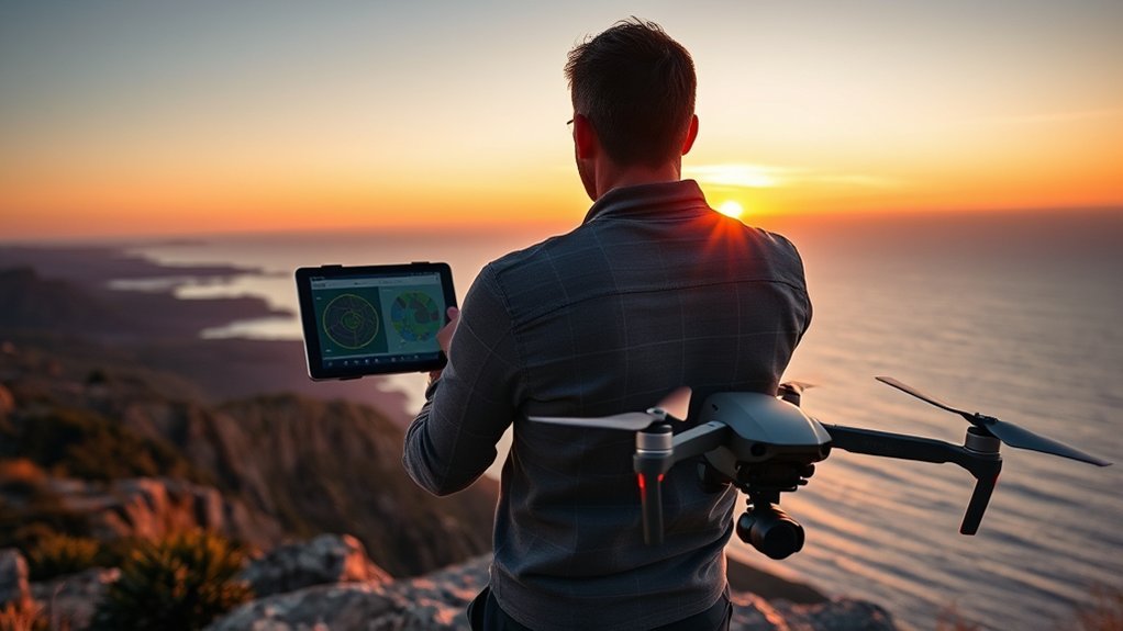
With PhotoPills, you can plan drone photos around the sun, moon, changing light, shadows, and the approximate aerial frame. Its dedicated Drone mode is the biggest reason it ranks first for this use case: the Planner can combine your drone/camera choice and field of view with Sun, Twilights, and Shadow layers.
The app’s planning tools help you visualize the sun’s path, check golden hour and blue hour, and preview how the light will move across a location. Its augmented reality features are especially helpful when you are standing on site and want to see where the sun will be later.
Sun Position Planning
As you prepare to capture stronger aerial shots, PhotoPills helps you plan around the sun’s path instead of guessing. In Planner, switch to Drone mode, choose the drone or camera and focal length, then use the map frame to explore composition. Add the Sun, Twilights, and Shadow layers to see how the light direction and shadow behavior change with time.
This is useful for sunrise and sunset flights, but it also helps during daytime shoots. You can decide whether to use side light for texture, backlight for drama, or front light for clear detail. You can also avoid times when the sun causes glare, washed-out skies, or harsh shadows across the wrong part of your subject.
PhotoPills also includes calculators for exposure, depth of field, and other photography settings. While drones have smaller sensors and fixed-lens limits compared with many ground cameras, these tools still help you think through light, shutter speed, motion, and sharpness before takeoff.
Augmented Reality Features
PhotoPills’ augmented reality view lets you hold up your phone and preview the path of the sun, moon, and other celestial objects over the real scene. For drone photographers, this can make planning faster and more visual.
Imagine standing near a lake, building, or overlook and seeing where the sun will sit at golden hour. You can decide whether to launch from one side of the location, shift your flight path, or return at a different time.
You can also use AR to avoid harsh backlight when it does not fit your shot. For example, if the sun will sit directly behind a building at your planned flight time, you may choose a lower angle, a side orbit, or a later window when the light wraps around the structure.
Photography Timing Optimization
Planning your drone photography does not stop at checking where the sun will be. You also need to choose the right timing for the effect you want.
For soft warm light, plan around golden hour just after sunrise or before sunset. For cooler tones, city lights, and dramatic skies, look at blue hour. For top-down patterns, beach scenes, and minimal shadows, a higher sun angle can sometimes work better than golden hour.
PhotoPills helps you compare these windows so you can schedule your flight around the scene, not just around your availability. That is especially helpful when battery time is limited and you only have one or two chances to capture the best light.
Pro Tip: Save your planned location in the app before leaving home. That way, you can review sun direction, arrival time, and backup angles even if mobile service is weak on location.
Shadowmap: Enhancing Aerial Photography With Sunlight Simulation
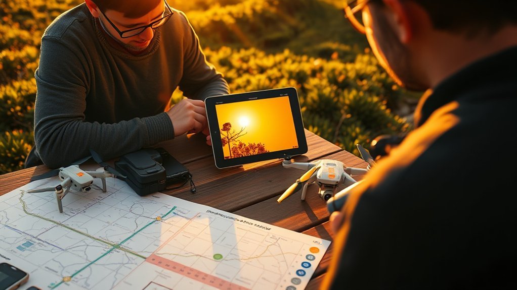
Capturing stunning aerial shots often hinges on one essential element: light. Shadowmap helps you understand how sunlight and shadows may affect a scene before you fly.
This is especially useful in urban areas, mountain towns, forest edges, canyons, and real estate projects where buildings or terrain can block the sun. Instead of arriving to find your subject in shade, you can preview better windows ahead of time.
Here’s how Shadowmap can support drone planning:
- Sunlight and shadow simulation: Preview how shadows may move across a location at different times of day.
- Location-based planning: Check cities, landscapes, and travel spots before you choose a flight window.
- 3D visual context: Use terrain and building information where available to understand how light interacts with the scene.
- Creative shadow control: Decide whether you want clean light, long shadows, silhouettes, or dramatic contrast.
Shadowmap works best when you need to understand obstacles. For example, a building may look perfect from the air, but nearby towers could cast dark lines across the roof at sunset. A mountain overlook may offer beautiful views, but the valley below may fall into shade earlier than expected. Its current free plan lets you change the time for the current day; broader date control is part of paid tiers, so check the live plan before depending on a future-date workflow.
Use Shadowmap with your drone’s map view and weather tools. If the simulation suggests a strong composition, confirm that the location is safe, legal, and practical for takeoff and landing.
Practical Techniques for Scheduling Drone Flights
With the right tools in hand, you can elevate your drone photography by scheduling flights around the light you actually want. Start by choosing the visual effect first, then pick the time that supports it.
For warm, cinematic footage, plan around sunrise or sunset. For soft city transitions, check blue hour. For top-down landscape patterns, farmland, beaches, or roads, consider when shadows help the composition instead of hiding the subject.
Use apps like Sunlitt or PhotoPills to check sun tracking details on a map. Look at the sun’s direction, the time of sunrise and sunset, and how the angle changes during your planned window.
Plan in this order: subject and access, airspace, weather, sun direction, shadow behavior, launch point, battery window, then a backup composition.
Shadowmap can help you visualize solar exposure and shadow influence before you arrive. This matters in cities, forests, canyons, and real estate shoots where shadows may move quickly across your subject.
Don’t forget to check sunrise and sunset times with SunQuest, Sun Surveyor, Sun Seeker, PhotoPills, or another reliable tool. These times change by location and date, so avoid relying on memory.
Then combine your light plan with weather and drone safety. Apps like UAV Forecast can help you review wind, gusts, visibility, temperature, cloud cover, and flight conditions. Also check airspace using the official tools available in your country or region.
Finally, give yourself a buffer. Arrive early enough to set up, inspect the location, confirm the sun angle, choose a safe launch point, and capture test shots before the best light peaks.
Leveraging AR Features for Visualizing Sun Trajectories
As you prepare to take your drone photography to new heights, augmented reality features can help you visualize sun trajectories in a simple, practical way.
AR is useful because it connects the planning data to the real scene in front of you. Instead of reading a chart and guessing how it fits the location, you can hold up your phone and see the sun path overlaid on the environment.
These apps can improve your planning by helping you:
- Visualize sun paths: Apps like PhotoPills and Sun Surveyor can show where the sun will move across the sky, making it easier to plan sunrise, sunset, and golden hour shots.
- Predict stronger compositions: You can see whether the sun will sit behind your subject, light it from the side, or create glare in your camera direction.
- Plan shadow behavior: Shadow-focused tools such as Shadowmap help you understand when shade may cover buildings, roads, landscapes, or launch areas.
- Choose better flight paths: When you know the sun direction, you can plan orbits, reveals, top-down shots, and tracking moves that keep the light working for you.
AR features are especially helpful for photographers who learn visually. They also speed up on-location decisions when the light is changing quickly.
Still, AR is a planning aid, not a guarantee. Trees, temporary structures, haze, clouds, hills, and local obstacles can change the final result. Always compare the app view with what you actually see on location.
Tips for Capturing Stunning Images During Golden Hour
The golden hour bathes landscapes in a soft, warm glow, transforming ordinary scenes into more dramatic visuals. For drone photography, this window can bring out shape, texture, depth, and color in a way that harsh midday light often cannot.
Plan your drone flights just after sunrise or before sunset when the light is lower and softer. Use apps like Sunlitt, PhotoPills, Sun Surveyor, or Shadowmap to understand where the sun will sit and how shadows will move across your scene.
Long shadows can become part of your composition. Roads, trees, dunes, buildings, fences, and ridgelines can create lines that guide the viewer’s eye through the frame. When used well, shadows add structure instead of distraction.
Consider using The Photographer’s Ephemeris to visualize sunrise or sunset direction on a map. This helps you decide whether a location works better in the morning or evening.
Scout your location ahead of time. Look for safe launch areas, power lines, trees, people, reflective surfaces, and potential obstacles that may not appear clearly in a sun position app.
Finally, adjust your camera settings for the light. Golden hour can change quickly, so watch exposure, histogram, shutter speed, and highlight clipping. If your drone supports manual exposure or exposure lock, test it before the best light arrives.
If exposure control is the weak point in your workflow, use the site’s drone camera settings guide for ISO, shutter speed, and ND-filter basics, then review RAW vs JPEG for drone photos if you want more editing latitude after a high-contrast sunrise or sunset flight.
Pro Tip: Shoot a short test clip or photo 10 to 15 minutes before peak light. It helps you fix exposure, framing, and gimbal angle before the best color appears.
Comparing Popular Sun Position Apps
When planning your drone shots, choosing the right sun position app can be the difference between an ordinary image and a breathtaking aerial photo. The best choice depends on your workflow.
Here’s a practical comparison of popular apps:
- PhotoPills: Best overall for drone photographers because the Planner has a dedicated Drone mode plus sun, twilight, and shadow layers.
- The Photographer’s Ephemeris: Best for map/3D planning, landscape alignment, sightlines, and deliberate sun or moon placement relative to a landmark.
- Shadowmap: Best for 3D shadow analysis in cities, architecture, real estate, mountains, and terrain-heavy scenes.
- Sunlitt: Best for Apple users who want a polished sun tracker with AR, Shadow Map, and landform-shadow tools.
- Sun Surveyor: Best cross-platform AR option for iOS and Android users who want Live View, maps, and sun/moon planning.
- Sun Seeker: Best for fast visual sun-path checks with compass, map, and 3D AR views on current Apple platforms.
- SunQuest: Best for Apple users who want sun-path, AR, map, and shadow data in a general-purpose sun-planning app.
If you are new to drone photography, start with one app that clearly shows sunrise, sunset, golden hour, and sun direction. If you already plan compositions in advance, PhotoPills gives you the clearest drone-specific upgrade because its Drone mode adds framing and flight-height context to the light plan.
How to Choose the Right Sun Position App for Drone Photography
Before you download several apps, think about the type of drone work you shoot most often. A simple sunset checker may be enough for casual scenic shots. Paid architectural, real estate, and travel work may need more precise planning.
Choose an app based on these needs:
- For landscapes: Look for map-based planning, terrain awareness, sunrise direction, sunset direction, and saved locations.
- For real estate: Choose a tool that helps predict when the front of a property receives clean light.
- For city scenes: Use shadow simulation so tall buildings do not ruin the shot window.
- For cinematic video: Pick an app that helps you plan sun direction during reveals, orbits, and tracking shots.
- For on-location scouting: AR features are useful because they show the sun path over the live scene.
- For beginners: Start with clear sunrise, sunset, golden hour, and weather information before using advanced features.
Also consider platform support, offline access, map quality, cost, and ease of use. PhotoPills and Sun Surveyor currently support both iOS and Android; Sunlitt’s current listing is Apple-focused; TPE spans web plus Apple tools. Check the live store listing before paying because platform support, pricing, and plan limits can change.
Common Sun Planning Mistakes to Avoid
Even with the best app, small planning mistakes can weaken your drone photos. Avoid these common errors before your next shoot.
- Only checking sunset time: Golden hour, blue hour, and shadow length matter more than the exact sunset moment alone.
- Ignoring sun direction: A beautiful location can look flat if the sun sits in the wrong place for your subject.
- Forgetting terrain and buildings: Hills, towers, trees, and cliffs can block light earlier than expected.
- Arriving too late: Drone setup, compass checks, framing, and test shots take time.
- Treating a sun app like a weather forecast: A perfect sun angle does not guarantee a clear horizon or safe wind. Check cloud cover, haze, wind, gusts, rain, and visibility separately.
- Not planning a backup angle: If glare, crowds, wind, or shadows ruin your first idea, a second composition can save the shoot.
- Flying into the sun without purpose: Backlighting can be beautiful, but it can also cause glare, low contrast, and blown highlights.
Use your sun app as part of a full planning system. The strongest drone photographers combine light, safety, composition, and timing into one clear plan.
A Practical Drone-Light Planning Workflow
A sun app becomes much more useful when you turn its data into a repeatable flight decision. Do not start with “What time is sunset?” Start with the shot you want, then work backward from the subject, legal flight area, weather, sun direction, and shadows.
For example, if you want warm side light on a building, first mark the building and the camera direction you want. Next, confirm that you can legally and safely fly from the area. Then use PhotoPills, TPE, Sun Surveyor, or another sun planner to find a time when the sun reaches the correct side of the subject. If nearby buildings or terrain can block the light, confirm the window in Shadowmap or a comparable shadow tool.
How to Build a Usable Flight Window
Use this sequence for an important drone shoot:
- Define the composition: Decide whether you need front light, side light, backlight, long shadows, or minimal shadows.
- Check airspace and local restrictions: Eliminate locations or altitudes you cannot legally use before spending time on light planning.
- Check weather at flight altitude: Review wind, gusts, visibility, precipitation, and cloud cover. UAV Forecast currently includes wind and gust data by altitude plus other drone-oriented conditions.
- Find the sun window: Use the sun app to identify the azimuth, elevation, golden/blue hour, or alignment that supports the shot.
- Test shadow blockers: In urban or mountainous areas, use 3D or terrain-aware shadow tools to see whether the subject will actually receive light.
- Add setup time: Arrive before the target window so you can inspect the launch area, confirm the real sun angle, set exposure, and shoot a test frame.
This workflow gives you a flight window, not just a sunset time. It also makes the plan easier to adapt when clouds, wind, glare, or access conditions change on location.
Which App Should Handle Each Planning Job?
Use PhotoPills when the composition itself is the main planning problem, especially for top-down framing or a drone-specific field-of-view plan. Use The Photographer’s Ephemeris when you need precise map/3D alignment with a mountain, building, bridge, coastline, or celestial target.
Use Shadowmap when the key uncertainty is whether buildings or terrain will block the sun. Use Sun Surveyor when you want cross-platform AR scouting on iOS or Android. Use Sunlitt, Sun Seeker, or SunQuest when a fast visual sun-path workflow on supported Apple devices better matches your needs.
The strongest setup is often two tools rather than one: a sun/composition planner plus a dedicated weather and airspace check. That separates the creative question—where will the light be?—from the safety question—can I legally and safely fly then?
Drone Safety Checks Before a Sun-Planned Flight
Sun position planning helps you capture better images, but it should never replace a complete safety check. Before every flight, confirm that your location, weather, and equipment support the plan.
- Check airspace: Make sure you are allowed to fly at your chosen location and altitude. In the United States, the FAA’s B4UFLY service is currently delivered through approved third-party providers rather than one standalone FAA B4UFLY app.
- Review weather: Look at wind speed, gusts, visibility, precipitation, cloud cover, and temperature.
- Inspect the launch area: Avoid power lines, trees, people, vehicles, animals, water hazards, and loose debris.
- Plan battery timing: Golden hour moves quickly, so start with charged batteries and leave enough power to return safely.
- Watch glare: Low sun can make it harder to see your drone, screen, or obstacles.
- Maintain visual line of sight: Do not let the search for better light push you beyond safe viewing distance.
- Respect people and property: Avoid flying over crowds, private spaces, or sensitive locations without proper permission.
A safe flight plan protects your drone, your subject, and the people around you. The best shot is never worth a risky launch. If low-angle light creates blade flicker in footage, the site’s guide to avoiding propeller shadows in drone footage explains how flight direction and camera angle can help.
Related Guides
Frequently Asked Questions
What is the best sun position app for drone photography?
PhotoPills is the best all-around choice for drone photography because its Planner includes a dedicated Drone mode plus Sun, Twilights, and Shadow layers. The Photographer’s Ephemeris is stronger for map/3D alignment, while Shadowmap is better for detailed 3D shadow analysis.
Does PhotoPills have a drone mode?
Yes. PhotoPills Planner has a Drone mode where you can choose a drone or camera, focal length, composition grid, and orientation. The map can show an approximate frame and drone height, and you can combine that view with Sun, Twilights, and Shadow layers.
Which app is best for predicting shadows before a drone shoot?
Shadowmap is the strongest option in this list when buildings or terrain are the main problem because it focuses on interactive 3D sunlight and shadow simulation. PhotoPills, Sunlitt, and Sun Surveyor also include useful shadow-planning tools.
Which sun tracking apps show the sun path in augmented reality?
PhotoPills, Sun Surveyor, Sunlitt, and Sun Seeker all offer AR-style sun-path visualization on supported devices. Platform support differs, so check the current app listing for your phone before buying.
Do I still need weather and airspace apps if I use a sun position app?
Yes. A sun position app answers where the light will be, not whether the flight is legal or the weather is safe. Check wind, gusts, visibility, precipitation, and cloud cover, then confirm airspace and local restrictions before launch.
Is golden hour always best for drone photography?
No. Golden hour is excellent for warm directional light and long shadows, but a higher sun can be better for top-down patterns, beaches, farmland, snow, mapping-style images, and scenes where you want shorter shadows.
Conclusion
You can fly a drone without planning the sun, but your results will often depend on luck. Sun position apps give you more control. They help you choose better timing, stronger angles, cleaner light, and more intentional shadows before you launch.
Use PhotoPills when you want the strongest drone-specific planning workflow. Use The Photographer’s Ephemeris for map/3D alignment, Shadowmap for detailed 3D shadow analysis, Sun Surveyor for iOS/Android AR scouting, and Sunlitt, Sun Seeker, or SunQuest when their visual sun-path tools and supported Apple platforms fit your workflow.
The strongest drone photos come from a simple habit: plan the light, check the weather, confirm the airspace, and arrive early enough to adapt. When you combine good planning with safe flying, capturing that perfect light becomes less of a lucky accident and more of a repeatable creative process.
Sources
- PhotoPills — verifies Sun/Moon planning, AR, shadow layers, and the dedicated Drone mode used in this guide.
- The Photographer’s Ephemeris — verifies map/3D sun and moon planning, light direction, shadows, and current TPE Web features.
- Shadowmap — verifies interactive 3D sunlight and shadow simulation.
- Sunlitt — verifies AR, sun-path, Shadow Map, offline, and landform-shadow planning features.
- Sun Surveyor — verifies Live View AR, interactive map, and sun/moon visualization features.
- Sun Seeker — verifies sun-path visualization and AR-based solar planning.
- SunQuest — verifies sun-path, AR, map, golden/blue hour, and shadow-planning features.
- UAV Forecast — verifies drone-oriented wind, gust, weather, and flight-condition planning features.
- FAA B4UFLY — verifies current U.S. B4UFLY service providers and airspace-awareness guidance.

1 thought on “Planning Drone Shots With Sun Position: Apps and Techniques”