
Many drone pilots overlook aeronautical charts because they assume charts are only useful for manned aircraft. For drone flying, that assumption can create avoidable risk. Sectional charts help you understand airports, terrain, obstacles, controlled airspace, special use airspace, and temporary restrictions before you launch.
Once you learn the symbols and basic layout, chart reading becomes much less intimidating. You do not need to memorize every aviation detail at once. Start with the items that affect drone operations most: location coordinates, airport markings, airspace boundaries, terrain height, obstacles, and active flight restrictions.
Quick Answer
Drone pilots read aeronautical charts by checking coordinates, airport symbols, airspace classes, terrain elevation, obstacles, special use areas, and temporary flight restrictions before flying. These details help you avoid controlled airspace violations, unsafe altitudes, airport traffic conflicts, and restricted areas.
Key Takeaways
- Latitude and longitude help you pinpoint exact locations on sectional charts.
- Blue airport symbols usually show airports with control towers, while magenta symbols usually show airports without control towers.
- Controlled airspace often requires authorization before drone operations.
- Terrain, obstacles, and Maximum Elevation Figures help you plan safer altitudes.
- Temporary Flight Restrictions can change quickly, so you should check current restrictions before every flight.
At a Glance
| Time Required | 15 to 30 minutes to review a flight area |
| Difficulty | Beginner to intermediate |
| Tools Needed | Sectional chart, drone flight app, current airspace map, NOTAM or TFR checker |
| Cost | Free with public chart tools and official flight-planning resources |
Latitude and Longitude

Understanding latitude and longitude is essential for drone pilots reading aeronautical charts. These coordinate lines help you confirm where you are flying, where nearby airports sit, and whether your planned route crosses sensitive airspace.
Latitude lines measure north and south of the equator. They range from 0 degrees at the equator to 90 degrees at the poles. On many charts, latitude markings appear along the edges and help you identify a position by degrees and minutes.
Latitude lines measure north and south from the equator, making them crucial for accurate location identification on aeronautical charts.
Longitude lines measure east and west from the prime meridian, which is 0 degrees longitude. They run from pole to pole and help complete the coordinate pair. When a latitude line and longitude line intersect, they mark a specific location on the chart.
For example, a location may be written as 47 degrees 40 minutes north and 101 degrees 26 minutes west. By following the latitude and longitude markings, you can narrow down the exact area and compare it with your intended drone flight location.
When analyzing coordinates on sectional charts, count the lines and notches carefully. Small errors can place your drone flight closer to an airport, obstacle, or controlled airspace than you expected.
Pro Tip: Before takeoff, compare your flight app location with the chart coordinates. This gives you a second check before flying near airspace boundaries.
Mastering this system improves navigation and strengthens your operational safety as a drone pilot.
Airports and Airport Information

When reading aeronautical charts, understanding airport symbols is essential for safe drone operations. Airports create higher-risk areas because crewed aircraft may be taking off, landing, circling, or entering traffic patterns nearby.
Blue symbols indicate airports with control towers, while magenta symbols mark airports without control towers. This color difference helps you quickly understand what kind of airport environment sits near your planned flight area.
You should also review runway details, runway orientation, surface type, airport elevation, traffic patterns, and available communication frequencies. Even if your drone does not need runway information for landing, the information helps you understand where crewed aircraft are likely to fly.
[Amazon Products Picked for You]

Accommodates both NACO and Jeppesen instrument charts

Designed for Student Pilots & Instructors: Master VFR navigation with a reliable plotter built specifically for FAA sectional charts—ideal for ground school, flight training, and checkride prep.

Made of sturdy material to ensure durability even in extreme heat, withstand heat of up to 60 degrees Celsius or 140 F.
Airport Symbols Explained
Aeronautical charts display a variety of airport symbols that help pilots quickly identify essential information about each airport. For drone pilots, these symbols are useful because they help you recognize nearby aviation activity before you launch.
Blue symbols indicate airports with control towers. Magenta symbols represent airports without control towers. Public-use airports are categorized by runway length and surface type, while military airports may use specific abbreviations such as AAF, NAS, or NAV.
Each airport also has an identifier. For example, Minot International Airport uses MOT and sits at an elevation of 1716 feet MSL. The elevation matters because controlled airspace limits and airport traffic patterns often relate to altitude.
The longest runway length at public-use airports may be shown in hundreds of feet. A runway listed as 770, for example, represents about 7700 feet.
Charts may also list the Common Traffic Advisory Frequency (CTAF) or other relevant airport frequencies. These frequencies support pilot awareness at non-towered airports and help crewed aircraft coordinate their positions.
Fuel and Runway Details
Fuel availability and runway details are most important for crewed aircraft, but drone pilots can still learn from them. Runway length, layout, and airport type reveal where aircraft may climb, descend, or enter a pattern.
On sectional charts, airports are marked with blue symbols for those with control towers and magenta symbols for those without. This allows quick visual identification while you scan a flight area.
Runway lengths are often expressed in hundreds of feet. For instance, a runway measuring 7700 feet may appear as “770.”
Public-use airports vary by runway length and surface type, such as paved, turf, or grass. This information can influence how much aircraft activity you may expect around the airport.
Fuel availability is also indicated on charts, which helps pilots identify refueling options. For drone pilots, fuel markings are less directly useful, but they can signal that the airport supports regular aircraft operations.
The airport’s elevation, such as 1716 feet MSL, is also crucial for understanding controlled airspace limits and safe drone operations nearby.
Warning: Do not assume an airport is inactive just because it looks small on a chart. Small airports can still have training flights, emergency operations, agricultural aircraft, and low-flying traffic.
Terrain and Obstacles
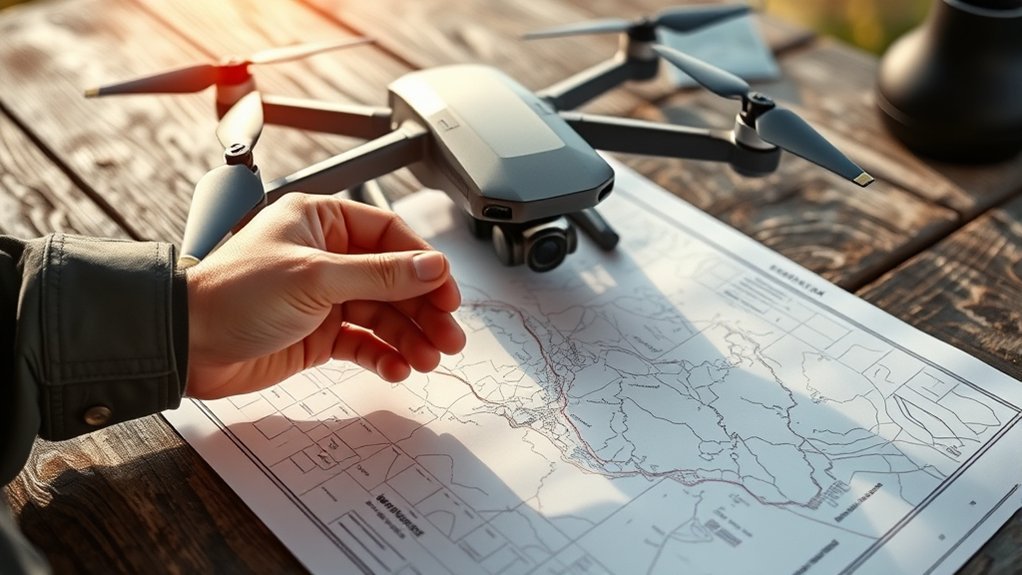
Understanding terrain and obstacles is essential for safe drone operations, especially when you fly across hills, ridges, towers, valleys, forests, or urban areas.
Sectional charts provide terrain information through contour lines. These lines connect points of equal elevation and help you understand how the ground rises or drops across an area.
Contour intervals vary by chart and terrain. In some areas, the spacing may represent smaller elevation changes, while mountainous regions may show wider changes. Closely spaced contour lines usually suggest steeper terrain.
Shaded relief maps also improve terrain awareness by simulating light and shadow. This makes ridges, valleys, and elevation changes easier to recognize at a glance.
Shaded relief maps provide a three-dimensional perspective of terrain, revealing elevation changes through simulated light effects.
The Maximum Elevation Figure (MEF) indicates the highest terrain or obstacle in hundreds of feet within a chart quadrangle. This gives pilots a quick reference for the highest known feature in that area.
Obstacles 1,000 feet or higher above ground level (AGL) are commonly marked directly on charts. Shorter obstacles may still matter to drone pilots, especially towers, cranes, power lines, and trees near the flight area.
Pay special attention to “UC” symbols, which signify obstacles under construction. Their height and position may change, making this information important for flight planning.
You should also scan for towers, antennas, wind turbines, smokestacks, bridges, and other vertical structures. These hazards can be difficult to see from a distance, especially in low light or against busy backgrounds.
Note: Charted obstacle data is helpful, but it should not replace a visual site check. Temporary cranes, new towers, and power lines may not appear where you expect them.
Always evaluate terrain and obstacles before you take off. This habit helps you choose safer launch points, maintain better clearance, and avoid surprises during the flight.
Controlled vs. Uncontrolled vs. Special Use Airspace

When planning your drone flight, recognizing the types of airspace you’ll encounter is essential for compliance and safety. Controlled, uncontrolled, and special use airspace each carry different rules and risks.
| Airspace Type | Description |
|---|---|
| Controlled | ATC provides services; includes Classes A, B, C, D, and E with specific requirements. |
| Uncontrolled | Class G airspace without ATC control, often found in lower-traffic areas. |
| Special Use | Includes Prohibited, Restricted, Warning, Alert, and other designated areas that may limit or prohibit drone flight. |
For drone pilots, the most important takeaway is simple: do not rely on guesswork. Check the airspace class, review any restrictions, and confirm whether authorization is required before flying.
Controlled Airspace

When flying your drone, understanding the different classifications of controlled airspace is essential for safe operation. Controlled airspace exists where air traffic services help manage aircraft movement.
Each class, including A, B, C, D, and E, has specific altitude limits, communication requirements, and operating rules. Drone pilots are most likely to deal with controlled airspace near airports and busy urban areas.
Recognizing traffic patterns within these airspaces will help you navigate effectively and avoid conflicts with crewed aircraft.
Airspace Classifications Overview
Controlled airspace plays an essential role in safe and efficient flight operations, especially for drone pilots operating near airports and populated areas. Understanding airspace classifications helps you know when authorization may be needed.
| Class | Common Altitude Limits | General Requirements |
|---|---|---|
| A | 18,000 to 60,000 feet MSL | IFR operations for crewed aircraft; not typical for standard drone operations. |
| B | Often surface to 10,000 feet MSL around major airports | Authorization required for drone operations where applicable. |
| C | Often surface to about 4,000 feet AGL around certain airports | Authorization required for drone operations where applicable. |
| D | Often surface to about 2,500 feet AGL around towered airports | Authorization required for drone operations where applicable. |
| E | Varies by location and charted boundary | Rules depend on the operation, altitude, and location. |
Familiarizing yourself with these classifications will improve your situational awareness and help you plan safer drone flights.
Traffic Patterns Importance
Understanding traffic patterns is vital for safe operations near airports. These patterns show the expected flow of arriving and departing aircraft.
Airport traffic patterns often include upwind, crosswind, downwind, base, and final legs. Many airports use a left-hand pattern unless otherwise noted, but you should always check local airport information.
Pilots announcing positions such as “midfield left downwind runway 1-3” improve situational awareness for other aircraft. Drone pilots should understand these references because they reveal where crewed aircraft may be flying.
Traffic patterns may extend close to the surface and often place crewed aircraft at lower altitudes near airports. That makes drone operations near airports more sensitive, even at relatively low heights.
Familiarizing yourself with the visual representation of traffic patterns on sectional charts supports safer and more legal drone operations.
Stay alert and informed to support safe drone operations around busy airspace.
Uncontrolled Airspace
Although flying in uncontrolled airspace, or Class G, offers greater flexibility for drone pilots, it still comes with specific responsibilities.
Class G airspace does not have the same air traffic control services as controlled airspace. It often appears in lower-traffic areas, which can make it more accessible for recreational and commercial drone flights.
You can generally operate a drone in Class G airspace without prior ATC authorization, but that does not mean you can fly carelessly. You still need to follow drone rules, maintain safe separation, and avoid endangering people or aircraft.
The vertical limits of Class G can vary. It usually begins at the surface and extends up to the base of nearby controlled airspace. In some areas, controlled airspace may begin much lower than expected, so you need to check the chart carefully.
While operating, you must maintain visual line-of-sight with your drone unless your specific operation allows otherwise under approved rules. You should also remain aware of nearby aircraft, obstacles, weather, and people on the ground.
It’s essential to stay aware of controlled airspace boundaries. Accidentally entering controlled airspace without authorization can create safety risks and potential penalties.
Special Use Airspace
When operating a drone, you must also be aware of special use airspace. These areas are designated for specific purposes such as military operations, security, training, or hazardous activity.
Special use airspace includes Prohibited Areas, Restricted Areas, Warning Areas, Alert Areas, Military Operations Areas, and other designations. Each type carries different levels of restriction and caution.
Prohibited Areas, marked as P-XXX, identify locations where flight is generally forbidden for security or national protection reasons. Drone flight in these areas should be treated as off-limits unless you have clear legal authority.
Restricted Areas, marked as R-XXX, may contain hazardous activity such as artillery, aerial gunnery, or missile operations. Prior approval from the controlling agency may be required before any aircraft, including drones, can operate within them.
Warning Areas, marked as W-XXX, often extend over coastal or offshore waters and may contain hazardous activity. Drone flights may not always require the same authorization, but you should remain cautious because aircraft activity may be unpredictable.
Alert Areas, marked as A-XXX, identify locations with high volumes of training or unusual aerial activity. These areas require extra vigilance from all pilots.
Always check aeronautical charts for these designations before flying. Understanding special use airspace helps you avoid violations and maintain safer operations in your flying area.
Temporary Flight Restrictions
Temporary Flight Restrictions (TFRs) are critical to drone operations because they can temporarily prohibit or limit flights in specific areas. TFRs may appear because of hazards, security events, wildfire response, stadium events, disaster areas, VIP movements, or other temporary needs.
You generally will not find current TFRs printed on standard sectional charts because they change too quickly. That makes it vital to consult current TFR and NOTAM resources before flying.
Failure to comply with TFRs can result in severe penalties and serious safety issues. More importantly, violating a TFR can interfere with emergency aircraft, law enforcement, firefighting, or security operations.
As a drone pilot, you must stay vigilant and check for active TFRs before each flight. This is especially important near wildfires, public events, stadiums, military activity, emergency scenes, and areas with major public officials.
Always plan your flights with this information in mind because TFRs can change rapidly. Knowing where and when you can’t fly is just as important as knowing where you can.
NOTAMs and Chart Updates
NOTAMs, or Notices to Air Missions, provide time-sensitive information that may affect flight safety. They can include temporary hazards, runway closures, airspace changes, communication outages, obstacle notices, and other operational updates.
For drone pilots, NOTAMs matter because they can reveal temporary risks that do not appear clearly on a static chart. A printed or saved chart may be accurate for general layout but still miss current flight restrictions.
You should also confirm that your aeronautical chart is current. Airspace boundaries, airport information, obstacles, and procedures can change. Using outdated information increases the chance of planning a flight based on old assumptions.
Before launching, check three things together: the sectional chart, current airspace authorization tools, and current NOTAM or TFR information. This layered approach gives you a stronger safety picture.
Common Chart Reading Mistakes
Drone pilots often make chart-reading mistakes when they focus only on the launch site and ignore the surrounding area. Your drone may stay close, but crewed aircraft and airspace boundaries can extend far beyond your takeoff point.
One common mistake is confusing airport symbol colors. Remember that blue usually shows towered airports, while magenta usually shows non-towered airports. Both can still have aircraft traffic.
Another mistake is overlooking airspace floors. A controlled airspace area may not always begin at the surface. Some areas begin at a charted altitude, while others extend down to the ground.
Some pilots also ignore terrain and obstacles because drones fly lower than crewed aircraft. This can be risky near towers, ridges, cranes, wind turbines, power lines, and tree-covered terrain.
Finally, many pilots check a chart once and assume the area stays clear. TFRs, NOTAMs, construction obstacles, and temporary events can change the situation quickly.
Pre-Flight Chart Checklist
Use a consistent chart review process before each drone flight. A short checklist helps you avoid missing important details when you are excited to launch.
- Confirm your launch location with latitude and longitude.
- Check nearby airports and heliports.
- Identify controlled airspace boundaries and altitude floors.
- Look for special use airspace near the flight area.
- Review terrain, obstacles, towers, and high ground.
- Check MEF values and nearby elevation changes.
- Confirm current TFRs and NOTAMs.
- Verify whether airspace authorization is required.
- Review local rules, site restrictions, and property access.
- Choose a safer alternate launch site if the area looks uncertain.
Pro Tip: Save screenshots or notes from your pre-flight review. They can help you stay organized and show that you planned your flight responsibly.
[Amazon Products Picked for You]

👍 25 PCS SHEET PROTECTORS INCLUDED – The binder comes with 25 pcs of clear pages allowing you to insert a title card to designate the type of information contained in your checklist. Comes with plastic envelopes for insertion of flight checklists.


You get 2 sets of 3 Labels, 1 FAA ID Card - All customized with your FAA information
Final Thoughts
Staying informed about airspace regulations and restrictions is essential for safe drone operations. Aeronautical charts give you a strong foundation for understanding what surrounds your flight area.
Start by familiarizing yourself with sectional chart symbols. Blue indicates airports with control towers, while magenta shows those without. Then review airspace classifications, special use areas, terrain, obstacles, and nearby airport traffic patterns.
Pay close attention to Maximum Elevation Figures (MEF) to avoid terrain and obstacle conflicts. These figures help you understand the highest known elevation or obstacle in a charted area.
Regularly check NOTAMs and TFRs for temporary hazards and restrictions that may affect your flight plans. Staying updated on these notices is critical for maintaining safety.
Additionally, understand the Common Traffic Advisory Frequency (CTAF) concept so you can better recognize how pilots coordinate around airports. Even when you are not using aviation radios, knowing how aircraft communicate improves your situational awareness.
The more you practice reading charts, the faster you will recognize risk areas. Over time, chart review becomes a normal part of responsible drone flight planning.
Frequently Asked Questions
How do you read latitude and longitude on aeronautical charts?
To read latitude and longitude on aeronautical charts, start with the degree and minute markings along the chart edges. Follow the latitude line and longitude line until they intersect near your location. Then compare those coordinates with your drone app or map tool.
How do you understand sectional charts as a drone pilot?
To understand sectional charts, focus first on the elements that affect drone flights: airports, airspace classes, terrain, obstacles, special use areas, and charted restrictions. Once those basics are clear, you can study additional aviation details over time.
How do you read distance on a sectional chart?
To read distance on a sectional chart, use the scale printed in the chart legend. Measure the distance between two points with a ruler or plotter, then convert that measurement into nautical miles using the chart scale.
Which aeronautical chart is most common for pilots?
The sectional chart is one of the most common aeronautical charts used by pilots for visual navigation. It shows airspace, airports, terrain, obstacles, navigation features, and other details that also help drone pilots plan safer flights.
Do drone pilots need to check aeronautical charts before every flight?
Yes, drone pilots should check aeronautical charts and current flight restrictions before every flight. Airspace, temporary restrictions, airport activity, and hazards can change, so a quick review helps reduce legal and safety risks.
What is the most important chart detail for drone pilots?
The most important chart detail depends on your location, but airspace classification is usually the first item to check. You should also review nearby airports, special use airspace, terrain, obstacles, and temporary restrictions before flying.
Conclusion
Learning to read aeronautical charts gives you a safer, clearer way to plan drone flights. By understanding coordinates, airport symbols, airspace types, terrain, obstacles, and temporary restrictions, you can avoid many common mistakes before they happen.
Every flight gives you another chance to build skill. Start with the chart basics, confirm current restrictions, and review your surroundings before launch. With consistent practice, you’ll navigate controlled and uncontrolled airspace more confidently and make your aerial adventures safer and more enjoyable.
