
Drone photogrammetry turns overlapping aerial photos into measurable maps, models, and site data. It helps you document land, buildings, crops, stockpiles, and construction progress without relying only on ground-based surveying. When you plan the flight carefully, use enough image overlap, and process the data in the right software, you can create detailed 2D maps and 3D models for many professional and hobby projects.
Quick Answer
Drone photogrammetry uses a drone to capture many overlapping photos of the same area. Software then matches shared points in those photos to build accurate 2D orthomosaic maps, 3D models, point clouds, and measurements. Accuracy depends on camera quality, flight planning, image overlap, GPS/GNSS precision, and ground control points.
Key Takeaways
- Drone photogrammetry creates measurable maps and models from overlapping aerial images.
- Good results depend on flight planning, consistent altitude, enough overlap, sharp images, and accurate positioning.
- Ground Control Points, RTK, and PPK can improve mapping accuracy when the project needs survey-grade data.
- Photogrammetry works well for construction, agriculture, environmental monitoring, mining, inspections, and land documentation.
- LiDAR performs better in dense vegetation and some low-light conditions, while photogrammetry often costs less and produces rich visual detail.
What Is Drone Photogrammetry?

Drone photogrammetry is a mapping method that uses overlapping aerial images to create detailed 2D maps and 3D models of landscapes, buildings, roads, stockpiles, and other physical features. Instead of measuring every point by hand, you fly a drone over the area, capture photos from many angles, and let specialized software connect the common points across those images.
The software identifies matching features, estimates camera positions, corrects distortion, and builds outputs such as orthomosaic maps, digital surface models, 3D meshes, point clouds, and volume measurements. The final result helps you view, measure, compare, and document a site with far more detail than a simple aerial photo.
Industries such as construction, agriculture, mining, land surveying, public safety, insurance, and environmental monitoring use drone photogrammetry for site inspections, crop health review, land documentation, progress tracking, and planning. When paired with Ground Control Points, RTK, or PPK positioning, drone photogrammetry can support highly accurate mapping workflows.
The biggest advantage is efficiency. You can capture a large site from the air, reduce time spent walking dangerous or hard-to-reach areas, and process the images into useful data for planning and decision-making.
How Does Drone Photogrammetry Work?

Drone photogrammetry works by capturing overlapping high-resolution images from a planned flight path. Each part of the ground appears in more than one photo. The software compares those photos, finds shared visual points, and uses geometry to calculate the position and shape of the mapped area.
The process usually starts with mission planning. You set the flight boundary, altitude, camera angle, image overlap, speed, and flight pattern. For many mapping jobs, pilots use an automated grid or double-grid flight so the drone captures consistent images across the entire site.
Image overlap matters because the software needs repeated views of the same objects. Many mapping projects use high front overlap and side overlap to help the software build a stronger model. More complex terrain, tall structures, or dense vegetation may need additional overlap or angled photos.
Mission planning is one of the most important steps in drone photogrammetry because flight height, overlap, lighting, and control points directly affect the quality of the final map.
After the flight, you upload the images to photogrammetry software. The software aligns the photos, matches tie points, creates a point cloud, builds a surface or mesh, and produces outputs such as 2D orthomosaic maps and 3D models. It also corrects image distortion and helps align the map with real-world coordinates.
The final outputs can support surveying, construction documentation, crop monitoring, drainage planning, roof inspections, stockpile measurement, and environmental change detection. The data becomes more useful when you compare maps from different dates to see what changed over time.
At a Glance
| Time Required | About 30 minutes to several hours, depending on site size, flight coverage, and processing time |
| Difficulty | Beginner to advanced, based on accuracy needs and project complexity |
| Tools Needed | Mapping drone, camera, flight-planning app, batteries, memory card, photogrammetry software, and optional Ground Control Points |
| Cost | Varies widely, from consumer drone setups to professional RTK drones and paid mapping software |
Common Terminology in Photogrammetry

When you work with photogrammetry, you will see several terms again and again. Understanding these terms helps you choose the right drone, plan better flights, and understand the quality of your results.
Terms like UAV, orthomosaic map, remote sensing, GIS, Ground Control Points, Ground Sampling Distance, and point cloud form the foundation of drone mapping. Once you understand them, the workflow becomes easier to follow.
Key Photogrammetry Terms
UAV means unmanned aerial vehicle. In everyday use, it usually means a drone. UAVs capture aerial images that become the source data for maps and models.
Ground Control Points, often called GCPs, are known reference points placed or marked on the ground. Their exact coordinates help the software align the map more accurately with real-world positions.
Ground Sampling Distance, or GSD, describes how much real-world distance each pixel represents. A smaller GSD means more detail. For example, a 1 cm GSD means each pixel represents about 1 cm on the ground.
Orthophoto means a corrected aerial image with a consistent scale. Unlike a normal photo, it reduces distortion from camera angle and terrain relief, so you can use it for measurement.
Orthomosaic map means a large corrected map made by stitching many orthophotos together. It gives you a top-down view of the whole site at a uniform scale.
Point cloud means a collection of 3D points created during processing. Each point represents a location on the mapped surface. Point clouds help create 3D models, surfaces, and volume calculations.
Digital Surface Model, or DSM, represents the top surfaces in an area, including trees, buildings, and other objects. A Digital Terrain Model, or DTM, tries to represent the bare ground surface.
UAV and Orthomosaic Maps
Understanding the relationship between UAVs and orthomosaic maps is essential for effective mapping and analysis.
UAVs capture high-resolution aerial images from above a site. Those images must overlap enough for the software to identify common points and stitch them into a clean orthomosaic map. The quality of the drone camera, flight altitude, lighting, and focus all affect the final result.
A lower flight altitude usually gives you more detail, but it also increases the number of images and flight time. A higher altitude covers more ground faster, but the final map may show less detail. The best setting depends on your project goal.
Orthomosaic maps help in construction planning, crop scouting, land documentation, drainage analysis, insurance claims, and environmental monitoring. They are useful because they combine a visual record with measurable map data.
Remote Sensing and GIS
Remote sensing means collecting information about an area without touching it directly. Drones, satellites, and aircraft can all collect remote sensing data. In drone photogrammetry, the drone collects image data from the air.
GIS, or Geographic Information System, helps store, analyze, and display location-based data. You can bring drone maps into GIS software to compare layers such as property boundaries, elevation, roads, vegetation, drainage features, and inspection notes.
Photogrammetry and GIS often work together. Photogrammetry creates the map or model. GIS helps you analyze that map with other spatial data, which makes it more useful for planning and reporting.
Key Applications of Drone Photogrammetry

While many technologies have changed mapping and inspection work, drone photogrammetry stands out because it is flexible, visual, and efficient. It can help you collect high-resolution site data without sending people into every area on foot.
- Agriculture: You can monitor crop health, check plant growth patterns, document irrigation issues, and compare field conditions over time. Drone maps help farmers and agronomists spot problems early.
- Construction: You can create detailed maps and 3D models for progress tracking, earthwork measurement, pre-pour documentation, site logistics, and stakeholder reporting.
- Energy: You can inspect access roads, solar sites, pipelines, and utility corridors. Drone maps help teams identify hazards, document site conditions, and plan maintenance work.
- Mining and quarrying: You can calculate stockpile volumes, monitor pit changes, measure haul roads, and document extraction areas.
- Environmental monitoring: You can track erosion, shoreline change, vegetation loss, flood impacts, wildfire damage, and habitat conditions.
- Real estate and land development: You can create site visuals, planning maps, terrain views, and development documentation for large properties.
Drone photogrammetry also helps with insurance claims, roof inspections, public works, disaster response, archaeology, and infrastructure planning. The same basic workflow can support many different industries because the output is visual, measurable, and easy to share.
Benefits of Using Drones for Photogrammetry
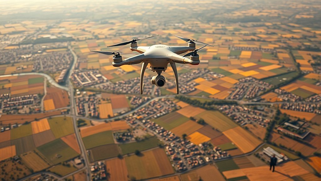
As you explore the benefits of using drones for photogrammetry, you will see why many teams now use drones for mapping and documentation. Drones can collect data quickly over large areas, which saves time compared with many traditional field methods.
Drones can deliver high-resolution imagery and detailed outputs when you use good flight planning, stable capture settings, and accurate positioning. That detail helps with measurements, progress tracking, site review, and communication.
Safety is another major benefit. A drone can capture data from slopes, rooftops, construction zones, mining areas, flooded land, or hard-to-reach locations without putting workers in unnecessary danger.
Cost can also be an advantage. Some small projects can use consumer or prosumer drones, while professional projects may require RTK drones, trained pilots, GCPs, and paid software. Even then, drone mapping can reduce repeat site visits and speed up reporting.
Drone photogrammetry also creates repeatable records. If you map a site every week or month, you can compare progress, detect changes, and show clear before-and-after data.
Pro Tip: Fly the same area at the same altitude, camera angle, and overlap settings when you need to compare maps over time. Consistent capture makes change detection more reliable.
Accuracy and Measurement Capabilities
Understanding the accuracy and measurement capabilities of drone photogrammetry is essential before you rely on the data for planning, construction, or measurement. Accuracy depends on your drone, camera, flight settings, processing software, control points, and the environment.
For general site documentation, a standard drone may provide useful visual accuracy. For survey-grade work, you usually need a stronger workflow with Ground Control Points, RTK, PPK, or a licensed survey professional where required by law.
Drone photogrammetry can support highly detailed measurement, but the final accuracy is only as strong as the flight plan, control points, image quality, and processing workflow.
Key factors affecting accuracy include:
- Ground Sampling Distance: A smaller GSD gives you more detail. Lower altitude often improves GSD, but it increases flight time and image count.
- Camera Quality: A sharp lens, good sensor, stable exposure, and enough resolution improve the quality of the map and model.
- Ground Control Points: GCPs help verify and improve geolocation accuracy, especially when the project requires reliable coordinates.
- Image Overlap: Higher overlap helps the software find more matching points, especially on complex terrain or vertical structures.
- Lighting Conditions: Even lighting reduces harsh shadows and glare, which helps the software match features more accurately.
- Flight Stability: Wind, motion blur, rolling shutter distortion, and inconsistent altitude can reduce output quality.
For simple visual maps, you may not need the highest possible accuracy. For measurements, legal boundaries, engineering decisions, or construction quantities, you should confirm the required accuracy standard before flying.
Warning: Do not treat a drone map as a legal survey unless the work meets the required professional standards in your location. Boundary, engineering, and construction-control work may require a licensed surveyor.
Comparing Photogrammetry With Lidar
When comparing photogrammetry with LiDAR, it helps to understand how each method collects data. Photogrammetry uses overlapping photos to create 3D models and maps. LiDAR uses laser pulses to measure distances and generate 3D point clouds.
Photogrammetry is often more accessible because many drones can capture the images needed for mapping. It also creates rich visual outputs, such as detailed orthomosaic maps and textured 3D models. These visuals are useful when you need to show real site conditions.
LiDAR can perform better in certain conditions. It can capture accurate elevation data, work well around complex structures, and may penetrate gaps in vegetation better than image-based methods. It can also be useful when lighting is poor or when the project needs dense elevation data.
The tradeoff is cost and complexity. LiDAR systems often cost more and may require more specialized processing. Photogrammetry usually costs less and works well for open sites, construction areas, stockpiles, rooftops, farmland, and many mapping projects with good lighting.
Choose photogrammetry when you need cost-effective visual detail and reliable mapping in clear conditions. Choose LiDAR when vegetation, elevation complexity, low texture, low light, or high vertical accuracy makes laser scanning a better fit.
[Amazon Products Picked for You]


24”x24” AERIAL TARGETS - Designed for low to medium altitude drone mapping and scanning, these drone GCPs were made for drone mapping up to 400 feet. The standard 24”x24” size is useful when scaling and verifying the map, providing a standard reference distance during post-processing.
Selecting the Right Drone for Photogrammetry
When selecting a drone for photogrammetry, focus on image quality, positioning accuracy, flight stability, battery life, and software compatibility. The best drone is not always the most expensive one. It is the one that matches your project size, accuracy needs, and budget.
If you only need basic maps for visual documentation, a capable consumer drone may be enough. If you need repeatable measurements, high accuracy, or professional deliverables, consider a drone with RTK, PPK support, a mechanical or global shutter, and a mapping-friendly camera.
[Amazon Products Picked for You]


Precision Measurement: Each UAV GCP features a 1.18 inches center hole for installing an RTK surveying pole or marker rod, ensuring perfect alignment between the coordinate measurement point and the image recognition point

Key Drone Features
Selecting the right drone for photogrammetry hinges on several important features that directly affect data quality and operational efficiency.
- Camera Quality and Shutter Type: Choose a high-resolution camera with a sharp lens. A mechanical or global shutter can reduce distortion during image capture, especially when mapping from a moving drone.
- Flight Time: Longer flight time lets you cover larger areas with fewer battery changes. For large mapping jobs, battery planning matters as much as camera quality.
- GPS/GNSS Precision: Reliable positioning helps tag images accurately. RTK or PPK can improve geolocation for professional mapping workflows.
- Stable Flight Performance: Good stability helps reduce blurry images and keeps the flight path consistent.
- Mission-Planning Support: Make sure the drone works with mapping apps that support grid flights, overlap settings, camera triggering, and repeat missions.
- Payload and Sensor Options: Some professional drones support interchangeable cameras, multispectral sensors, or other payloads for specialized work.
Budget Considerations
Budget plays a major role in choosing the right drone for photogrammetry because prices vary widely based on features and capabilities.
For entry-level users, a compact drone with a strong camera can help you learn the basics of image capture, overlap, and processing. These drones may work well for practice, visual maps, and small documentation projects, but they may lack the positioning accuracy required for professional measurement.
For professional mapping, drones such as the DJI Phantom 4 RTK have been widely used because they combine a mapping-focused camera with RTK positioning. Fixed-wing or VTOL mapping drones, such as the WingtraOne Gen II, can cover larger areas and support more advanced mapping workflows.
For budget-conscious users, smaller drones such as the DJI Mini 3 Pro can help with learning and basic aerial documentation. However, they may not offer the same mapping workflow, shutter type, accuracy, or software support as professional survey-focused drones.
Do not forget the extra costs. You may need mapping software, spare batteries, propellers, memory cards, landing pads, GCP targets, cloud processing, training, insurance, and licensing depending on your location and business use.
Recommended Software for Photogrammetry
Choosing the right software for photogrammetry can greatly affect the quality and efficiency of your mapping projects. The software turns images into useful outputs, so compare options based on your project type, skill level, budget, and file formats.
Good photogrammetry software should match your workflow, not just your drone. Check processing speed, export formats, cloud options, measurement tools, and GIS compatibility before you commit.
- Pix4D: Pix4D is a popular professional mapping option for creating orthomosaics, point clouds, 3D models, and measurement-ready outputs. It works well for surveying, construction, agriculture, and inspection workflows.
- Agisoft Metashape: Agisoft Metashape offers strong desktop processing for dense point clouds, meshes, orthomosaics, and 3D models. It is useful when you want more control over processing settings.
- DroneDeploy: DroneDeploy provides a user-friendly cloud-based workflow for planning flights, processing images, and sharing maps. It is often helpful for construction, agriculture, and business teams that need collaboration tools.
- RealityCapture: RealityCapture is known for fast photogrammetry processing and high-quality 3D reconstruction. It can be useful for 3D modeling, cultural heritage, and complex visual scenes.
- WebODM: WebODM is an open-source option based on OpenDroneMap. It may suit users who want more control and do not mind a more technical setup.
Before choosing software, check whether it supports your drone model, image format, coordinate system, output needs, and computer hardware. Also compare subscription costs, cloud processing limits, data ownership, and export options.
[Amazon Products Picked for You]


DEGRADABLE GCPS - Ideal for remote ground control points, our burlap GCPs are degradable so that you can leave your GCPs in the field to degrade over time, saving you time on retrieval in remote areas. The control points last up to 1 year depending on weather conditions.

48”x48” AERIAL TARGETS - Designed for low to medium altitude drone mapping and scanning, these drone GCPs were made for drone mapping up to 400 feet. The standard 48”x48” size is useful when scaling and verifying the map, providing a standard reference distance during post-processing.
Tips for Getting Started With Drone Photogrammetry
As you begin your journey into drone photogrammetry, focus on the basics first. A clean flight plan, sharp images, and organized files matter more than fancy settings.
Start by selecting a suitable drone for your goal. A drone such as the DJI Mavic 3 can capture detailed imagery for many mapping and documentation tasks. For professional measurement work, look for RTK, PPK, a mapping-friendly camera, and strong software support.
Learn the role of overlapping images. Many mapping projects need strong front and side overlap so the software can match the same ground features from several photos. If the site includes trees, roofs, slopes, or tall objects, increase overlap and consider additional angled images.
Plan your flight before takeoff. Choose a safe altitude, confirm airspace rules, check weather, inspect the site, format your memory card, charge batteries, and set camera exposure. Avoid flying in strong wind, rain, fog, poor visibility, or harsh shadows when possible.
Use Ground Control Points when accuracy matters. Place them where they are clearly visible from the air, spread them across the site, and measure them with suitable equipment. GCPs help improve and validate the final map.
After the flight, organize your files by project name and date. Keep original images, processed outputs, flight logs, control point notes, and reports together. Good file management makes repeat projects easier and helps you compare maps over time.
Note: Before flying for mapping work, check local drone rules, airspace limits, privacy requirements, and commercial operation requirements. Rules can vary by country, state, and project type.
Common Mistakes to Avoid
Drone photogrammetry can produce strong results, but small mistakes can reduce map quality. The most common problem is poor overlap. If images do not overlap enough, the software may fail to align them or may create gaps in the model.
Another mistake is flying in poor lighting. Harsh shadows, glare, low light, and fast-changing cloud cover can make it harder for the software to match features. Try to fly when the site has even lighting and clear visibility.
Motion blur can also damage accuracy. Use a safe shutter speed, avoid flying too fast, and do not map in strong wind unless your drone can stay stable. Blurry images may still look acceptable at first glance, but they can cause weak outputs during processing.
Do not ignore camera settings. Automatic exposure can work for simple flights, but large changes in brightness across the site may create inconsistent images. Manual or locked settings can help keep image quality consistent on some projects.
Finally, do not skip quality checks. Review the image set before processing, check the map for warped areas, compare known distances, and inspect control point errors when you use GCPs.
Frequently Asked Questions
What is photogrammetry in simple words?
Photogrammetry is a method for making measurements from photos. In drone mapping, you take many overlapping aerial photos, then software uses them to create accurate 2D maps and 3D models.
What is photogrammetry in simple terms?
Photogrammetry turns photos into measurable maps and models. A drone captures the photos from different angles, and software matches the same points across those photos to build a detailed digital version of the site.
What are the principles of drone photogrammetry?
Drone photogrammetry relies on image overlap, tie points, camera position, triangulation, and scale control. Ground Control Points, RTK, or PPK can improve accuracy by helping the software align the model with real-world coordinates.
What is the process of drone mapping?
The process starts with planning the mission and setting flight paths. Next, the drone captures overlapping photos. Then you process the images in photogrammetry software to create maps, models, measurements, and reports.
How accurate is drone photogrammetry?
Accuracy varies by drone, camera, flight altitude, overlap, GPS/GNSS quality, Ground Control Points, and processing settings. Basic drone maps can be useful for visual documentation, while professional workflows with GCPs, RTK, or PPK can support much higher accuracy.
Is drone photogrammetry better than LiDAR?
Neither method is always better. Photogrammetry is often more affordable and creates detailed visual maps. LiDAR can perform better in dense vegetation, low-texture areas, and projects that need strong elevation data.
Do you need Ground Control Points for drone photogrammetry?
You do not always need Ground Control Points for simple visual maps. However, GCPs are strongly recommended when you need reliable measurements, repeatable site comparisons, or higher positional accuracy.
Conclusion
Drone photogrammetry gives you a practical way to capture aerial data, create accurate maps, and build detailed 3D models for many types of projects. It combines drone imagery, careful flight planning, and specialized software to turn photos into measurable site information.
For the best results, plan your flight carefully, use enough overlap, capture sharp images, choose the right software, and use Ground Control Points or RTK/PPK when accuracy matters. Also compare photogrammetry with LiDAR before complex jobs, especially when dense vegetation or elevation detail is a major concern.
Whether you are mapping a farm, tracking construction progress, measuring stockpiles, reviewing land conditions, or documenting environmental change, drone photogrammetry can help you work faster and make better decisions from reliable visual data.
