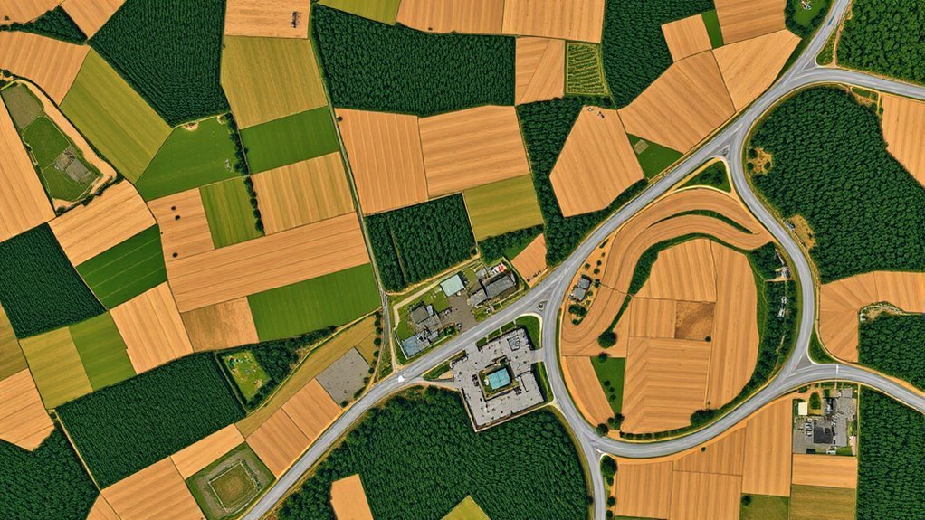
A Global Mapper orthomosaic from drone imagery is a seamless, georeferenced, top-down raster built from overlapping photos. It removes perspective distortion, aligns pixels to real-world coordinates, and supports precise measurement and digitizing. Good results depend on stable flight planning, strong frontlap and sidelap, and geotagged inputs. In Global Mapper Pro, photos can be converted to dense point clouds and orthorectified against a DSM for better accuracy. Further details clarify quality, seams, and expected output.
Key Takeaways
- Global Mapper produces a seamless orthomosaic with true top-down geometry and geographic coordinates for accurate measurement.
- Expect best results from well-planned drone flights with 60-80% frontlap and at least 30% sidelap.
- Import geotagged drone photos to preserve positioning and improve the accuracy of the photogrammetry workflow.
- A DSM and Pixels to Points processing help orthorectify images, refine alignment, and reduce distortion.
- Quality checks should confirm seam blending, tonal balance, and dense point cloud detail before final analysis.
What a Global Mapper Orthomosaic Looks Like
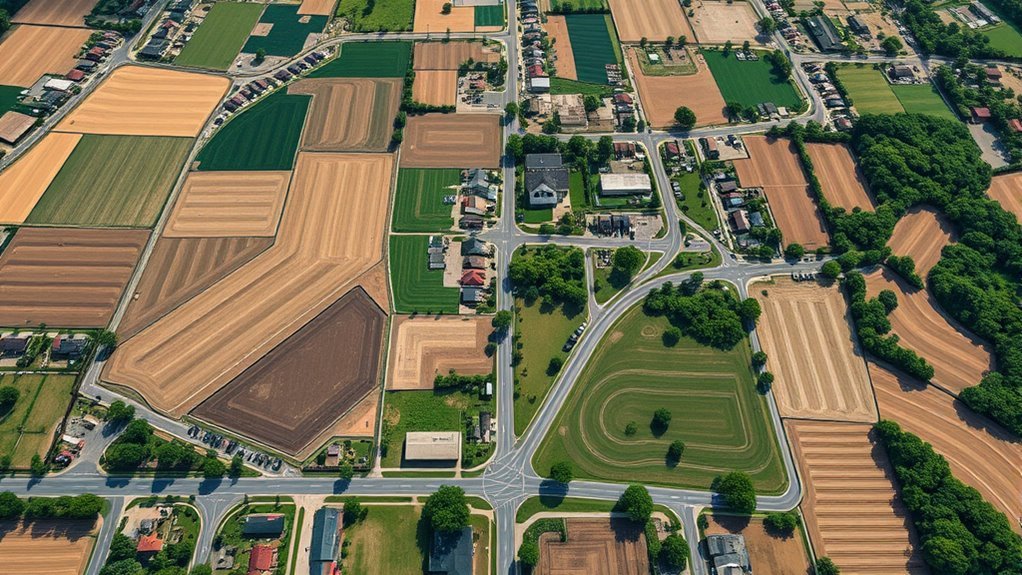
A Global Mapper orthomosaic appears as a seamless, geometrically corrected raster image that presents the ground in a true top-down view without perspective distortion.
In Global Mapper, orthomosaic maps derived from drone imagery are assembled from overlapping frames, then rectified through photogrammetric processing such as Pixels to Points in Global Mapper Pro. The result is a continuous surface in which each pixel is tied to a specific geographic coordinate, supporting exact digitizing and measurement.
Terrain features, property edges, and infrastructure are rendered with centimeter-level precision, enabling reliable spatial analysis without visual warping. The raster layer is consequently not merely illustrative; it is an operational dataset.
For communities and practitioners seeking liberation from opaque, error-prone surveying methods, this form of mapping provides clear, reproducible evidence. Its structure supports land management, construction planning, and environmental monitoring with disciplined accuracy and minimal ambiguity, making it a practical instrument for informed geographic decision-making.
Plan Your Drone Flight for Good Coverage
Effective drone coverage begins with virtual reconnaissance in Global Mapper, where the project area can be examined for obstructions, terrain variation, and other factors that may constrain flight paths. For disciplined drone mapping, the operator should define altitude, speed, and image spacing before any launch, converting the site into a measurable flight plan.
High-resolution aerial imagery and topographic layers support this analysis, revealing where access, relief, or structures demand adjustment.
High-resolution imagery and topographic layers reveal where access, relief, or structures require careful adjustment.
- Delineate the site with drawing tools to establish precise boundaries.
- Review local regulations and nearby structures for overflight restrictions.
- Draft the flight plan in Global Mapper, then transfer it to Global Mapper Mobile for field verification.
- Tune the path to maintain systematic overlapping images and uniform coverage.
This workflow reduces uncertainty, strengthens compliance, and preserves operational freedom by replacing improvisation with spatially informed control.
Capture Enough Overlap for Photogrammetry
Adequate frontlap and sidelap are essential to provide consistent image redundancy, with 60–80% overlap commonly used to support reliable photogrammetric matching.
A grid flight path improves coverage by maintaining overlap across the survey area, including regions with complex terrain or isolated features.
When overlap is controlled, Global Mapper can identify more common points between images, producing a denser point cloud and a more accurate orthomosaic.
Frontlap And Sidelap
For photogrammetric orthomosaics, frontlap and sidelap must be planned to preserve sufficient image redundancy across the flight grid. Frontlap, ideally 60% to 80%, links successive frames; sidelap, at least 30%, connects adjacent lines. Together, they create a disciplined capture geometry that supports photogrammetry, protects ground control points, and limits voids in the mosaic.
- Frontlap stabilizes tie point generation.
- Sidelap maintains cross-track continuity.
- Higher overlap improves 3D reconstruction.
- Consistent coverage reduces distortion.
This overlap architecture gives the dataset analytical freedom: features are represented with less ambiguity, and the resulting orthomosaic remains more precise, more traceable, and more resilient to mission variability.
Consistent Image Redundancy
Consistent image redundancy depends on capturing enough overlap to preserve photogrammetric continuity across the survey block. For reliable consistent image redundancy, adjacent frames should retain roughly 60-80% overlap in both lateral and longitudinal directions.
This redundancy reduces voids, strengthens tie-point matching, and supports robust point cloud generation for terrain and structure reconstruction. When overlap is insufficient, surface breaks and reconstruction noise can undermine precise measurements, limiting the analytical value of the orthomosaic.
Flight planning software can estimate altitude and speed to satisfy terrain-specific overlap targets, while strategically placed GCPs improve georeferencing and validate coverage.
During acquisition, image review enables detection of underlapped sectors and immediate correction. The result is a survey dataset suited to rigorous mapping and informed, liberated spatial decision-making.
Flight Path Coverage
A flight path that preserves 70-80% overlap between consecutive images provides the redundancy needed for reliable photogrammetric stitching and 3D reconstruction.
Global Mapper can then be used to tune altitude and speed so the image footprint remains stable and coverage is not compromised.
A virtual reconnaissance of the site helps expose trees, structures, and terrain breaks that could interrupt overlap and degrade alignment.
- Verify camera resolution against target ground detail.
- Maintain consistent airspeed for uniform capture intervals.
- Adjust flight path around obstructions before launch.
- Confirm photogrammetry software can detect shared points.
With sufficient overlap, the software resolves common features more accurately, supporting orthomosaics and DEMs that reflect the terrain with greater precision and less dependence on guesswork.
Import Drone Photos Into Global Mapper Pro
Drone photos are imported into Global Mapper Pro through the File menu by selecting Open Data and browsing to the imagery folder for loading. This workflow allows an operator to import drone photos into Global Mapper Pro without unnecessary intermediaries, preserving geospatial fidelity from the outset.
Geotagged images are preferred because the embedded coordinate metadata enables the software to position each frame accurately on the map. When loaded as Picture Points, the imagery becomes a spatial index of camera locations, supporting visual review and disciplined data handling.
The Digitizer tool can then be used to select, inspect, or manipulate the imported scenes for downstream analysis. For workflows oriented toward liberation through technical control, the Pixels to Points tool is the next analytical gateway, converting the imported drone set into a point cloud and orthomosaic-ready dataset.
This import stage establishes organized, traceable inputs for subsequent processing.
Create the Orthomosaic in Global Mapper
To create the orthomosaic in Global Mapper, the imported drone imagery is first loaded as picture points through the Digitizer tool.
The Pixels to Points workflow is then used to generate a dense point cloud, ideally without enabling Reduce Image Size, while a DSM and corrected camera parameters improve orthorectification accuracy.
Once processing is complete, the software produces georeferenced orthoimage layers that can be stitched into a seamless orthomosaic for analysis or digitization.
Import Drone Imagery
Importing overlapping drone imagery into Global Mapper as picture points establishes the georeferenced basis required for orthomosaic creation, allowing embedded coordinates to guide accurate spatial placement.
This importing stage converts drone data into a structured dataset, enabling the software to treat each image as a spatially aware input for orthomosaic assembly.
- Load overlapping files with consistent metadata.
- Confirm coordinate integrity before processing.
- Apply Pixels to Points to densify the surface model.
- Specify a DSM to support orthorectification.
The workflow favors analytical control and practical liberation from manual guesswork.
Oblique frames and elevated structures may still disturb alignment, so the imported imagery should be reviewed for continuity, gaps, and positional error before any stitching decision is finalized.
Generate Orthomosaic Output
With the imagery loaded as picture points and the target frames selected, Global Mapper can generate the orthomosaic by first building a dense point cloud with the Pixels to Points tool; omitting the “Reduce Image Size” option helps preserve source detail and improves surface fidelity.
The drone dataset should then be orthorectified against a DSM to improve geometric alignment and reduce height-driven distortion.
Once the point cloud is created, manual mosaic tools may refine feathering, cropping, and color or contrast balance. To complete the orthomosaic, the stitch-images option can merge frames into a seamless output.
However, edge misalignment remains a technical risk, especially near buildings and non-nadir captures, so inspection and localized correction are essential for an accurate, liberated map product.
Choose the Right DSM or Terrain Model
Selecting the appropriate Digital Surface Model (DSM) is essential for reliable orthorectification, since the model directly governs how accurately the orthoimage is aligned to real-world coordinates.
Selecting the right DSM is critical for accurate orthorectification and true-to-coordinate orthoimagery.
In Global Mapper, the Digital Surface Model should represent the highest visible surfaces, including vegetation and structures, so the orthomosaic reflects terrain reality rather than an abstracted ground plane. A DSM derived from high-quality photogrammetric point clouds is preferred because it preserves geometric fidelity and supports disciplined image rectification.
- Use dense, well-processed point cloud data.
- Verify vertical accuracy before orthomosaic generation.
- Pair the DSM with Pixels to Points for orientation refinement.
- Minimize acquisition and processing errors to protect measurement precision.
When the model is sound, derived distances, areas, and elevations become more trustworthy, allowing analysis to proceed with greater autonomy from uncertainty.
Fix Color, Contrast, and Seams
Color balance adjustments in Global Mapper can normalize tonal shifts across drone-derived orthomosaics, improving feature separation and overall visual consistency.
Contrast and tone tuning further refine radiometric differences, making surfaces, edges, and terrain details more legible.
Seam blending cleanup then uses feathering, cropping, and localized color correction to reduce overlap artifacts and produce a continuous mosaic.
Color Balance Adjustments
Orthomosaic quality depends heavily on post-processing adjustments that normalize visual inconsistencies across overlapping drone images. In Global Mapper, color balance adjustments refine RGB values so adjacent tiles present a coherent spectral signature, even when illumination and exposure vary.
This disciplined correction supports liberated interpretation by reducing visual noise that can obscure terrain details.
- Apply color balance adjustments to equalize image tonality.
- Use contrast enhancement to improve feature discernibility without altering geometry.
- Employ seam blending to suppress edge artifacts between source frames.
- Use feathering at overlaps to smooth connections and preserve mosaic continuity.
These methods produce a more consistent orthomosaic, where discrepancies recede and spatial information remains readable, precise, and analytically dependable.
Contrast And Tone Tuning
Contrast and tone tuning refines orthomosaic imagery by correcting brightness, contrast, and color imbalances that arise from uneven lighting and variable exposure during drone capture.
In Global Mapper, this process improves tonal uniformity and increases feature legibility across the mosaic. Histogram analysis helps identify departures from balanced luminance, enabling targeted corrections rather than broad, imprecise edits.
Adjusting color balance and contrast strengthens edge definition, reveals subtle surface detail, and produces a more coherent visual record. The editing tools support localized adjustments, allowing operators to address irregular areas with controlled precision.
For land management, inspection, and mapping workflows, this tuning advances readable imagery and reduces visual distortion. The result is a clearer, more usable orthomosaic that supports informed analysis and operational autonomy.
Seam Blending Cleanup
Seam blending cleanup resolves visible mismatches between stitched drone images by correcting color, brightness, and contrast discontinuities across the orthomosaic. This seam blending cleanup step improves visual continuity and supports a coherent map surface for users who require clear, liberated spatial interpretation.
- Adjusting brightness, contrast, and color balance normalizes adjacent tiles.
- Feathering and cropping reduce hard borders in overlap zones.
- Manual mosaic tools in Global Mapper enable targeted layer refinement.
- Reordering layers by geographic position supports consistent treatment across the dataset.
Applied systematically, these operations limit artifacts, align tonal response, and preserve edge integrity. The result is a cleaner orthomosaic in which shifts read as continuous terrain rather than stitched fragments, improving analytical reliability and presentation quality.
Build a DTM for Surface Checks
A Digital Terrain Model (DTM) is generated in Global Mapper Pro from processed point cloud data to represent the bare-earth surface, excluding vegetation and structures.
In Global Mapper, this Digital Terrain Model is built after QA and cleanup remove noise points and other artifacts that obscure true ground returns in the point cloud. The resulting raster surface supports disciplined surface checks, because it isolates terrain geometry from drone-derived clutter and improves analytical reliability.
In Global Mapper, DTM creation follows cleanup, isolating true ground returns for more reliable surface analysis.
The gridding tool converts the ground surface into a 3D raster layer, enabling contour generation and volume calculations with controlled resolution. Such a DTM also supplies a stable foundation for watershed delineation, land use planning, and environmental assessments.
For teams seeking operational autonomy, this workflow reduces dependence on opaque external products and keeps the terrain model editable within one environment.
Precise ground extraction consequently becomes not only a technical step, but a prerequisite for accurate geographic inference.
Check Your Orthomosaic Against 3D Data
The orthomosaic should be validated against 3D point cloud data to confirm positional accuracy and surface alignment. In Global Mapper Pro, the Pixels to Points tool can generate dense point clouds that provide an objective reference for review. This comparison exposes misregistration, elevation drift, or control deficiencies before analysis proceeds.
A Digital Terrain Model derived from the same point clouds strengthens the assessment by revealing whether mapped features conform to ground geometry.
- Compare tie features across the orthomosaic and 3D data.
- Inspect edges, breaks, and high-relief areas for offsets.
- Test whether the Digital Terrain Model supports measured distances and areas.
- Record anomalies that suggest image capture or control-point weakness.
Routine cross-checking improves the reliability of the orthomosaic and preserves analytical freedom by reducing dependence on unverified imagery.
What to Expect From Global Mapper Output
Global Mapper output typically consists of a high-resolution orthomosaic that is geometrically corrected and suitable for centimeter-level measurement. The software transforms overlapping drone frames into seamless orthoimages, then aligns each pixel to real-world coordinates for rigorous terrain analysis and spatial comparison. Through the Pixels to Points workflow, Global Mapper builds a dense point cloud, which supports sharper surface reconstruction and more reliable mapping. Users may refine image quality by adjusting camera roll and lens distortion parameters, improving fidelity where field conditions are imperfect.
| Output element | Expected result |
|---|---|
| Orthomosaic | Seamless raster coverage |
| Geometric correction | Accurate pixel positioning |
| Point cloud | High-density surface detail |
| Image tuning | Reduced distortion artifacts |
| Application value | Land, construction, agriculture |
This output enables disciplined measurement without dependence on opaque manual tracing, giving practitioners a technically grounded basis for informed, emancipated decision-making across inspection, planning, and resource management tasks.
Frequently Asked Questions
How Much Money Can You Make Drone Mapping?
Drone mapping can generate $50,000 to $150,000 annually, with projects earning $1,000 to $10,000. Drone mapping revenue depends on market demand, area size, and pricing strategies, especially in agriculture, construction, and inspection.
What Is Orthomosaic Imagery?
Orthomosaic imagery is geometrically corrected drone-captured photography stitched into a uniform, top-down map; coincidentally, it enables precise measurement. Its orthomosaic advantages support diverse imagery applications, while drone technology delivers liberated, analyzable spatial detail.
What Is the Best Equivalent of Global Mapper?
Agisoft Metashape is often the closest equivalent to Global Mapper, because its drone software excels at mapping alternatives, photogrammetry, and GIS tools. Pix4Dmapper and DroneDeploy are also strong, depending on workflow, accuracy, and autonomy.
How Accurate Are Dronedeploy Maps?
DroneDeploy maps can be razor-sharp: with robust mapping techniques, ground control, and disciplined aerial surveys, data accuracy may reach centimeter-level precision. Results still depend on altitude, camera quality, and overlap, but verification tools empower independent quality control.
Conclusion
In Global Mapper, the orthomosaic settles like a stitched aerial quilt, each tile aligned to the ground with measured precision. When flight coverage is complete and overlap is sufficient, the mosaic sharpens into a coherent surface map, though seams, tone shifts, and minor distortions may still appear at edges or in complex terrain. Compared against DTM and 3D data, its reliability becomes clear: a practical, analytically sound product, not a flawless mirror of the landscape.
