
To check drone no-fly zones for free, start with an official airspace-awareness source for your country. In the United States, use an FAA-approved B4UFLY provider to check the location, then review current temporary flight restrictions, local takeoff and landing rules, and weather. If controlled-airspace authorization is required, use an FAA-approved LAANC provider before launching. DJI FlySafe can provide useful advisory warnings, but it is not legal clearance.
Last updated: September 21, 2026 — reviewed against current FAA B4UFLY, LAANC, National Park Service, Remote ID, and DJI GEO guidance.
Quick Answer
The easiest free way to check a drone location in the U.S. is to use an FAA-approved B4UFLY provider such as Airspace Link, Aloft, AutoPylot, Avision, FlightLoop, or UASidekick. Then check temporary flight restrictions, confirm whether the property allows drone takeoff and landing, and review the weather. If the location is in controlled airspace, use an approved LAANC provider when authorization is required. Manufacturer tools such as DJI FlySafe are advisory and do not replace official airspace authorization.
Key Takeaways
- In the U.S., B4UFLY is now an FAA service delivered through approved third-party providers rather than the old standalone FAA app.
- Controlled airspace does not always mean “no flying”; it may mean you need FAA authorization through LAANC or DroneZone.
- Airspace permission and permission to launch or land from a park, city property, beach, or private property are separate issues.
- Temporary flight restrictions can change on the same day, so check current information before every flight.
- DJI FlySafe and community maps are useful planning layers, but they do not replace official aviation-authority data or required authorization.
At a Glance
| Time Required | 5 to 15 minutes before each flight |
| Difficulty | Beginner-friendly |
| Tools Needed | Official airspace source, TFR check, local-rule source, weather information, and your drone app |
| Cost | The core airspace checks covered here can be done free, although some apps sell optional premium features |
Understanding Drone No-Fly Zones
Drone pilots often use the phrase no-fly zone for several different restrictions, but they are not all the same. One location may contain prohibited or temporarily restricted airspace, another may be controlled airspace where authorization is possible, and another may have open airspace but prohibit launching or landing from the property below.
In the United States, the FAA controls the national airspace. Restricted or prohibited airspace, Temporary Flight Restrictions (TFRs), controlled airspace near airports, and certain security-sensitive locations can affect whether and how you may fly.
State, local, tribal, territorial, park, or property rules can separately affect where you may take off, land, or operate from the ground. For example, National Park Service policy generally restricts launching, landing, or operating drones from NPS-administered lands and waters, while FAA rules still govern the airspace itself.
Manufacturer maps add another layer. DJI FlySafe can show airspace warnings, but DJI’s GEO system is an advisory safety tool and does not determine whether a flight is legally authorized.
No-fly and restricted areas differ by country, state, city, park, property, and temporary event. Always confirm the rules for your exact location immediately before takeoff.
Warning: Do not rely on one app alone for flights near airports, emergency scenes, military or security-sensitive areas, major events, or protected land. Check the applicable aviation authority, current restrictions, and local property rules before launching.
Importance of Checking No-Fly Zones Before Flight
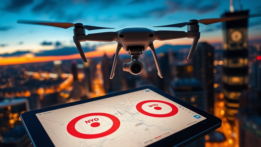
Checking the location before every flight helps you avoid unauthorized airspace, conflicts with crewed aircraft, and last-minute cancellations. Depending on the rule and location, violations can lead to FAA or other agency enforcement, civil penalties, or additional legal consequences.
A place that was clear last week may be restricted today because of a wildfire, security event, VIP movement, disaster response, major sporting event, or other temporary condition.
The most useful distinction is not simply “fly” versus “no fly.” Identify what type of restriction applies:
| Restriction Type | What It Means | What to Check |
|---|---|---|
| Controlled Airspace | Flight may be possible, but FAA authorization can be required | B4UFLY and an approved LAANC provider |
| Restricted, Prohibited, or Temporary Airspace | Operations may be prohibited or allowed only under stated conditions | FAA restrictions, TFRs, and NOTAM information |
| National Park Service Land | Launching, landing, or operating from NPS-administered land is generally restricted unless authorized | Official NPS unit guidance plus FAA airspace information |
| Local No-Drone Area | A city, park, or other authority may restrict takeoff or landing from the property | Official local ordinance, park page, signs, or property rules |
| Emergency or Event Restriction | A temporary restriction may be created around fires, emergencies, VIP movements, or large events | Current TFR and official emergency information |
This distinction prevents a common mistake: an airspace authorization does not automatically give you permission to launch from property where drone operations are prohibited.
Free Tools for Identifying No-Fly Zones

You can complete the core pre-flight airspace check without paying for a subscription. The important part is choosing the correct tool for the question you need answered.
| Source or Tool | Best Use | Does It Grant FAA Authorization? |
|---|---|---|
| FAA-approved B4UFLY provider | Check U.S. airspace awareness, airports, restrictions, and advisories | Not by the B4UFLY check alone |
| FAA-approved LAANC provider | Request eligible controlled-airspace authorization | Yes, for eligible approved requests |
| FAA TFR / No Drone Zone information | Check temporary and special restrictions | No |
| Local government or land manager | Check takeoff, landing, park, property, permit, and event rules | No FAA authorization |
| DJI FlySafe | DJI-specific advisory airspace awareness | No |
| Drone Assist / Drone Buddy | Additional planning, hazards, weather, or regional map context | Depends on service and country; verify before relying on it |
For U.S. flights, the safest workflow is to treat FAA data and FAA authorization as the primary source for legal airspace status. Manufacturer and community maps can then provide additional context.
Key Features Overview
Useful drone-planning tools can provide several types of information:
- Airspace status: Shows whether your location is in uncontrolled, controlled, restricted, prohibited, or specially managed airspace.
- Interactive maps: Help you identify airports, heliports, security-sensitive areas, parks, and other relevant locations.
- TFR information: Helps identify temporary restrictions created for emergencies, security, major events, or other short-term conditions.
- LAANC support: Lets eligible U.S. pilots request FAA authorization for certain operations in controlled airspace.
- Weather: Helps you evaluate wind, gusts, visibility, precipitation, temperature, and other flight conditions.
- Local and ground hazards: Can identify park restrictions, ground hazards, or other location-specific concerns that airspace maps alone may not answer.
Drone Assist remains useful for UK pilots who want airspace and ground-hazard planning. Drone Buddy provides additional map and weather tools, but it describes its map as a planning aid rather than legal clearance.
DJI FlySafe remains useful to DJI pilots as an advisory layer. Current DJI GEO warnings should not be treated as permission to fly, and the absence of a DJI warning does not prove that a flight is legal.
Popular Free or Free-Core Tools
Current options include:
- FAA-approved B4UFLY providers – The FAA currently lists Airspace Link, Aloft, AutoPylot, Avision, FlightLoop, and UASidekick for B4UFLY services.
- FAA-approved LAANC providers – Use an approved supplier when your planned U.S. operation needs eligible controlled-airspace authorization.
- Drone Assist – Useful for UK airspace awareness, hazards, flight planning, and supported approval workflows.
- Drone Buddy – Provides planning maps, restriction layers, and weather-related features; confirm official rules separately.
- DJI FlySafe – Provides DJI-specific airspace warnings and situational awareness but does not replace official authorization.
Some services sell premium planning features, but you do not need a paid subscription simply to begin checking whether airspace restrictions affect a U.S. flight.
Using B4UFLY and LAANC for U.S. Drone Flights
B4UFLY and LAANC solve different problems. B4UFLY is an FAA airspace-awareness service delivered through approved third-party applications. It helps pilots identify restrictions, controlled airspace, airports, national parks, military training routes, and other relevant airspace information.
LAANC, the Low Altitude Authorization and Notification Capability, is the FAA system used through approved UAS Service Suppliers to request eligible controlled-airspace authorization. The FAA reported in August 2026 that LAANC was available at 726 airports.
A B4UFLY check does not itself authorize a flight in controlled airspace. If authorization is required, submit the request through an approved LAANC provider or use the applicable FAA process. LAANC approval also does not override a TFR, property restriction, weather hazard, or other operating rule.
Pro Tip: Use a B4UFLY provider first to understand the location. If the map shows controlled airspace requiring authorization, complete the appropriate LAANC request and save the authorization details before takeoff.
Utilizing Local Government Resources for Compliance

Airspace status is only part of the pre-flight check. In the United States, the FAA regulates the national airspace, while state, local, tribal, territorial, park, and property authorities may have rules affecting where drones can take off or land and how particular sites may be used.
That means a location can have flyable airspace but still prohibit you from launching from the park, beach, public property, or other site below it.
Useful local resources include:
| Resource Type | Description | Access Method |
|---|---|---|
| Local Ordinances | Rules affecting takeoff, landing, property use, privacy, or permits | Official city, county, tribal, or territorial websites |
| Park Rules | Restrictions for parks, beaches, preserves, trails, or recreation areas | Official park or land-management pages |
| Event Rules | Site-specific restrictions for festivals, races, sporting events, or public gatherings | Official organizer or government pages |
| On-Site Signs | Current property-specific restrictions or closures | Entrance, parking, trailhead, or launch-area signage |
Community groups and drone clubs can help you discover local issues, but treat their advice as a lead to verify, not as legal permission.
How to Check Drone No-Fly Zones for Free Before Launch
Use this sequence before every flight:
- Check official airspace information: In the U.S., open an FAA-approved B4UFLY provider and place the pin at your planned operating area.
- Identify the type of airspace: Determine whether the location is uncontrolled, controlled, restricted, prohibited, or affected by another special rule.
- Check current temporary restrictions: Review TFR or other current restriction information rather than relying on an old screenshot.
- Request authorization when required: If your U.S. flight needs controlled-airspace authorization and is eligible for LAANC, submit the request through an approved provider.
- Check local launch and landing rules: Confirm whether the park, beach, city property, school, event venue, or private property allows drone operations from the site.
- Review weather: Check wind speed, gusts, visibility, precipitation, temperature, and other conditions relevant to your aircraft.
- Check manufacturer warnings: Review DJI FlySafe or your aircraft manufacturer’s app as an additional advisory layer, not as legal clearance.
- Inspect the drone: Check propellers, battery charge, GPS status, firmware warnings, return-to-home settings, and storage capacity.
- Monitor conditions during flight: Stay alert for crewed aircraft, emergency activity, changing weather, people entering the area, or new app warnings.
This process separates legal airspace status from property permission and aircraft-specific warnings, which prevents many common pre-flight mistakes.
Benefits of Real-Time Updates in Drone Apps
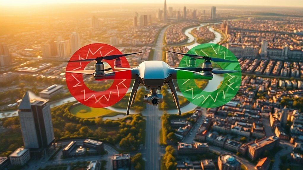
Current information matters because airspace restrictions, emergency activity, weather, and event-related limitations can change after you planned the flight.
Do not treat a saved screenshot from a previous day as a current airspace check. Reopen the relevant service before takeoff and confirm that the location, time, and planned altitude still fit the applicable rules.
Enhanced Safety Awareness
Current planning data can improve situational awareness in three important ways:
- Temporary Restrictions: Current TFR information can reveal short-term restrictions that were absent during earlier planning.
- Controlled-Airspace Status: Updated FAA data helps you determine whether authorization is required at your location and planned altitude.
- Weather and Ground Conditions: Current wind, visibility, precipitation, and local hazard information can change whether a technically legal flight is still safe to conduct.
Real-time information supports decision-making, but the authority behind the information still matters. Use official aviation data for legal airspace questions.
Improved Flight Planning
Good flight planning combines airspace, local property rules, weather, and aircraft limitations before you leave for the location.
A B4UFLY provider can answer the U.S. airspace-awareness question, an approved LAANC provider can handle eligible controlled-airspace authorization, local authorities can answer property-use questions, and your weather or aircraft app can help assess practical flight conditions.
Keeping those roles separate makes conflicting app messages easier to interpret and reduces last-minute surprises.
Community Resources: Crowd-Sourced Flying Spots
Community tools can help you discover possible flying spots, especially when you are new to an area.
Drone Buddy and similar platforms may show community-submitted locations, weather information, or additional map layers that are useful during early planning.
Community flying spots are suggestions, not permission to fly. Verify the airspace, property access, local rules, and current restrictions yourself.
Community tools are most useful for:
- Location ideas: Finding places other pilots have used or discussed.
- Local context: Learning about terrain, access, parking, obstacles, or common ground hazards.
- Pilot connections: Finding clubs, training opportunities, and people familiar with local operating conditions.
Never assume that a pin submitted by another user has been legally vetted for your aircraft, date, altitude, or type of operation.
Tips for Ensuring Safe Drone Operation
Finding legal airspace is only one part of responsible drone operation. You still need to evaluate the aircraft, weather, people, obstacles, and operating environment.
Check official airspace information before launch and obtain any authorization the operation requires. If you use DJI FlySafe, treat its warnings as an extra situational-awareness layer rather than the final legal decision.
Keep your flight app and drone firmware reasonably current so you receive current compatibility and safety updates. Do not assume, however, that a manufacturer’s database replaces government airspace data.
Before takeoff, inspect battery condition, propellers, GPS status, return-to-home altitude, nearby obstacles, and the planned emergency landing area. During flight, maintain awareness of crewed aircraft, people, animals, signal quality, and changing weather.
How to Stay Informed About Changing Regulations
Drone rules, authorization systems, and local policies change, so periodically review the official sources rather than relying indefinitely on information you learned when you bought the aircraft.
- Follow the aviation authority: In the U.S., review FAA UAS guidance, B4UFLY information, LAANC information, and current airspace restrictions.
- Check land managers: Review current park, city, county, tribal, territorial, or other property-management rules before using a new site.
- Keep planning tools current: Update the apps you use for airspace awareness, weather, and aircraft operation.
- Use communities as secondary sources: Forums and local groups can alert you to changes, but verify those changes against the responsible authority.
A regulation-sensitive article, saved screenshot, or forum answer can become outdated quickly. Recheck official information whenever the location or operating conditions change.
Best Practices for Navigating No-Fly Zones
The safest approach is to separate your pre-flight questions rather than expecting one app to answer everything.
First confirm the legal airspace status. Next determine whether authorization is required. Then check whether you have permission to use the launch and landing site. Finally, review weather, aircraft limitations, manufacturer warnings, and current activity around the location.
For DJI aircraft, current FlySafe warnings can add useful situational awareness, but they should not be used as a substitute for FAA or other applicable aviation-authority information.
During flight, be ready to reroute, return home, or land if crewed aircraft enter the area, emergency activity develops, weather deteriorates, signal quality becomes unsafe, or people move into the operating area.
Common Mistakes to Avoid When Checking No-Fly Zones
Avoid these common errors:
- Looking for the old standalone FAA B4UFLY app: B4UFLY is now delivered through FAA-approved service providers.
- Using only one third-party map: Cross-check sensitive or unfamiliar locations against the responsible aviation authority.
- Ignoring local launch rules: Legal airspace does not automatically give you permission to take off or land from a park, beach, city property, or private site.
- Assuming rural areas are unrestricted: Rural locations can still be affected by airports, military or security activity, protected land, or temporary restrictions.
- Forgetting TFRs: Fires, emergencies, VIP movements, sporting events, and security operations can create short-term restrictions.
- Treating DJI FlySafe as legal clearance: DJI’s current GEO information is advisory. A warning or lack of a warning does not determine legality.
- Flying outside an authorization: LAANC approvals apply only to the authorized location, altitude, time, and conditions.
Note: An airspace map may not show every privacy rule, property restriction, park policy, wildlife protection, permit requirement, or temporary on-site closure.
Related Guides
Frequently Asked Questions
Is There a Way to Bypass DJI No Fly Zone?
Do not try to bypass a legal airspace restriction. DJI has changed its GEO system so areas that were historically hard Restricted Zones are generally presented as Enhanced Warning Zones in its updated markets, and DJI announced retirement of the old GEO Unlock Request service. That change does not make restricted airspace legal to enter. Check the responsible aviation authority and obtain any required authorization before flying.
What Is the Best App for Checking Airspace for Drones?
For U.S. pilots, start with any current FAA-approved B4UFLY provider rather than the retired standalone FAA app. The FAA currently lists Airspace Link, Aloft, AutoPylot, Avision, FlightLoop, and UASidekick. If you need controlled-airspace authorization, use an FAA-approved LAANC provider. UK pilots can also use Drone Assist for regional planning.
How Do I Check Whether a Location Is a Drone Flying Zone?
Check the location in the official airspace-awareness system for your country. In the U.S., use an FAA-approved B4UFLY provider, review current TFRs, determine whether controlled-airspace authorization is required, and then check local takeoff and landing rules. Finally, review weather and your aircraft manufacturer’s warnings before launch.
How Can I Track Drones in My Area for Free?
Some nearby drones that comply with Remote ID broadcast identification and location data that compatible receivers or apps may be able to detect locally. Remote ID is not a nationwide public live-tracking service for every drone, however, and an airspace-planning map such as B4UFLY is designed to show restrictions rather than every aircraft flying nearby.
Can I Fly a Drone in a National Park?
In the United States, National Park Service policy generally prohibits launching, landing, or operating a drone from NPS-administered lands and waters unless specifically authorized. That land-use restriction is separate from FAA control of the airspace. Check both the specific park’s official rules and current FAA airspace restrictions before planning a flight.
Does LAANC Permission Mean I Can Fly Anywhere Nearby?
No. A LAANC authorization applies to the approved location, altitude, time, and conditions. It does not override TFRs, prohibited airspace, other operating rules, unsafe weather, or a property owner’s or land manager’s takeoff and landing restrictions.
Sources
- Federal Aviation Administration UAS — U.S. drone rules, safety guidance, and airspace resources.
- FAA B4UFLY — current FAA-approved B4UFLY providers and airspace-awareness features.
- FAA LAANC — controlled-airspace authorization and approved UAS Service Supplier information.
- FAA No Drone Zone — distinction between FAA airspace restrictions and local takeoff or landing restrictions.
- National Park Service: Uncrewed Aircraft in the National Parks — current NPS policy for launching, landing, and operating drones from NPS lands and waters.
- DJI GEO System Update — transition from traditional no-fly geofencing to Enhanced Warning Zones and retirement of the old unlock workflow.
- FAA Remote ID — current Remote ID broadcast requirements and information.
Conclusion
The safest free way to check a drone location is to use the correct source for each question. In the U.S., start with an FAA-approved B4UFLY provider, check current temporary restrictions, obtain LAANC authorization when required, and separately confirm the rules for the property where you plan to launch and land.
Use DJI FlySafe, Drone Assist, Drone Buddy, weather tools, and community resources as additional planning layers where appropriate, not as substitutes for official authorization.
Repeat the check before every flight because airspace, temporary restrictions, weather, and local conditions can change.
