
Just like a pilot needs to know the cockpit controls to navigate effectively, understanding drone terminology helps you fly, troubleshoot, buy gear, and communicate with confidence. From UAVs and UAS to payloads, geofencing, LiPo batteries, and Remote ID, each term describes a part of how drones operate in the real world. This glossary explains the essential words you’ll see in manuals, flight apps, drone reviews, and aviation rules so you can make safer, smarter decisions.
Quick Answer
Drone terminology covers the aircraft, control system, battery, navigation tools, safety features, sensors, data links, and legal terms used in drone operations. Knowing these terms helps you understand manuals, compare drone models, follow flight rules, and operate safely whether you fly for fun, photography, inspections, mapping, or commercial work.
Key Takeaways
- Drone, UAV, and UAS are related terms, but UAS refers to the whole system, not just the aircraft.
- Flight terms like IMU, GPS, RTH, waypoints, and geofencing explain how drones navigate and stay stable.
- Battery terms such as LiPo, mAh, cell count, and BMS directly affect flight time, safety, and performance.
- Commercial pilots in the United States must understand FAA rules, including registration, Remote Pilot Certificate requirements, airspace limits, and Remote ID.
- Imaging, mapping, telemetry, and autonomy terms matter more as drones move into agriculture, construction, inspections, public safety, and logistics.
General Drone Terms

Understanding drone terminology is essential for anyone involved in UAV operations. A drone, or UAV (Unmanned Aerial Vehicle), operates without a human pilot onboard and can be controlled remotely, fly semi-autonomously, or follow programmed routes. The complete system, known as a UAS (Unmanned Aircraft System), includes the drone, controller or ground control station, communication links, software, batteries, payload, and supporting equipment.
Understanding drone terminology is crucial for safe UAV operations because it covers the aircraft, control systems, safety features, sensors, and rules that affect every flight.
Drones come in several common types. Fixed-wing drones have rigid wings and glide efficiently, making them useful for long-distance mapping, agriculture, and surveying. Multirotor drones, including quadcopters, hexacopters, and octocopters, use multiple spinning propellers to hover, take off vertically, and maneuver precisely in tight spaces.
Microdrones are small, lightweight drones designed for confined spaces, close inspections, training, or indoor work. Some compact drones are built mainly for photography, while others are designed for industrial inspections, public safety, or research.
Another key term is payload, which refers to the equipment or cargo a drone carries. Common payloads include cameras, thermal sensors, multispectral sensors, LiDAR units, speakers, spotlights, delivery containers, and sampling tools. A drone’s payload affects its weight, battery life, handling, and legal operating limits.
You may also see the term RPAS, or Remotely Piloted Aircraft System. It is similar to UAS and is often used in international aviation discussions. In everyday use, most pilots and buyers use “drone” as the broad term, but official rules may use UAV, UAS, small UAS, or unmanned aircraft.
Common Drone Acronyms
- UAV: Unmanned Aerial Vehicle, meaning the aircraft itself.
- UAS: Unmanned Aircraft System, meaning the aircraft plus the controller, software, communication links, and support equipment.
- sUAS: Small Unmanned Aircraft System, a term often used for drones under regulatory weight limits.
- RPIC: Remote Pilot in Command, the person responsible for a flight under commercial rules.
- LOS: Line of Sight, meaning you can see the drone with your own eyes without relying only on the camera feed.
- BVLOS: Beyond Visual Line of Sight, meaning the drone flies beyond the pilot’s direct visual range. This usually requires special authorization in regulated airspace systems.
- RTH: Return to Home, an automated function that sends the drone back to a saved home point.
- FPV: First-Person View, meaning you see video from the drone’s camera in real time through goggles, a screen, or a controller display.
Flight Control and Navigation
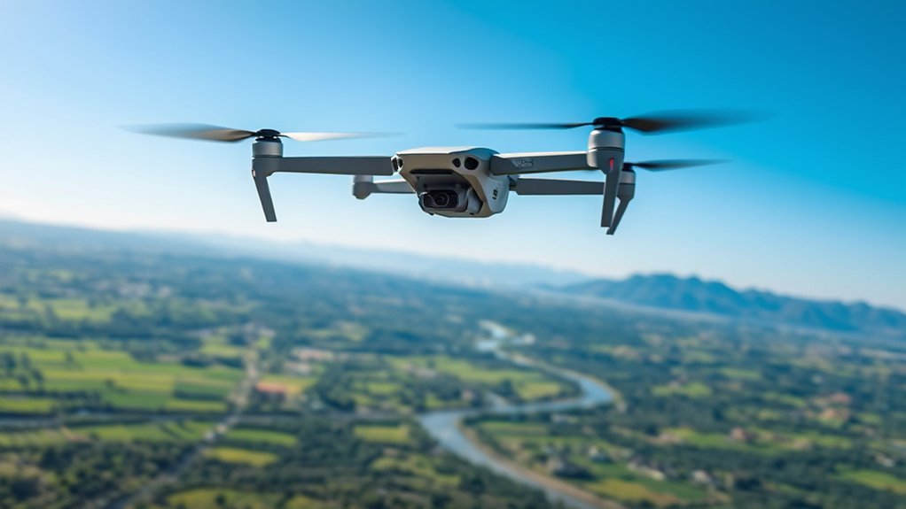
Flight control and navigation are essential components that help a drone operate effectively and safely. The flight controller acts as the brain of your drone. It processes sensor inputs, motor commands, stick movements, and software instructions to manage stability, orientation, speed, and maneuverability.
GPS is vital for many drone navigation features because it provides location data, supports position hold, enables mapping missions, and helps power features like Return to Home (RTH). In some systems, GPS may work with GLONASS, Galileo, BeiDou, or other satellite networks to improve positioning.
Key aspects of flight control and navigation include:
- Inertial Measurement Unit (IMU): Measures acceleration, angular rate, and orientation to support stable flight.
- Compass or Magnetometer: Helps the drone understand direction, especially during GPS-assisted flight.
- Barometer: Measures air pressure to estimate altitude and help maintain height.
- Geofencing: Creates virtual boundaries that can warn you or limit flight in restricted or sensitive areas.
- Follow Me Mode: Allows some drones to track a moving subject for dynamic footage.
- Altitude Control: Maintains the drone’s height during flight.
- Waypoint Navigation: Enables pre-planned flight paths for automated missions.
- Position Hold: Helps the drone stay in one place using GPS, optical sensors, or both.
Understanding these components helps you maximize your drone’s performance while maintaining a safer flying experience. It also helps you diagnose problems. For example, drifting may point to compass interference, weak GPS, poor calibration, wind, or sensor error.
Note: GPS-assisted features do not make a drone fully automatic or risk-free. Buildings, trees, mountains, metal structures, and radio interference can reduce accuracy, so you still need to monitor the aircraft and maintain control.
Manual Mode vs. Assisted Flight
Drone manuals often use terms that describe how much help the flight controller provides. Manual mode gives the pilot more direct control, while assisted modes use sensors and software to stabilize the aircraft. Altitude hold helps maintain height, while GPS mode can help hold position when satellite reception is strong.
FPV racing and freestyle drones may use terms like Angle Mode, Horizon Mode, and Acro Mode. Angle Mode self-levels the drone. Horizon Mode allows flips while still offering some leveling assistance. Acro Mode gives experienced pilots more control but requires constant stick input and practice.
Control Link and Video Link
The control link carries commands from your controller to the drone. The video link sends camera footage from the drone back to your screen or goggles. Signal quality matters because weak links can cause lag, breakup, failsafe events, or lost control.
Common terms include latency, which means delay; range, which means how far the link can operate under suitable conditions; and interference, which refers to competing radio signals or obstacles that weaken performance.
Safety Features and Compliance
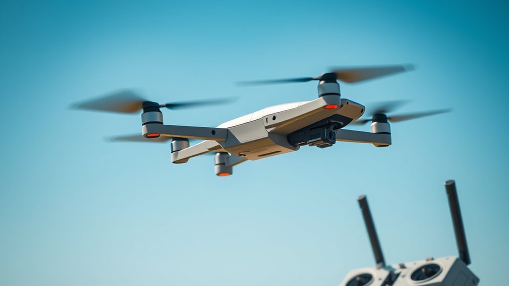
In drone operations, essential safety measures are vital for protecting the aircraft, people, property, wildlife, and surrounding airspace.
You must comply with applicable regulations and understand emergency response protocols to help ensure safer flight.
Familiarizing yourself with these terms can reduce risk, improve planning, and help you respond quickly when a flight does not go as expected.
Essential Safety Measures
While operating a drone, it’s essential to implement crucial safety measures to protect both the aircraft and the surrounding environment.
Here are key safety features you should prioritize:
- Fail-Safe: Triggers a preset action, such as hovering, landing, or returning home, during signal loss or system problems.
- Collision Avoidance System: Uses sensors, cameras, or software to detect obstacles and help reduce the risk of collisions.
- Return to Home (RTH): Directs the drone back to its launch point or saved home point when battery levels are low, the connection is lost, or the pilot activates the feature.
- Temporary Flight Restrictions (TFR): Airspace limitations issued for events, emergencies, security needs, or other special conditions.
- Pilot in Command (PIC): The person responsible for the safe operation of the drone and for following regulations and safety guidelines.
- Pre-Flight Check: A quick inspection of battery level, propellers, firmware, airspace, weather, compass status, GPS signal, and takeoff area before flying.
Warning: Never rely on obstacle avoidance as your only safety system. Thin branches, wires, reflective surfaces, low light, rain, fog, and fast movement can reduce sensor performance.
Compliance With Regulations
Understanding and adhering to regulations is essential for safe drone operation. In the United States, the Federal Aviation Administration oversees civil drone operations. Recreational and commercial pilots may face different requirements, so you should check the rules that apply to your flight before taking off.
For many commercial drone operations in the United States, pilots need a Remote Pilot Certificate under 14 CFR Part 107. Commercial pilots must also follow operational rules for airspace, altitude, visual line of sight, aircraft condition, and safe operation.
Drone registration is another common compliance term. The FAA provides registration through FAADroneZone, and some drones must display registration markings. Many drones operating in U.S. airspace must also meet Remote ID requirements, which allow certain identification and location information to be broadcast during flight.
Drones come equipped with fail-safe systems, helping them return safely to a launch point, hover, or land during signal loss or low battery events. Collision avoidance systems help detect obstacles in real time, lowering accident risks when used correctly. The Return to Home (RTH) feature directs your drone back when the battery is low or it loses connection, helping prevent crashes or loss.
Pilots must also comply with Temporary Flight Restrictions (TFRs) issued by regulatory bodies, which restrict operations in certain airspace. As the Pilot in Command (PIC), you’re responsible for ensuring all operations meet legal and safety guidelines, including performing pre-flight checks and following airspace regulations diligently.
Remote ID, Airspace, and Authorization
Remote ID is often described as a digital license plate for drones. It helps identify certain drones in flight and supports airspace awareness. Depending on the drone and operation, Remote ID may be built into the aircraft, added through a broadcast module, or handled through approved operating areas.
Controlled airspace generally refers to airspace around many airports where drone pilots may need authorization before flying. The FAA’s LAANC system can provide near-real-time airspace authorizations for eligible drone operations in certain controlled airspace areas.
Uncontrolled airspace usually has fewer authorization requirements, but you still need to follow safety rules, avoid restricted areas, check local limits, and keep the drone away from crewed aircraft.
Emergency Response Protocols
As emergency situations arise, having robust response protocols in place is critical for safe drone operations. Effective protocols help you manage unexpected challenges while minimizing risks.
Key components include:
- Return to Home (RTH): Automatically directs the drone back to its takeoff point when battery is low or signal is lost.
- Fail-Safe Mechanisms: Initiate pre-programmed procedures to prevent accidents during system failures.
- Temporary Flight Restrictions (TFR): Compliance is essential to protect airspace around emergencies.
- Collision Avoidance Systems: Detect obstacles to enhance safety in complex environments.
- Pilot in Command (PIC): Responsible for guaranteeing all safety features function and compliance with regulations during operations.
- Emergency Landing Zone: A safe backup area where you can land quickly if the mission needs to stop.
- Lost-Link Procedure: The planned action your drone takes if the control signal drops.
Implementing these protocols can greatly enhance safety during drone missions. Before every flight, decide what you will do if weather changes, the battery drops faster than expected, GPS weakens, or people enter your operating area.
Battery and Performance
When it comes to drone battery performance, understanding battery types, performance metrics, and maintenance is essential.
You’ll find that Lithium Polymer (LiPo) batteries dominate many consumer and FPV drone categories because they offer a strong power-to-weight ratio, high discharge rates, and compact size.
Battery Types Explained
Batteries are the lifeblood of drones, directly impacting their performance and flight duration. The most common type you’ll encounter in drones is the Lithium Polymer (LiPo) battery, prized for its high energy density and ability to deliver power quickly.
Understanding battery specifications is essential for peak performance:
- Cell Configuration: LiPo batteries come in various configurations, such as 3S, 4S, and 6S. The number shows how many cells are connected in series, which affects voltage.
- Battery Capacity: Measured in milliamp-hours (mAh), it helps estimate how long a drone can stay airborne.
- C Rating: Describes how quickly a battery can safely discharge current. High-performance FPV drones often need higher discharge capability.
- Battery Management System (BMS): Vital for monitoring health, charging, and discharging in many smart batteries.
- Ingress Protection (IP) Rating: Indicates resistance to dust and moisture damage when a drone or component carries an IP rating.
- Drone Weight: Heavier drones require more power, influencing overall battery performance, flight time, and motor load.
Knowing these factors helps you maximize your drone’s capabilities and avoid using the wrong battery for your setup.
Performance Metrics Overview
Understanding battery performance metrics is key to optimizing your drone’s capabilities.
Battery management systems (BMS) play an essential role in monitoring your drone’s lithium polymer (LiPo) batteries, enhancing safety, efficiency, and longevity.
Drone endurance, measured in minutes, indicates how long your drone can stay airborne on a single charge. Many consumer drones fly for roughly 20 to 45 minutes under typical conditions, while specialized platforms may vary widely based on battery size, payload, wind, temperature, and flight style.
The load factor, which compares the lifting force to the drone’s weight, notably impacts stability and payload capacity. A drone carrying a heavy camera, thermal sensor, or delivery item usually needs more throttle, which drains the battery faster.
Additionally, the Ingress Protection (IP) rating reflects the drone’s resistance to dust and moisture, with higher ratings usually indicating better protection against environmental challenges. Not every drone has an IP rating, so do not assume a drone is water-resistant unless the manufacturer clearly states it.
Monitoring these metrics helps you maximize your drone’s performance and spot problems before they become serious.
Charging and Maintenance Tips
To guarantee peak drone performance, it’s essential to follow proper charging and maintenance practices for your lithium polymer (LiPo) batteries.
Adhering to these tips safeguards safety and longevity:
- Use a compatible charger and avoid exceeding the recommended voltage.
- Monitor individual cell voltage, keeping each cell within the range recommended by the battery or drone manufacturer.
- Regularly calibrate the Battery Management System (BMS), if your drone’s manufacturer recommends calibration.
- Store batteries at a partial charge in a cool, dry place during long periods of inactivity.
- Perform routine maintenance by cleaning battery terminals and securing connections.
- Inspect batteries for swelling, punctures, heat damage, cracked housings, or unusual odor before use.
- Let batteries cool before recharging them after a demanding flight.
Pro Tip: Label your drone batteries and rotate them evenly. Tracking cycles helps you notice weaker packs, shorter flight times, and batteries that should be retired.
Propellers, Motors, and Thrust
Battery performance connects directly to motors, propellers, and thrust. Motors turn electrical energy into motion. Propellers create lift by moving air. Thrust describes the force that lifts and moves the drone.
Common motor terms include KV rating, which describes motor speed per volt with no load, and ESC, or Electronic Speed Controller, which regulates motor speed. Propeller terms include diameter, pitch, blade count, and direction. A prop with more pitch or larger diameter can create more thrust, but it may also draw more current and reduce flight time.
Thrust-to-weight ratio compares available lift to total aircraft weight. Camera drones may focus on efficiency and smoothness, while racing drones often need a much higher thrust-to-weight ratio for fast acceleration and acrobatic moves.
Imaging Technology and Data Handling
As drones become integral to various industries, mastering imaging technology and data handling is essential for maximizing their potential. A gimbal stabilizes the camera, ensuring steady, high-quality imagery despite drone movements.
Using FPV (First-Person View) enhances your control by providing real-time video feedback from the drone’s camera, improving situational awareness.
Resolution describes how much detail a camera can capture, such as 1080p, 2.7K, 4K, or higher. Frame rate, measured in frames per second, affects how smooth video looks. Bitrate describes how much video data is recorded per second, which can affect detail, file size, and editing flexibility.
Dynamic range describes how well a camera captures bright highlights and dark shadows in the same scene. Log profiles and flat color modes preserve more editing flexibility, but they usually require color correction in post-production.
Multispectral imaging is imperative for applications like agricultural monitoring, allowing you to assess plant health by capturing images across different wavelengths.
LiDAR (Light Detection and Ranging) employs laser pulses to measure distances, creating detailed 3D maps and models of terrain, which is invaluable for surveying and mapping projects.
Telemetry systems enable two-way data communication between your drone and ground station, giving you access to real-time flight parameters. This information is essential for making informed, data-driven decisions during operations, enhancing overall mission success.
Mapping and Surveying Terms
Drone mapping introduces a few important terms. Orthomosaic refers to a corrected aerial map made from many overlapping images. Photogrammetry uses photos to measure distances and build maps or 3D models. Ground sample distance, often shortened to GSD, describes how much ground area each image pixel represents.
RTK, or Real-Time Kinematic positioning, improves GPS accuracy by using correction data. PPK, or Post-Processed Kinematic positioning, applies correction data after the flight. Both terms matter for surveying, construction progress tracking, mining, agriculture, and inspection work where location accuracy matters.
Data Storage and Privacy
Drone data can include photos, video, flight logs, GPS coordinates, thermal imagery, and sensor readings. Flight logs help diagnose crashes, battery issues, and control problems. Metadata can store location, altitude, camera settings, and time stamps.
For professional work, you should manage data carefully. Use reliable memory cards, back up important files, protect client information, and follow privacy rules where you operate. Avoid recording people, private property, or sensitive locations in ways that violate laws, contracts, or ethical expectations.
Emerging Drone Technologies
While the landscape of drone technology evolves rapidly, emerging innovations are reshaping how industries operate. These advancements enhance operational efficiency and open new possibilities across various sectors.
Key technologies include:
- 5G Drone Connectivity: Enables real-time communication, supporting longer-range missions with reduced latency where network coverage and system design allow it.
- AI-Powered Autonomy: Employs machine learning for advanced obstacle avoidance, subject tracking, inspection workflows, and optimized routing.
- Drone-in-a-Box Systems: Autonomous docking stations allow drones to recharge, upload data, and execute repeatable tasks with less human intervention.
- Swarm Drone Technology: Multiple drones coordinate in formations, boosting efficiency for search and rescue, entertainment, environmental monitoring, and research.
- Industrial Applications: Drones are integrated into construction, agriculture, utilities, public safety, and logistics for tasks like surveying, crop analysis, inspection, and delivery testing.
- Detect-and-Avoid Systems: Sensors and software help drones detect obstacles or other aircraft and support safer automated operations.
- UTM: Unmanned Aircraft System Traffic Management, a developing framework for coordinating drone traffic at scale.
As these technologies continue to develop, you can expect to see even greater integration into daily operations, transforming how businesses function. Still, newer technology does not remove the need for pilot judgment, safe planning, maintenance, and compliance.
Commercial Drone Use Cases
Drone terminology becomes easier to understand when you connect each term to a real job. In real estate, drones capture aerial photos, video tours, and neighborhood views. In construction, drones document progress, inspect roofs, and support mapping. In agriculture, drones can help monitor crop health, irrigation problems, and field conditions.
In public safety, drones may support search and rescue, disaster response, fire assessment, and situational awareness when operated under the correct authority. In utilities, drones help inspect power lines, cell towers, pipelines, wind turbines, and solar farms without always placing workers in dangerous positions.
Each use case brings its own vocabulary. Inspection pilots may talk about zoom cameras, thermal sensors, standoff distance, and asset tracking. Mapping teams may talk about overlap, ground control points, RTK, PPK, and orthomosaics. FPV pilots may talk about rates, props, ESCs, VTX power, and latency.
Frequently Asked Questions
What are the legal requirements for flying drones commercially?
In the United States, many commercial drone operations require a Remote Pilot Certificate under FAA Part 107, drone registration when applicable, airspace compliance, safe operating practices, and Remote ID compliance when required. You should also check state, local, site-specific, and client requirements before flying.
How do I choose the right drone for my needs?
Start with your main use: casual flying, travel photography, FPV, inspections, mapping, agriculture, or delivery testing. Then compare camera quality, flight time, payload support, controller range, obstacle sensing, portability, battery cost, software features, repair options, and the rules that apply to your drone’s weight and operation.
Can drones be used for package delivery?
Yes, drones can be used for package delivery, and companies continue to test and operate drone delivery systems in approved areas. Delivery drones must meet strict safety, airspace, operational, and regulatory requirements, especially when flights go beyond visual line of sight or operate near people.
What are the best practices for drone maintenance?
Regularly inspect propellers, motors, batteries, landing gear, camera mounts, sensors, firmware, and controller connections. Clean dust and debris, replace damaged props, store batteries correctly, check for loose screws, and run a pre-flight check before every mission.
How do weather conditions affect drone performance?
Weather conditions greatly impact drone performance. High winds can destabilize flight, rain may damage drones that are not weather-rated, and extreme temperatures can reduce battery efficiency. Fog, snow, glare, and low light can also affect visibility and obstacle sensors.
What is the difference between a drone, UAV, and UAS?
A drone is the everyday word most people use. UAV means Unmanned Aerial Vehicle and usually refers to the aircraft itself. UAS means Unmanned Aircraft System and includes the aircraft, controller, software, communication links, payload, and support equipment.
What does payload mean on a drone?
Payload means the equipment or cargo a drone carries. This can include a camera, gimbal, thermal sensor, LiDAR unit, mapping sensor, delivery box, spotlight, speaker, or sampling tool. Payload weight affects flight time, stability, handling, and battery drain.
What does FPV mean in drone flying?
FPV means First-Person View. It lets you see live video from the drone’s camera through goggles, a controller screen, or a display. FPV is common in racing, freestyle flying, cinematic flying, inspections, and close-control applications.
Conclusion
As you navigate the skies of drone technology, think of these terms as your compass, guiding you through the clouds of complexity. Each definition is a stepping stone, leading you toward mastery in this dynamic field. Just as a pilot trusts their instruments, you can rely on this glossary to enhance your understanding and communication.
The most useful drone terms fall into a few clear groups: aircraft types, flight control, navigation, safety systems, batteries, imaging tools, data handling, and compliance. Once you understand those categories, drone manuals, app settings, product specs, and aviation rules become much easier to follow.
Embrace these insights, and let them lift you to new heights in your drone journey, ensuring you soar safely and effectively. Whether you fly for fun, create aerial content, map job sites, inspect assets, or study emerging technology, a strong vocabulary helps you make better choices before, during, and after every flight.
Sources
- Federal Aviation Administration UAS — drone rules, safety programs, and UAS operating guidance.
- 14 CFR Part 107 — U.S. commercial small unmanned aircraft rules.
- FAADroneZone — official FAA drone registration and airspace services portal.
- FAA LAANC — airspace authorization information for eligible drone operations.
- FAA Remote ID — Remote ID requirements and compliance information.
