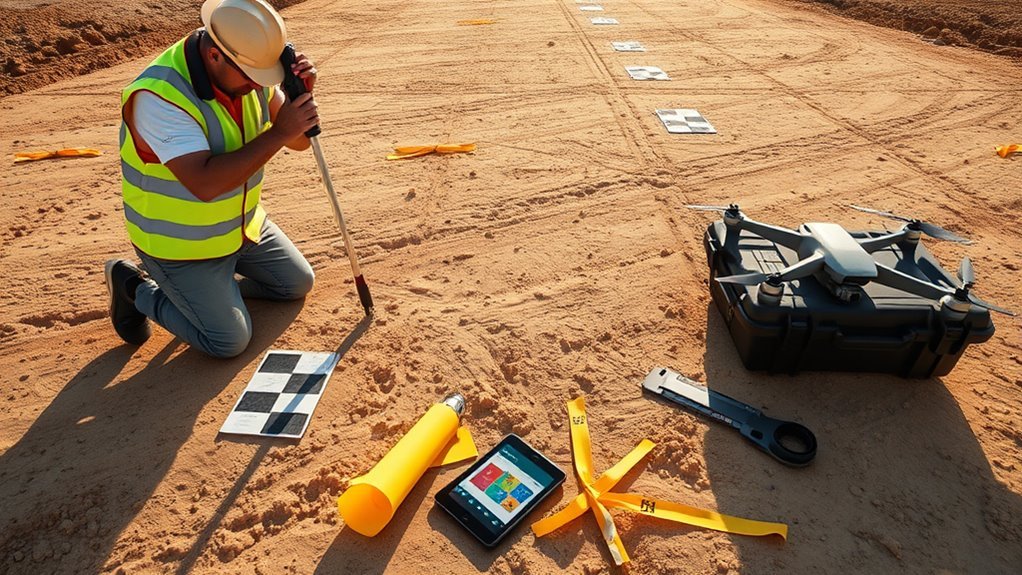
Drone map accuracy depends on two different point types that are often confused: ground control points, which constrain the model, and checkpoints, which test it. The distinction matters because a map can look precise while still hiding vertical or horizontal error. Placement, survey method, and point count all affect the result, and the real question is not whether the map is usable, but how much error remains after calibration.
What Do GCPs Do in Drone Mapping?

Ground Control Points (GCPs) provide surveyed X, Y, and Z coordinates that anchor drone imagery to real-world positions, allowing mapping software to correct systematic GPS error and improve absolute accuracy from meter-level estimates to centimeter-level results.
In drone mapping, GCPs act as fixed reference targets that constrain the photogrammetric solution and reduce positional drift across the project area. Proper placement on flat, high-contrast, durable markers improves detectability in aerial images and supports stable adjustment.
At least four Ground Control Points are typically needed for basic control, while five or more strengthen reliability on medium-sized sites. This framework is valuable for surveying and volumetric work where liberation from uncertainty depends on measurable precision.
RTK-equipped drones may reduce error, yet GCPs still provide independent validation of the final map geometry. Their role is not decorative; it is corrective, making accuracy auditable, repeatable, and fit for decisions requiring centimeter-level confidence.
Why Do Checkpoints Matter?
Checkpoints matter because they provide independent validation of a drone map without influencing the adjustment process. Positioned after processing, they measure discrepancies between mapped coordinates and actual ground features, exposing true accuracy rather than fitted confidence.
Unlike Ground Control Points (GCPs), which shape the solution, Checkpoints function as external auditors, preserving objectivity and enabling independent validation. When placed strategically across a project area, even 1-2 points can reveal spatial drift, especially over long distances where small errors accumulate. This makes checkpoints valuable for detecting systematic bias and quantifying map integrity.
Unlike GCPs, checkpoints independently audit accuracy, revealing drift, bias, and true map integrity.
In RTK or PPK workflows, checkpoints commonly achieve 2-5 cm accuracy, supporting dependable evaluation in demanding mapping applications. Consistent use of Checkpoints strengthens trust in shared outputs, because stakeholders can examine measurable error instead of accepting unsupported claims.
For operators seeking technical clarity and operational freedom, checkpoints are the mechanism that converts map production into verifiable evidence.
How Many GCPs Do You Need?
A minimum of four Ground Control Points is required for basic accuracy, with five commonly recommended for medium-sized projects.
Terrain complexity and site extent alter the count, as uneven or larger areas may require ten or more well-distributed points to maintain accuracy across the full dataset.
RTK/PPK systems reduce this burden substantially, often lowering the need to roughly one GCP per 200 images instead of one per 60 images on non-RTK platforms.
Minimum GCP Count
For basic drone mapping accuracy, a minimum of four Ground Control Points is generally recommended, while five points is often preferable for medium-sized projects because it anchors the corners and center of the area.
This minimum gives GCPs enough spatial constraint to support survey-grade accuracy and to verify checkpoints independently.
In mapping projects using RTK or PPK systems, the count can be reduced, but not eliminated: a practical rule is one GCP per 200 images, versus one per 60 images on non-RTK platforms.
For demanding work, especially where precise freedom from distortion matters, denser control is warranted.
Larger extents may need 10 or more points, with spacing kept under 400 meters to preserve uniform accuracy across the model and protect measurement integrity.
Placement By Terrain
Terrain governs GCP count and placement as much as project size does: basic mapping generally requires at least four Ground Control Points, five being preferable for moderate areas, while larger or uneven sites often benefit from 10 or more strategically distributed points. Placement must respect terrain gradients, not merely acreage, to preserve accuracy and geospatial independence.
| Terrain | GCPs |
|---|---|
| Flat sites | 4–5 |
| Moderate areas | 5 |
| Hilly zones | 10+ |
| Uneven ground | 10+ |
| Checkpoints | Verify spacing |
GCPs should rest on stable, visible surfaces, spaced evenly, and never clustered. Maximum separation should stay within 1,312 feet. In varied terrain, include high and low elevations so mapping remains consistent and checkpoints can expose residual error without surrendering analytical freedom.
RTK Reduces GCPs
RTK drone systems sharply reduce the Ground Control Point burden by delivering centimeter-level geotagging, with roughly 1 GCP needed per 200 images instead of the 1 per 60 images typical of non-RTK workflows.
In drone surveying, this reduction frees crews from dense field targeting while preserving accuracy. Yet RTK does not eliminate validation needs; 1 to 2 checkpoints should still be placed on medium projects to verify map quality without influencing processing.
Strategic Ground Control Points remain useful at high and low terrain positions, especially where relief changes can bias models. For professional surveys, a few GCPs provide an independent quality check, ensuring RTK and PPK outputs meet specification.
The result is leaner fieldwork, tighter control, and greater methodological freedom.
Where Should You Place GCPs and Checkpoints?
Where should GCPs and checkpoints be placed to produce reliable photogrammetric results?
GCPs should occupy flat, stable surfaces such as asphalt or concrete, where visibility and positional stability support strong accuracy. A corners-and-center pattern across the survey area is typically preferred, with each point set 50–100 feet inside the flight boundary to reduce edge obstruction.
In larger blocks, the maximum spacing between GCPs should not exceed 1,312 feet (400 meters); rugged terrain requires points at both high and low elevations.
Checkpoints should represent 10–20% of all surveyed points, distributed evenly across the project area and concentrated near edges and elevation shifts to test map bias.
Coordinates should be recorded with a professional GPS receiver using RTK, rather than consumer hardware, so the control network remains defensible.
This placement strategy yields measurable control, transparent validation, and operational freedom from undetected mapping error.
Which RTK/PPK GPS Tools Should You Use?
RTK rover receivers are typically used to capture centimeter-level GCP coordinates in the field, while PPK base station tools support post-processed correction when real-time solutions are not available.
GNSS survey software is then used to log, quality-check, and export the coordinate data in a format suitable for mapping workflows.
Together, these tools support reduced GCP dependence while preserving the independent verification role of checkpoints.
RTK Rover Receivers
Professional-grade rover receivers are central to centimeter-level surveying workflows because they let drone teams collect GCP and checkpoint coordinates with far greater accuracy than consumer GPS devices.
RTK rover units correct drone GPS positions in real time, improving mapping precision and reducing reliance on postflight fixes. For GCPs and checkpoints, this hardware supports rigorous validation against ground truth, helping operators detect bias, drift, and residual error.
Built-in communications can streamline field corrections and keep crews moving with minimal delay.
- RTK rovers deliver immediate positional correction.
- Professional receivers protect measurement integrity.
- Checkpoints confirm map accuracy independently.
For teams seeking autonomy in the field, these tools make accuracy measurable, repeatable, and operationally transparent.
PPK Base Station Tools
PPK workflows rely on a stable base station to correct flight data after acquisition, allowing drone imagery to be geotagged with centimeter-level accuracy.
In practice, PPK depends on high-precision GNSS receivers that record raw observations for later correction, unlike Real-Time Kinematic (RTK), which resolves positions in real time.
The base station should occupy a known, stable point and be calibrated within effective range of the flight area to preserve accuracy.
Trimble and Leica systems are common professional choices because they support reliable logging and post-processing.
When maps must be verified without dependence on GCPs alone, independent validation points remain essential, but the base station provides the positional backbone that lets PPK users reclaim control over survey-grade results and reduce unnecessary field constraints.
GNSS Survey Software
Survey-grade GNSS software serves as the control layer for RTK and PPK workflows, converting raw receiver observations into map products with centimeter-level reliability. It coordinates GNSS survey software inputs from Trimble or Leica receivers, preserving RTK integrity and supporting absolute accuracy claims.
- It processes GCPs and Ground Control Points efficiently, reducing field-to-office latency.
- It compares checkpoints against known coordinates to validate drone maps without guesswork.
- It filters errors from standard drone GPS, tightening precision to 2-5 centimeters.
For teams seeking operational freedom, these tools enable disciplined measurement, repeatable calibration, and defensible outputs.
Used consistently, they expose residual bias early, protect mapping quality, and make accuracy verification a measurable, auditable procedure rather than an assumption.
How Do You Validate Drone Map Accuracy?
Drone map accuracy is validated by using checkpoints—independent control points excluded from the processing workflow—to compare calculated map positions against known ground coordinates and quantify error.
In drone surveys, GCPs anchor processing, while Checkpoints validate accuracy by revealing residuals that remain after adjustment. At least one or two checkpoints should be distributed evenly across the project area so the assessment reflects the full map, not a single zone.
Their coordinates should be verified regularly against surveyed ground locations, allowing operators to detect drift in GCPs and changes in georeferencing performance. Professional GPS receivers with RTK or PPK capability are preferred for recording both GCPs and checkpoints because centimeter-level precision strengthens the validation result.
The verification steps should be documented carefully, creating a repeatable reference for future missions and a transparent record of data integrity. This disciplined method helps drones deliver maps that are measurable, defensible, and operationally free.
When Should You Use GCPs vs Checkpoints?
Ground control points are used when a drone map must be tied accurately to real-world coordinates, while checkpoints are reserved for independent quality verification of the finished dataset.
For projects demanding centimeter-level accuracy, Ground Control Points remain indispensable; they anchor the model, correct spatial drift, and support defensible outputs in topographic surveys and volumetric work.
Checkpoints, by contrast, quantify residual error without influencing the solution, giving a separate measure of validation and map accuracy.
- Use at least 4 GCPs for basic control, evenly distributed across the area, with no gaps beyond 1,312 feet.
- Use 1-2 Checkpoints, placed on edges and corners, to expose discrepancies between calculated and actual positions.
- For RTK/PPK drones, reduce GCP count only when the project tolerance allows it; never remove Checkpoints.
This structure preserves analytical freedom: control where necessary, verify everywhere.
Frequently Asked Questions
What Is the 1:1 Rule for Drones?
The 1:1 rule for drones means one Ground Control Point should be used for each captured image, or roughly one GCP per 60 images with non-RTK systems and one per 200 with RTK/PPK.
It supports mapping techniques, accuracy standards, and data processing, while respecting drone regulations and flight safety.
Technology advancements may reduce dependence on dense control, yet distributed GCPs still stabilize large surveys and improve absolute positional confidence.
How Accurate Is Drone Mapping?
Drone mapping accuracy can be razor sharp, or wildly misleading, depending on the system. Standard drones often achieve 1-3 meter absolute accuracy, while RTK/PPK platforms can reach 2-5 centimeters.
Proper ground control can improve results to 1-3 centimeters. Reliable data validation requires checkpoints, mapping software, and error analysis, with flight parameters strongly influencing outcomes.
Precision expands when survey design is disciplined and verification remains independent.
Is PPK or RTK More Accurate?
PPK is often slightly more accurate than RTK when post-processing is well executed, though both can reach 2–5 cm. The accuracy comparison depends on satellite geometry, correction quality, and workflow control.
PPK advantages include resilient correction and fewer real-time failures; RTK limitations include link dependence and field variability.
Equipment costs, best practices, and use cases should guide selection. Independent checkpoints remain essential for verification and disciplined mapping outcomes.
Can FAA Know You Flew a DJI Drone?
Yes, the FAA can know a DJI drone flew, because Remote ID, GPS traces, and Flight logging can expose activity.
Under DJI regulations, Drone ownership records and app telemetry may support Compliance checks.
Privacy concerns persist, since identifiers and locations can be correlated with Airspace restrictions or incident reports.
In practice, detection is technical, not absolute, but it materially limits anonymity and expands regulatory visibility.
Conclusion
In drone mapping, GCPs and checkpoints serve distinct but complementary functions. GCPs anchor the photogrammetric model to surveyed reality, while checkpoints act like independent auditors, confirming whether the final product meets accuracy requirements. Proper distribution, sufficient point quantity, and RTK/PPK-grade measurements improve reliability across variable terrain. When used correctly, these control points convert map quality from an assumption into a measurable, defensible result, enabling precise validation rather than approximate confidence.
