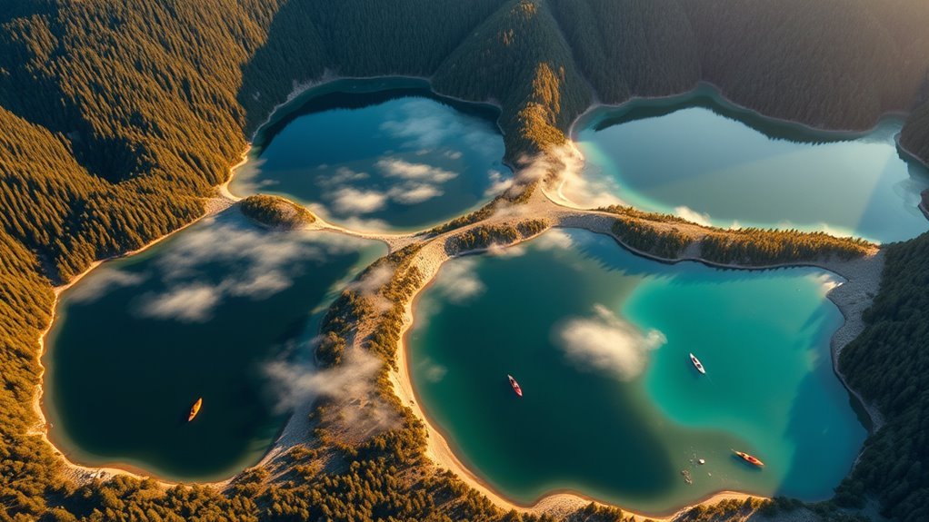
Lake Superior is the world’s largest freshwater lake by surface area and the biggest of North America’s five Great Lakes. Its vast waters border the United States and Canada, with rugged cliffs, sandy beaches, islands, and northern forests along the shore. Whether you want to understand its remarkable size, explore its history, or plan a trip, these Lake Superior facts explain what makes this inland sea so distinctive.
Quick Answer
Lake Superior covers approximately 31,700 square miles (82,100 square kilometers) and reaches a maximum depth of 1,332 feet. It contains more water than the other four Great Lakes combined. Its cold, clear water, ancient geology, rich Indigenous heritage, and protected shorelines make it important for both wildlife and people.
Last checked: September 26, 2026. Key geographical figures and 2026 visitor information were checked against official sources.
Key Takeaways
- Lake Superior borders Minnesota, Wisconsin, Michigan, and Ontario.
- Its shoreline, including islands, measures approximately 2,726 miles.
- The lake is exceptionally deep, cold, and relatively low in nutrients.
- Indigenous communities have maintained cultural and practical connections to the lake for thousands of years.
- Apostle Islands, Pictured Rocks, Split Rock Lighthouse, and Lake Superior Provincial Park offer different ways to explore its shores.
- Cold water, changing weather, and seasonal access restrictions are important considerations for visitors.
Lake Superior In a Nutshell
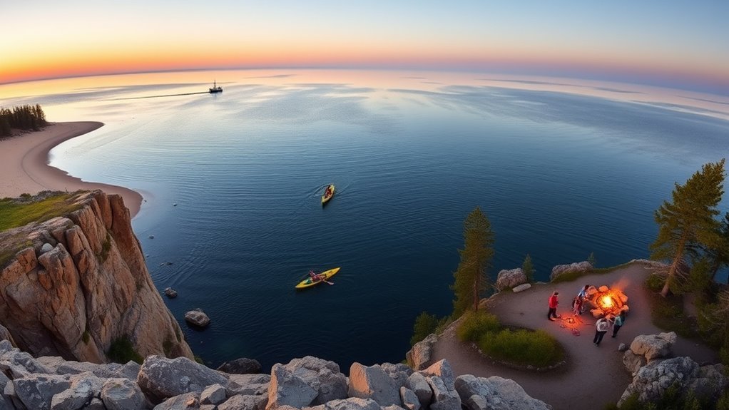
Lake Superior is the largest of the Great Lakes by surface area and water volume. It also ranks as their deepest and coldest lake.
The US Environmental Protection Agency’s Great Lakes physical data provides these measurements:
- Surface area: Approximately 31,700 square miles (82,100 square kilometers).
- Average depth: Approximately 483 feet (147 meters).
- Maximum depth: Approximately 1,332 feet (406 meters).
- Water volume: Approximately 2,900 cubic miles (12,100 cubic kilometers).
- Shoreline: Approximately 2,726 miles (4,385 kilometers), including islands.
- Water retention time: Approximately 191 years.
Retention time describes how long water remains in a lake on average before flowing out. Lake Superior’s enormous volume helps explain its unusually long retention time.
Lake Superior contains more water than the other four Great Lakes combined, making its volume as remarkable as its surface area.
Its main outlet is the St. Marys River, which carries water toward Lake Huron. Hundreds of rivers and streams also feed the lake, including the Nipigon, St. Louis, and Pigeon rivers.
Although Lake Superior is the largest freshwater lake by surface area, it is not the largest lake of every type. The saline Caspian Sea has a greater surface area, while Lake Baikal contains more freshwater by volume.
Why Lake Superior Matters to the Region
Lake Superior supports drinking-water supplies, fisheries, transportation, tourism, and local communities across two countries. Its influence extends well beyond the shoreline.
Municipal water systems draw water from the lake and treat it before distribution. Its relatively low levels of development and pollution help protect this resource, but water quality still requires regular monitoring.
The lake also connects regional economies through commercial shipping. Vessels transport materials such as iron ore and other cargo through the Great Lakes waterway system.
Tourism supports communities in Minnesota, Wisconsin, Michigan, and Ontario. Visitors come for fishing, hiking, camping, wildlife watching, boating, and historic sites.
For Indigenous communities, the lake remains part of a living cultural landscape. Fishing, harvesting, ceremonies, and relationships with the land continue alongside modern conservation and economic activity.
These overlapping uses make Lake Superior both a shared resource and a place requiring careful long-term management.
Lake Superior’s Wildlife and Clean Water
Lake Superior supports a diverse cold-water ecosystem, even though its waters contain relatively few nutrients. This condition is called oligotrophic, meaning the lake has relatively low nutrient levels and limited algae production.
Its clear water supports specialized fish communities. Lake trout, lake whitefish, cisco, and other species occupy different depths and habitats.
The Great Lakes Fishery Commission’s fish-diversity assessment identifies approximately 88 fish species in the broader Lake Superior watershed. The lake itself supports more than 70 recorded species, although totals vary with the area and species included.
One distinctive fish is the siscowet, a deep-water form of lake trout. Siscowet are important predators in the offshore food web.
Lake Superior’s surrounding forests, wetlands, islands, and coastal areas also provide habitat for bald eagles, gray wolves, Canada lynx, and other wildlife.
| Wildlife | Clean-water benefit |
|---|---|
| Lake trout, whitefish, and other fish | Cold-water habitat and functioning food webs |
| Bald eagles, wolves, and lynx | Healthy connected shoreline and forest ecosystems |
Water clarity is not the same as drinking-water safety. Even clear lake water may contain harmful microorganisms or other contaminants and should not be consumed untreated.
Environmental concerns include invasive species, pollution, runoff, and changing water temperatures. Protecting the lake requires attention to the surrounding land as well as the water itself.
Lake Superior’s Geography and Ancient Shores
Lake Superior’s landscape reflects billions of years of geological change. Its basin developed through ancient tectonic activity and was later reshaped by glaciers.
The lake occupies part of the Midcontinent Rift, an ancient zone where Earth’s crust stretched and fractured. Later geological processes and repeated glaciation helped shape the basin and surrounding landforms.
Some rocks along the Ontario shoreline are more than 2.7 billion years old. Parks Canada’s Lake Superior conservation area management plan documents this ancient geology and the region’s ecological importance.
The retreat of the last major glaciers helped create the lake’s more recent form. Meltwater filled the basin, while shifting water levels and the gradual rebound of land affected its shoreline.
Today, visitors encounter several distinct coastal landscapes:
- Sandstone cliffs and sea caves along parts of Wisconsin and Michigan.
- Volcanic rock formations and rugged headlands along Minnesota’s North Shore.
- Ancient bedrock, sheltered bays, and forested islands along Ontario.
- Sandy beaches, wetlands, and river mouths around the lake.
Lake Superior rarely freezes completely. Its great depth and volume help retain heat, while wind and changing weather can keep sections of water open during winter.
Powerful storms can produce large waves, particularly during autumn and winter. This makes the lake more comparable to an inland sea than a small recreational lake.
A Brief History of Lake Superior
Lake Superior’s history reaches from ancient geological events to thousands of years of Indigenous settlement and modern international commerce.
Its natural resources, transportation routes, and freshwater have shaped life around the basin for generations.
Glacial Origins
The modern lake emerged after the last major Ice Age, as glaciers retreated and meltwater collected in the basin.
Although Lake Superior’s present form is relatively young in geological terms, the rocks beneath and around it are vastly older.
Glaciers moved across this landscape repeatedly, eroding rock, transporting sediment, and changing drainage patterns.
As the ice disappeared, water levels changed. The land also began to rise after the weight of the glaciers was removed, a process called glacial rebound.
These changes helped produce the cliffs, terraces, beaches, and bays visible today.
Indigenous Heritage
Indigenous peoples have lived around Lake Superior for thousands of years. For Anishinaabe communities, the lake is known as Gichigami or related regional forms of the name, commonly translated as the great or big lake.
The lake and surrounding land have long supported fishing, hunting, harvesting, travel, and cultural practices.
Rock art and pictographs preserve important connections to the region’s history and spiritual traditions. These sites remain culturally significant and deserve respectful treatment.
| Resource | Meaning | Use |
|---|---|---|
| Fish | Sustenance | Food and traditional fishing |
| Wild rice | Cultural food | Harvesting |
| Freshwater | Life and connection | Travel and daily needs |
| Rock art | Cultural memory | Teaching and tradition |
The 1854 Treaty between the United States and Lake Superior Ojibwe bands remains important to the region’s history.
The Minnesota Department of Natural Resources’ treaty history explains the treaty’s relationship to hunting and fishing rights in northeastern Minnesota.
Indigenous stewardship continues today through tribal and First Nations governments, fisheries management, conservation programs, and cultural activities.
Modern Exploration
European exploration and trade expanded around Lake Superior during the 17th century. French explorers and traders used the lake as part of broader regional travel and commercial networks.
In the 19th century, copper and iron mining helped drive shipping and industrial development.
Ports and transportation infrastructure connected communities along the lake to wider markets. However, storms, reefs, and limited visibility also made navigation dangerous.
Shipwrecks remain part of Lake Superior’s maritime history, reflecting both its economic importance and the risks of travel across open water.
Today, researchers, Indigenous communities, conservation organizations, and government agencies work to understand and protect the lake’s natural and cultural resources.
Best Places to Visit on Lake Superior
Lake Superior offers destinations for short scenic stops, family outings, camping trips, and longer wilderness adventures. The experience changes considerably between its southern shores and Ontario’s more remote northern coast.
The following places provide a useful starting point for planning a visit.
Scenic Shoreline Stops
Apostle Islands National Lakeshore, Wisconsin: Located near Bayfield, this protected area is known for sandstone sea caves, islands, beaches, historic lighthouses, and boating.
The mainland sea caves can be explored by experienced paddlers when conditions are suitable. Guided trips and boat tours offer alternatives for visitors who prefer not to paddle independently.
According to the National Park Service’s Apostle Islands fee schedule, there is no general entrance fee. However, parking, camping, docking, and certain programs have separate charges. Standard Meyers Beach parking for a vehicle under 20 feet is $5.
Split Rock Lighthouse State Park, Minnesota: This North Shore destination combines a historic lighthouse, rocky beaches, hiking trails, and elevated lake views.
The lighthouse historic site is managed separately from the state park. Visiting the historic site and entering the park may involve different fees.
Gooseberry Falls State Park, Minnesota: This park offers accessible waterfall viewing, river scenery, hiking, and Lake Superior shoreline access.
It is a practical stop for travelers following Highway 61 along Minnesota’s North Shore.
Tettegouche State Park, Minnesota: Rugged cliffs, forest trails, waterfalls, and lake overlooks make this park particularly appealing to hikers and photographers.
Shovel Point provides dramatic views of Lake Superior. The Baptism River and its waterfalls offer additional hiking opportunities.
Pictured Rocks National Lakeshore, Michigan: Multicolored sandstone cliffs, beaches, waterfalls, and forest trails define this stretch of shoreline near Munising.
Miners Castle offers a land-based viewpoint, while authorized boat tours provide views of the cliffs from the water.
The National Park Service’s Pictured Rocks fee schedule lists standard entrance passes ranging from $15 to $25, depending on entry type. Camping and commercial tours have separate fees.
Parks And Lookouts
Lake Superior Provincial Park, Ontario: This park protects a striking section of the eastern shoreline, with beaches, forests, waterfalls, hiking trails, and backcountry camping.
Agawa Bay, Katherine Cove, and Old Woman Bay provide different ways to experience the coast.
The park also contains Agawa Rock, an important Indigenous pictograph site.
Thunder Bay, Ontario: This city provides access to the northwestern shoreline, regional cultural attractions, and nearby natural areas.
It is also a useful starting point for exploring the Canadian side of Lake Superior.
Lake Superior National Marine Conservation Area, Ontario: The Parks Canada conservation area covers a large section of the northern lake, including islands, shoals, and coastal waters.
The area offers opportunities for kayaking, boating, fishing, hiking, and nature appreciation. Parks Canada operates visitor services while work toward full formal establishment continues.
Isle Royale National Park, Michigan: This remote island destination offers wilderness hiking, camping, wildlife viewing, and boating.
Unlike roadside parks, Isle Royale requires transportation by ferry, seaplane, or private watercraft. Its isolated setting makes advance planning particularly important.
How to Protect Lake Superior
Protecting Lake Superior requires cooperation across borders and between the communities that depend on it.
Although the lake remains relatively clean compared with the other Great Lakes, pollution and ecological threats can still affect its waters and wildlife.
Important conservation priorities include:
- Reducing phosphorus and other pollutants entering through runoff.
- Preventing the introduction and spread of invasive aquatic species.
- Protecting wetlands, coastal forests, fish habitat, and natural shorelines.
- Monitoring water quality and changes in the food web.
- Supporting responsible fishing and habitat restoration.
- Encouraging community cleanups and local conservation projects.
Recreational visitors can contribute by packing out waste, respecting wildlife, staying on designated trails, and avoiding damage to sensitive shoreline areas.
Boaters and anglers should also clean and inspect equipment to help prevent invasive species from moving between waterways.
Conservation work includes the Lake Superior National Marine Conservation Area on the Canadian side. The proposed protected area covers more than 10,000 square kilometers and is intended to support long-term conservation alongside sustainable public use.
Protecting the surrounding watershed is equally important because rivers and streams carry water, sediment, and pollutants into the lake.
Plan a Trip to Lake Superior
Summer and early autumn are practical periods for many Lake Superior activities, although every season offers something different.
Choose your route based on whether you prefer accessible viewpoints, family-friendly beaches, organized tours, or remote wilderness.
The lake’s shoreline spans a large international region, so visiting every major destination requires more time than a short weekend trip.
Plan around one section of Lake Superior at a time. Its scale rewards slower travel and gives you more time to explore each destination.
What Is the Best Season to Visit?
Summer offers the broadest range of conventional sightseeing and outdoor activities. Early autumn is especially appealing for cooler hiking weather and changing forest colors.
| Season | Main attractions | Planning considerations |
|---|---|---|
| Spring: March–May | Waterfalls, emerging greenery, quieter trails | Cold weather, muddy trails, and limited early-season services |
| Summer: June–August | Boat tours, beaches, hiking, camping, and kayaking | Popular attractions and campgrounds can be busy |
| Autumn: September–November | Fall colors, photography, and scenic drives | Increasing storm risk and seasonal facility closures |
| Winter: December–February | Snow-covered scenery, winter photography, and snowshoeing | Heavy snow, ice, severe cold, and restricted access |
Important 2026 Access Information
Lake Superior Provincial Park’s published 2026 operating dates include:
- Day use: May 1 through October 25.
- Backcountry camping: May 1 through October 25.
- Agawa Bay camping: May 1 through October 13.
- Rabbit Blanket Lake camping: May 15 through October 25.
These dates come from the official Ontario Parks operating schedule.
Ontario Parks also reported that the Agawa Rock Pictographs Trail closed for the season on September 11, 2026. Gargantua Road was closed for maintenance, affecting several backcountry access points.
Visitors planning an Ontario shoreline trip should review the current Lake Superior Provincial Park alerts before choosing a route.
Lake Superior Water and Weather Safety
Lake Superior’s water remains cold even during summer. Warm air temperatures do not mean the lake is safe for prolonged swimming or unprotected paddling.
Warning: Cold-water immersion can rapidly affect breathing, movement, and judgment. Wear an appropriate life jacket when boating, use suitable cold-water protection when paddling, and avoid exposed water during unsafe weather.
The National Park Service’s Lake Superior safety guidance recommends sea kayaks rather than recreational kayaks on exposed waters at Pictured Rocks.
Visitors should also keep away from unstable cliff edges and be aware of falling rock near sea caves.
For a practical trip, pack layered clothing, rain protection, sturdy footwear, drinking water, and a map that works without cell service.
If you plan to fish, confirm the license and regulations for the state or province where you will be fishing. Rules and possession limits can differ across Lake Superior’s jurisdictions.
Frequently Asked Questions
What Is the Only State With No Lake?
Maryland is the only US state without a naturally occurring lake, according to the Maryland Geological Survey. It does have artificial lakes and reservoirs, including Deep Creek Lake and Triadelphia Reservoir. These provide recreation, wildlife habitat, and water-management benefits.
What Is the Most Popular Lake in the World?
There is no universally accepted ranking of the world’s most popular lake. Popularity may refer to visitor numbers, tourism activity, or public recognition. Lake Superior is internationally recognized for its size, natural beauty, outdoor recreation, and importance within the Great Lakes region.
Which Great Lake Is Considered the Cleanest in America?
Lake Superior is generally considered the cleanest of the Great Lakes because of its low nutrient levels, relatively limited development, and clear water. However, conditions vary by location, and pollution can still affect individual areas. Its clarity does not mean untreated lake water is automatically safe to drink.
How to Memorize the 5 Great Lakes?
Use the mnemonic HOMES to remember the five Great Lakes: Huron, Ontario, Michigan, Erie, and Superior. You can also trace their locations on a map to connect each name with its position. Repetition and map practice make the sequence easier to remember.
Can You Swim in Lake Superior?
Yes, swimming is allowed at many Lake Superior beaches, but the water can remain dangerously cold even in summer. Choose designated or sheltered swimming areas, pay attention to local warnings, and avoid entering during hazardous waves or currents. Never assume a calm-looking shoreline guarantees safe conditions.
Does Lake Superior Belong to the United States or Canada?
Lake Superior is shared by the United States and Canada. Its shoreline borders Minnesota, Wisconsin, Michigan, and Ontario. Both countries participate in environmental protection and resource management, while applicable fishing, boating, and park rules depend on the jurisdiction.
Conclusion
Lake Superior combines exceptional natural scale with ancient geology, diverse wildlife, and deep cultural history. Its shorelines offer memorable experiences, from accessible waterfalls and beaches to remote island wilderness. Choose a destination that matches your interests, plan around seasonal conditions, and respect the lake’s powerful weather and fragile ecosystems.
Sources
- US Environmental Protection Agency — Physical Features of the Great Lakes: Surface area, depth, volume, shoreline length, and water retention.
- Great Lakes Fishery Commission — Lake Superior Fish Diversity: Fish species and watershed biodiversity.
- Parks Canada — Lake Superior Interim Management Plan: Regional geology, fish communities, and conservation context.
- Minnesota Department of Natural Resources — Treaty History: The 1854 Treaty and related hunting and fishing rights.
- Parks Canada — Lake Superior National Marine Conservation Area: Protected-area information, activities, and visitor services.
- National Park Service — Apostle Islands Fees and Passes: Entrance information, parking, and other visitor charges.
- National Park Service — Pictured Rocks Fees and Passes: Entrance passes and additional visitor fees.
- Ontario Parks — Lake Superior Provincial Park: Published 2026 operating dates.
- Ontario Parks — Lake Superior Park Alerts: Agawa Rock and Gargantua Road access information.
- National Park Service — Pictured Rocks Safety: Cold-water, kayaking, boating, and cliff hazards.
- Maryland Geological Survey — Lakes and Reservoirs FAQ: Maryland’s natural-lake status and artificial lakes.
